Discussion: corn maze mapped with help from drone
in: Python Rogaine - Cuyahoga Valley N P (Oct 6, 2018 - Peninsula, OH, US)
Jul 21, 2018 12:31 AM
#
The video is in 360 degree mode. So, you can click and drag on the video to look all around.
Jul 21, 2018 12:59 AM
#
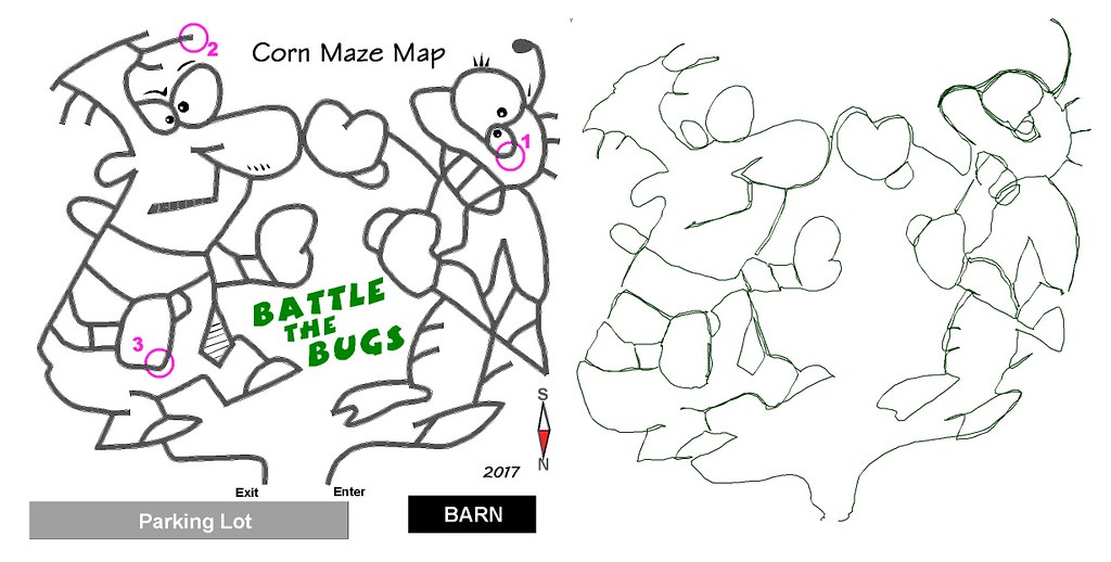
Here is last year's corn maze map. On the left is the OCAD result. On the right is the GPS track that I worked from. The area is about 100 m on a side. Last year took about 4 hours and two visits to the maze to complete. With the drone pic I was able to finish in two hours without actually setting foot in the growing corn maze.
<https://farm1.staticflickr.com/942/29666527928_f70...>
<https://farm1.staticflickr.com/942/29666527928_f70...>
Oct 12, 2018 3:55 PM
#
Szalay's Farm corn maze used in Python #Rogaining adventure race by @NEOOrienteering #CVNP#CuyahogaValley#CornMaze#Orienteering#MazeMap pic.twitter.com/YjKzQ5Pknn
— West PA Orienteering (@wpaorienteering) October 12, 2018
This discussion thread is closed.