Discussion: Printing
in: NEOC: 2014 Troll Cup (Nov 8–9, 2014 - Townsend, MA, US)
Oct 28, 2014 1:11 PM
#
Following the discussion some months ago about print scales, sanctioning granted NEOC permission to print Brown at 1:7500. Ultimately however, at a previous meeting a few weeks ago, the organizers decided to print Brown at 1:10. Ed is in charge of printing, and the digital offset printing by TPI Solutions - the shop from when he procures printing - is very high quality. It has been used for the US SML Champs by CSU and at the Blue Hills Traverses in recent years.
Still, for future organizers, sanctioning was very receptive to the argument that an irregular scale can result in improvement for veteran classes. However, maps should be made so that they are readable at 1:15, and elite classes should not be printed at finer scales than 1:10. Even 1:10 can result in gratuitously large, place-mat like maps.
Still, for future organizers, sanctioning was very receptive to the argument that an irregular scale can result in improvement for veteran classes. However, maps should be made so that they are readable at 1:15, and elite classes should not be printed at finer scales than 1:10. Even 1:10 can result in gratuitously large, place-mat like maps.
Oct 28, 2014 1:42 PM
#
Better a placemat than a postage stamp. Sorry not to get a 1:7500 for Troll cup, but I presume the printing on the 1:10000 will be excellent.
Oct 28, 2014 4:11 PM
#
geof:
For us really oldies 1:7,500 makes all the difference to an easy or a hard map - even with glasses. What a shame I will have to stumble around again. I was hoping that after US Nationals used 1:7,500 for Brown (and we followed suit at Love the lakes) it would start to become the norm. I have not heard many, if any, complaints from the over 70s about the larger scale - quite the opposite.
Oct 28, 2014 4:21 PM
#
Geof - I definitely agree that the consensus is moving towards 1:7500. I have heard many concerns about the print quality at A-meets. Ed Despard has invested a lot of work in improving print quality. While increasing the scale to 1:7500 is one way of mitigating decreasing eyesight, it's also possible that sharper digital offset printing at 1:10,000 will be adequate.
Consider this an experiment. Personally, I endorse the idea of printing (non-F18) Brown at 1:7500, but there is an added cost of a second map layout. I'm certainly curious about your feedback after racing on 1:10 with high quality, digital offset printed maps.
The meet packets will include a warmup map at 1:10 with digital offset printing.
Oct 28, 2014 4:41 PM
#
If the printing for this meet are as good as the other ones I've seen Ed take care of then it will definitely be interesting to see how people (especially those on the younger end of the adult Brown course offerings) compare a really good and proper 1:10000 to the recent 1:7500s.
Oct 28, 2014 4:48 PM
#
My impression this past weekend was that the 1:7500 looked similar (in readability) to what a 1:10000 ought. The larger scale compensated for the print quality. You may be pleasantly surprised with the 1:10, Geof.
Oct 28, 2014 5:34 PM
#
GuyO:
Sanctioning Committee approval is needed to print Brown at 1:7500?
@Geof: Did we seek/get that, or just go ahead and do it?
@Geof: Did we seek/get that, or just go ahead and do it?
Oct 28, 2014 6:16 PM
#
bubo:
Agree on everything said about 1:7500 being the way to go for older eyes.
I´m probably spoiled here in Sweden, but we rarely have badly printed maps and sometimes even a decent 1:10.000 may be OK. The difference being that for 1:7500 I don´t necessarily need my magnifier while the 1:10.000 usually asks for additional help. I´m lucky enough to not really need glasses for anything but reading/map-reading of finer detail so I may not be representative ...
PS. The place-mat like map that Boris is fiddling with did contain a slightly longer course than what US Brown usually runs (10-mila 2008, Long Night).
Oct 28, 2014 6:29 PM
#
Sorry to be an ass, but how did you have a map consultant, and still end up with such non standard results? What did they consult on?
Oct 28, 2014 6:32 PM
#
Yes, you should have asked for permission to print Brown at 1:7500. The application HVO sent it explicitly stated that all courses would be printed at 1:10000 and no exceptions were asked for.
Oct 28, 2014 7:36 PM
#
geof:
@edwarddes. I meant course consultant.
@ BorisGr. My mistake, I assumed that as precedent had been set at West Point (and then again at NA Champs) a specific request to allow 7,500 was not required.
@ BorisGr. My mistake, I assumed that as precedent had been set at West Point (and then again at NA Champs) a specific request to allow 7,500 was not required.
Oct 28, 2014 7:50 PM
#
Geof>> NA Champs are not subject to OUSA Sanctioning when they are held in Canada. USMAOC requested an exception to print Brown at 1:7500 during the sanctioning process.
It is certainly possible that the rules will be changed in the near future in order to allow 1:7500 for the Brown course. but for now waivers are required (and usually approved, but not without some discussion and dissent).
It is certainly possible that the rules will be changed in the near future in order to allow 1:7500 for the Brown course. but for now waivers are required (and usually approved, but not without some discussion and dissent).
Oct 28, 2014 8:16 PM
#
geof:
Ok. Understood.
I actually meant US Champs, but presumably they asked for a waiver also.
I actually meant US Champs, but presumably they asked for a waiver also.
Oct 28, 2014 9:53 PM
#
A few dumb questions: Clarity of the map printing is a real issue and how should it be solved? With all sorts of ways to print from any given file, is there a system that everyone can use to get good printing? If you take a certain file to Staples will that work? Should we make is standard operating procedure to send a sample map to some group a few weeks in advance to see how things look? Can we get the process standardized so that people who don't do it very often get good quality maps? Is there a direct relation to the cost of the printing to the quality of the map?
Oct 28, 2014 9:56 PM
#
Peter, are you going to be at the troll cup? I can talk to you about some of those issues after the races.
Oct 28, 2014 10:26 PM
#
I'm curious as to whether the 1:10,000 maps at the Troll Cup will be printed with symbol sizes and line widths at 1.5x the 1:15,000 scale as specified in ISOM, or without enlargement. For at least some of us older folks, it is important to have larger blobs of ink on the paper, not just to have them further apart, as often seems to be the case with the production of 1:10,000 maps nowadays. It would be nice to know in advance, though I might wear my flip-down magnifiers on the Saturday in any case, just to be on the safe side. By Sunday, I will presumably already know whether I can read the map.
Oct 28, 2014 10:27 PM
#
Excellent questions, Peter, some of which I have also been thinking about, after talking to Ed at the US championships in Rochester, and reading the discussion by him and a few others about how to best prepare map files for printing. My sense from all that is that the pre-production steps (preparing the map for printing) may be more important and more prone to things being done wrong than the actual printing process itself. (I know I've been pretty happy with maps I've had for some local meets printed at Staples, for example.) Correct me, Ed, if I'm wrong on the relative importance of file preparation vs actual printing.
So it would be very helpful to have a standardized process that everyone follows -- or if the process it too complicated for someone unskilled to follow, have a central place/person (Ed, for example) who assists in file preparation, with appropriate pay for the task.
So it would be very helpful to have a standardized process that everyone follows -- or if the process it too complicated for someone unskilled to follow, have a central place/person (Ed, for example) who assists in file preparation, with appropriate pay for the task.
Oct 28, 2014 10:34 PM
#
The 1:10000 maps will be per the ISOM spec for symbol sizes. That means that the symbols will be 1.5x the 1:15000 size.
Oct 28, 2014 11:24 PM
#
Note that the inkjet prints that the setters/vetters used for the HVO meet were in some regards better than the maps that the competitors got for the actual races. Something went kerflooey when it came to creating the actual race maps. It's important to do some proofs using the exact printer that you're intending to use, far enough in advance that you can correct problems. I've been caught by this myself; I skipped this step for the Billygoat last spring, and when the maps arrived (too late to do anything about it), I took one look at them and my heart sank.
Oct 29, 2014 12:35 AM
#
GuyO:
So HVO/WCOC didn't seek a waiver for its eye-friendly larger scale maps...
Oh the humanity!!!
It didn't seem to bother George Walker, who was CCd on much internal e-mail, and also happens to be a Sanctioning Committee member.
Oh the humanity!!!
It didn't seem to bother George Walker, who was CCd on much internal e-mail, and also happens to be a Sanctioning Committee member.
Oct 29, 2014 1:24 AM
#
walk:
Sorry - it would definitely bother me, and I object any time the issue is raised. Do not remember seeing any such message. I did see the highly objectionable effort on the part of the mapper to print at 2.5 meter contour intervals and helped to squelch that.
Oct 29, 2014 1:35 AM
#
PG:
So what is the objection to 7,500 maps for the elderly? That it makes things too easy? That it makes things too enjoyable?
I would divide the readability of maps into 3 general categories -- maps that are very frustrating to try to read, maps that you can cope with, and maps that are enjoyable. Why should we not be doing what we can to make them enjoyable.
And for those with youth and good eyes on their side, just bear in mind that what you find enjoyable, we may be struggling just to cope with. And what you can cope with, we find very frustrating.
Or at least a lot of us do.
Oct 29, 2014 1:52 AM
#
I found the 2014 North American Champs M21E Long very well printed and enjoyable at 1:15k. Keys seemed to be (1) choosing the part of the terrain that had a smaller feature density, and (2) decent printing, in that order.
Oct 29, 2014 5:27 AM
#
So what is the objection to 7,500 maps for the elderly?
The elderly are the best moaners, just edging past the MF21s. You also fill up a bunch of board positions. If we give you legible maps, who will fight to keep certain standards?
The elderly are the best moaners, just edging past the MF21s. You also fill up a bunch of board positions. If we give you legible maps, who will fight to keep certain standards?
Oct 29, 2014 10:36 AM
#
@PG divide the readability of maps into 3 general categories -- maps that are very frustrating to try to read, maps that you can cope with, and maps that are enjoyable. Why should we not be doing what we can to make them enjoyable.
For me, I would classify NAOC middle and Long in the first category (frustrating), Mt Lakes 1:7500 in the second (can cope with), and US Champs in Rochester in the third (enjoyable).
For me, I would classify NAOC middle and Long in the first category (frustrating), Mt Lakes 1:7500 in the second (can cope with), and US Champs in Rochester in the third (enjoyable).
Oct 29, 2014 10:57 AM
#
I think this is evidence that there are also factors other than printing that affect readability and people's enjoyment of a map.
Oct 29, 2014 1:22 PM
#
The "elderly" are a large part of the market, make the best donors and only one out of the 12 board members is in the Brown user group.
You need a good 1:15,000 map to be able to blow it up to 1:7,500 and be good.
It wouldn't be too difficult or expensive to have a very fine offset printed 1:10,000 Brown map back to back with a decent enough laser printed 1:7,500 map in the same map bag. (You wouldn't want the possibility of a discrepancy between them triggering a protest. If everyone has both maps, there is a strong argument that it is fair.) You could then poll the runners to see which one they preferred to use.
At the moment, I am counting 37 maps out of 105 each day. A not insignificant group. (I'm counting 5 Red and 8 Blue 1:15,000 maps needed each day.)
Oct 29, 2014 11:01 PM
#
ISOM and ISSOM international standards (and the IOF rules) are there for a reason; so that elite competition around the world can understand and interpret a map anywhere. At a WRE, WOC or World Cup event. There is no good reason why these standards should be applied to kids or near-blind veterans. Just blow the maps up!
Oct 30, 2014 5:34 AM
#
I look forward to reading a similar length thread concerning the elite results at the Troll Cup.
Oct 30, 2014 8:19 AM
#
Just blow the maps up!
I have no problem with bigger scales for old and young and beginners. But many of the vocal people seem to be those whose eyes are so bad that they can't tell the difference between a good print and a really shitty one (based on what I've seen and heard over the past few weeks). I don't want them dictating what is acceptable. Making a shitty map readable by blowing it up doesn't help the larger problem. Let's insist on great printing first and then blow those great maps up for old and young.
I have no problem with bigger scales for old and young and beginners. But many of the vocal people seem to be those whose eyes are so bad that they can't tell the difference between a good print and a really shitty one (based on what I've seen and heard over the past few weeks). I don't want them dictating what is acceptable. Making a shitty map readable by blowing it up doesn't help the larger problem. Let's insist on great printing first and then blow those great maps up for old and young.
Oct 30, 2014 8:23 AM
#
A good bad example:
http://sprintseries.org/doma/show_map.php?user=cha...
http://sprintseries.org/doma/show_map.php?user=cha...
- Minimum length of a cliff is 0.6 mm (if printed at 1:15), same as the diameter of the large boulder symbol. Most of the cliffs here are a lot shorter, plenty of cliffs smaller than a small boulder symbol!
- the minimum distance between brown objects is not followed. Here contours touch other contours and dot knolls.
I'd say those shortest cliffs should be about twice as long as the are. 1:7500 scale is 2x enlargement, so I'd say if mapped as ISOM says and printed at 1:15 000 the map would be equally readable as this one at 1:7500 scale.
1:7500 enlargement for kids and elderly is just fine, but enlarging will not help at all if the enlargement is compensated by shrinking symbols 50% or adding several levels of form lines (like Moreau, one of the worst cases out there).
---
I personally would like to see one would have to ask permission to use 1:5000 and/or 1:7500 scales or 1:10 000 for long instead of 1:150000 for elites. And attach the map file. If minimum dimensions and minimum distances are followed well enough and there is no stacks of form lines and other hot known issues are OK the permission would always be granted. Just because the need for using such scales so often indicates the map is not quite right.
And it would be smart to ask such 1:7500/10 000 permission just in case. If less good printer for some reasons one would be able to save it by using enlarged versions.
http://sprintseries.org/doma/show_map.php?user=cha...
http://sprintseries.org/doma/show_map.php?user=cha...
- Minimum length of a cliff is 0.6 mm (if printed at 1:15), same as the diameter of the large boulder symbol. Most of the cliffs here are a lot shorter, plenty of cliffs smaller than a small boulder symbol!
- the minimum distance between brown objects is not followed. Here contours touch other contours and dot knolls.
I'd say those shortest cliffs should be about twice as long as the are. 1:7500 scale is 2x enlargement, so I'd say if mapped as ISOM says and printed at 1:15 000 the map would be equally readable as this one at 1:7500 scale.
1:7500 enlargement for kids and elderly is just fine, but enlarging will not help at all if the enlargement is compensated by shrinking symbols 50% or adding several levels of form lines (like Moreau, one of the worst cases out there).
---
I personally would like to see one would have to ask permission to use 1:5000 and/or 1:7500 scales or 1:10 000 for long instead of 1:150000 for elites. And attach the map file. If minimum dimensions and minimum distances are followed well enough and there is no stacks of form lines and other hot known issues are OK the permission would always be granted. Just because the need for using such scales so often indicates the map is not quite right.
And it would be smart to ask such 1:7500/10 000 permission just in case. If less good printer for some reasons one would be able to save it by using enlarged versions.
Oct 30, 2014 8:51 AM
#

Here is Mt Lakes map clip with some additional standard size ISOM comparison symbols. The size of those two small cliff is the minimum, 0.6 mm at 1:15 000. This image should give a good perspective how much over detailed the map actually is and how much the symbol shrinking must has increased the need for using enlargements. And how legible map would be if mapped with standard symbols and printed at 1:10 000, and how easy it would be to read when printed at 1:7500.
Oct 30, 2014 1:23 PM
#
Waaait!... what's up the deal with superskinny cliffs slash trail segments? that's almost like raping ISOM. Did the mapper invent these? Was there oversight of said mapper?
I don't think this particular problem is called "printing", it is called "drafting". (Whereas in Rochester it was definitely printing.)
I don't think this particular problem is called "printing", it is called "drafting". (Whereas in Rochester it was definitely printing.)
Oct 30, 2014 4:04 PM
#
In the course notes, the mapper said that it was too hard to see the indistinct trail symbol because it looked like pairs of cliffs, so he changed it to a non-ISOM super-skinny-trail symbol, as you're seeing above. So at least he was honest about needing to pick and choose from the international standard to create his own bastardized map.
Agree, these are drafting errors, and without good drafting you can't get good printing. It's too bad that it seems to be a trend that we're giving up on the ISOM in our latest maps.
Agree, these are drafting errors, and without good drafting you can't get good printing. It's too bad that it seems to be a trend that we're giving up on the ISOM in our latest maps.
Oct 30, 2014 4:39 PM
#
No, no, no. I am very definitely talking about nonstandard cliffs, not nonstandard trails. There seem to be two kinds of symbols for passable cliffs on Charlie's scans, regular and skinny. The regular seems to be ISOM 203 or very close, judging by Jagge's superposition. The skinny is bastardized, invented, reprehensible.
... and, of course, this skinny cliff symbol is indistinguishable from dashes for 507 and 508 trails. Duh. Don't mess with the standard.
... and, of course, this skinny cliff symbol is indistinguishable from dashes for 507 and 508 trails. Duh. Don't mess with the standard.
Oct 31, 2014 3:05 AM
#
The drafting is definitely wrong. The printing was also bad. The forest was great.
several levels of form lines (like Moreau, one of the worst cases out there)
And yet Moreau is truly excellent.
several levels of form lines (like Moreau, one of the worst cases out there)
And yet Moreau is truly excellent.
Oct 31, 2014 4:24 PM
#
or adding several levels of form lines (like Moreau, one of the worst cases out there).
I don't have a map of Moreau handy. Could someone explain precisely what's supposed to be wrong with the form lines? Does "several levels " mean more than one form line symbol was used, with one or more of them being non-standard? Does it mean multiple form lines representing different elevations commonly appear between two adjacent main contours? Something else?
I don't have a map of Moreau handy. Could someone explain precisely what's supposed to be wrong with the form lines? Does "several levels " mean more than one form line symbol was used, with one or more of them being non-standard? Does it mean multiple form lines representing different elevations commonly appear between two adjacent main contours? Something else?
Oct 31, 2014 7:21 PM
#

right, standard says only one form line, here we have often three form line levels. Truly excellent example of bad nonstandard mapping. Not that small cliffs are way too short and small here too, some smaller than small boulder symbol. The difference between this and mt lakes miniature symbols is mt lakes becomes sort of if blown up and possibly converting to ISSOM since the detail size is about what one would expect of ISSOM map, but blowing up Moreau will not make those stacked form lines disappear.
Oct 31, 2014 9:21 PM
#
Okay, that's clear enough - stacked form lines and a side helping of misuse of the passable rock face symbol (I think you're saying they're too short AND too thin but not entirely certain). What, then, would be the proper way to map these parts of Moreau? With a 2.5m contour interval (might work in the sample areas above but not ideal in the steeper parts of the terrain)? In a considerable more simplified way, omitting a fair bit of the subtle contour variation (though some of it you might be able to rescue by using the dot knoll and cup depression symbols to represent features currently drawn with formlines). I'm guessing the latter will be the preferred approach. I'm not sure what proportion of active orienteers would prefer running on the ISOM-compliant version of the map rather than the current one, It would be interesting to compare the two versions, though not likely interesting enough to motivate someone to go out and make the ISOM-compliant map. Maybe someone out there would care enough to, as an armchair exercise, redraw one or more of the samples above the way they think it might look if properly mapped.
Oct 31, 2014 10:06 PM
#
@Nev: Don't count on it. That wouldn't be the spirit of AP or the sport in general.
Nov 1, 2014 4:47 AM
#
"How does this happen?"
I can only guess that it has something to do with some volunteer/volunteers trying to do the best they can---and not getting some parts absolutely right.
I can only guess that it has something to do with some volunteer/volunteers trying to do the best they can---and not getting some parts absolutely right.
Nov 1, 2014 9:09 AM
#
Quick armchair re-draft to ISOM - no stacked form lines, no undersized dot knolls or other symbols (ocad default symbols only):

Nov 1, 2014 10:30 AM
#
There are professionals available that do get things right, and apparently, as evidenced by the Lakes, some who decide not to. ISOM (And other standards) exist for a reason.
Nov 1, 2014 1:36 PM
#
@Hammer, lol, as I just stumbled on an older thread where you attempted to derail the same topic for a celebration of the athletes.
Nov 4, 2014 3:02 PM
#
Out of curiosity I looked at some other US maps. Here most of the small cliffs are little bit shorter than the minimum. And dot knolls too. Boulders are correct, tiny ground symbols are larger, printing issue I guess. Minimum sized symbols inside purple ring.

here is an other comparison, old WOC map versus more recent version. Look how cliffs has magically gotten shorter.

Anyway, if symbols are 25% smaller than the standard ones and you print it out 1:7500 instead of 1:10 000 you end up getting same sized symbols on paper than standard symbols printed at 1:10 000.
Some areas seems be vaccinated against this shrinking virus. No need to put comparison cliffs here:
http://www.sprintseries.org/doma/show_map.php?user...
But I would say mappers are not the ones to blame. If athletes and O community praises those over detailed non-standard maps why should they not do more of those and even more over detailed maps? And clubs order such maps to be made?
here is an other comparison, old WOC map versus more recent version. Look how cliffs has magically gotten shorter.
Anyway, if symbols are 25% smaller than the standard ones and you print it out 1:7500 instead of 1:10 000 you end up getting same sized symbols on paper than standard symbols printed at 1:10 000.
Some areas seems be vaccinated against this shrinking virus. No need to put comparison cliffs here:
http://www.sprintseries.org/doma/show_map.php?user...
But I would say mappers are not the ones to blame. If athletes and O community praises those over detailed non-standard maps why should they not do more of those and even more over detailed maps? And clubs order such maps to be made?
Nov 5, 2014 12:53 AM
#
I'm not sure what you're pointing out with the two WOC maps. First of all, what are those two maps? The one on the right looks like a bad scan of the souvenir Surebridge map with the winners' routes. If I had to guess, I'd think that the one on the left is the newer print. But I don't see what you're saying about cliffs getting shorter, and there shouldn't be a difference, because Surebridge wasn't even redrafted, it was simply converted to 0CAD from the original data files.
Nov 5, 2014 6:09 AM
#
That's from Mogensen's archives. It is not easy to find good scans of the original map. But when comparing all scans I have seen against more recent ocad versions it looks like smallest cliffs are shorter in recent versions. Maybe there was some kind of rounding or something at the end of microstation cliffs symbols and those disappeared when it got converted, making cliffs a bit shorter. Makes no difference with long cliffs but the very short ones became even shorter. Shortest are as long as they are the width making then squares and those cliffs in scans of the original version sure look longer. You may have original maps and files, you can check it by yourselves. But the point is no-one seems to care (the opposite, maps with undersized symbols get praised) - this all indicates there seems to be no much interest on trying to follow minimum dimensions of the standards. And that may be big part of the legibility "printing" issue.
Nov 5, 2014 11:22 AM
#
I do have originals, and I'll try to do some high-resolution images tonight.
However, this completely misses the main point. The big issue isn't whether the details of printing result in some cliffs that are at the very edge of meeting the spec being slightly below the minimum. The real problem is when there are far too many tiny cliffs put onto the map in the first place. As far as I'm concerned, Surebridge is and has always been an offender in that regard. What makes that map wonderful is the terrain, much more than the map itself. There's too much detail mapped on Surebridge. Most of the dot knolls, in particular, don't actually exist, except in the imagination of the mapper. It has always been difficult to read, but it was at least mapped in a manner that made it (barely) printable at 1:15000, and the more recent prints at 1:10000 are somewhat more readable. Other maps that have been made in the past 20 years squeeze even more detail in, by using symbols smaller than these.
However, this completely misses the main point. The big issue isn't whether the details of printing result in some cliffs that are at the very edge of meeting the spec being slightly below the minimum. The real problem is when there are far too many tiny cliffs put onto the map in the first place. As far as I'm concerned, Surebridge is and has always been an offender in that regard. What makes that map wonderful is the terrain, much more than the map itself. There's too much detail mapped on Surebridge. Most of the dot knolls, in particular, don't actually exist, except in the imagination of the mapper. It has always been difficult to read, but it was at least mapped in a manner that made it (barely) printable at 1:15000, and the more recent prints at 1:10000 are somewhat more readable. Other maps that have been made in the past 20 years squeeze even more detail in, by using symbols smaller than these.
Nov 9, 2014 3:08 AM
#
Bringing this thread back into focus: after Day 1, what did you think of the printing?
And specifically, the problem is that for the Brown course 1:10k at "typical" printing (say, good laser) is hard to read. While digital offset is ideal in basically all circumstances, while helps more:
(1) Printing at 1:7.5k with laser (e.g.)
(2) Printing at 1:10k with digital offset
All pertinent comments about printing at the Troll Cup are welcome.
Nov 9, 2014 7:56 AM
#
Same thing on the new Estabrook map. Is there an errant symbol running around NEOC land?
Nov 9, 2014 11:02 AM
#
i recall a thread four years ago where several runners from Boston land were adamant you should be allowed to run through any water bodies regardless of depth or safety. Perhaps they have had great influence. ;-)
Nov 9, 2014 10:08 PM
#
geof:
The printing was nice and sharp although I thought many of the light green should have been darker. The problem is for us old, fading eyesight people is not so much the printing but our eyes; no matter how sharp the printing, two features close to each other can blur into one and deep brown can look like purple or black; e.g. the connection line between 10 and 11 on Day 2 (Brown) looks to me like one continuous line; only under magnification can I tell that it is a broken connection line with a form line and a boulder cluster(?) - the boulder cluster, if that is what it is, would have helped navigate to the re-entrant (OK - sour grapes, I drifted right so it would not have helped me). At 1:7,500 it would have been much easier to make out the different features.
Did anyone else thing that 2.5m contours were superfluous and made the map hard to read.
However, I really enjoyed the courses both days and I agree that the print job was good; it would have been very difficult for Brown with laser print.
Congratulations to all involved.
Did anyone else thing that 2.5m contours were superfluous and made the map hard to read.
However, I really enjoyed the courses both days and I agree that the print job was good; it would have been very difficult for Brown with laser print.
Congratulations to all involved.
Nov 9, 2014 10:13 PM
#
The 2.5 m contour thing is kind of a historical accident dating back to about 1989. It's not obvious to me that it was the right decision in the first place, but once it was made, nobody ever changed it. It's not really flat enough to justify it, in my opinion. It would be interesting to see a 5m version of the same map, but you can't create that by just deleting half of the contours, because there are intricate areas that would need to be adjusted in the field.
Nov 9, 2014 10:21 PM
#
Joe:
brown seemed dark. I could not see my first control yesterday as it was a boulder on top of a index contour. courses were great though. no complaints.
2.5 meter contours were fine. the conversion from the 1990 map was well done.
thanks for reviving the chase start.
2.5 meter contours were fine. the conversion from the 1990 map was well done.
thanks for reviving the chase start.
Nov 9, 2014 10:55 PM
#
Brown was a little dark. I hadn't used the spot color since 2011, and it was being very problematic in getting the mix correct in the press. My options at that point were to either use the brown a little dark and get crisp (dark) browns, or use a standard cmyk mix for brown that may be closer to the correct color, but would not be quite as crisp.
Once I choose to use the darker brown, I probably should have changed the purple color away from a simulation of PMS Purple, towards something with less cyan in it to create higher contrast between the brown and purple.
Once I choose to use the darker brown, I probably should have changed the purple color away from a simulation of PMS Purple, towards something with less cyan in it to create higher contrast between the brown and purple.
Nov 9, 2014 10:56 PM
#
The map wasn't really a conversion of the 1990 map. It was a complete remap with a new basemap. I'm not really sure if Marcello used the old map at all, but I did georeference it and provide is as a background map in OCAD. The 2.5m contour decision was made though based I think on the old map which was 2.5m as JJ said.
Nov 9, 2014 11:06 PM
#
I'm pretty sure Marcello used the 1990 map little or not at all, other than for comparing for amusement to see how things had changed. But the contour decision was because (AFAIK) in 1989 when we ordered the base, we weren't sure what contour interval to ask for and Ivar did 2.5 m, then we left it up to Mikell whether to use them all or leave half of them out, and he decided to use them all, and for the new map, I guess it was 2.5 m just because the old one was.
Nov 10, 2014 12:42 AM
#
Printing was better than some maps I've seen this fall; index contours seem a bit thick, but much better to have them than not! (as at Mountain Lakes)
As for the mapping:
On day 1 the Brown course leg from 8-9 went close to the edge of the map where a marsh was only half-depicted. The wetness/marshiness extended noticeably farther south than depicted before becoming more stream-like. I crossed that area on leg 9-10 today and recognized it so swung left but still hit more marsh than expected from the map.
Regarding very large erratics, seen just west of the north line near day 2's Brown #8 (shown) and Green #12:
Why wasn't ISOM symbol 202 used to designate these very large erratics? They're depicted using a hollow black oval, and to my eyes they sure didn't stand out on the map --particularly the one due west of #8, in a line of boulders curving along a contour line-- though they definitely did in the terrain.
Nov 10, 2014 12:53 AM
#
There are a lot of places on the map that 202 was used for the large rock, but it was drafted as a hollow oval of 202. I don't know why, and I think we should change it to a solid area symbol so that it stands out more. I will have to ask Marcello what his intent was by doing it that way.
Nov 10, 2014 1:11 AM
#
He's drafting it as a closed-loop cliff. I remember people doing this a long time ago kind of "because they could", sort of because it was cute, for maybe the one largest boulder on a map. I don't know why Marcello does it (he did that on Bear Brook, and also on the new UNO map to be used for next fall's Boulder Dash), but I don't like it. I'm going to see if we can fix it for next year. The only way I can see this being justified is when there's enough dirt on top of the boulder that there are multiple trees growing up there.
Nov 10, 2014 1:14 AM
#
Just rechecked the ocad file, its not a cliff loop, its actually a 202 area, with a hole in the center.
Nov 10, 2014 1:16 AM
#
When we were in Italy in 2009 for JWOC there were some super massive erratics that must have been around 25+ meters in diameter with actual forest on top. These were mapped as a closed loop cliff and in that case it made a lot of sense as it really had a cliff-type field and you could see the forest on top which was the white inside the closed loop of cliff. In these smaller cases I don't think it does make sense.
Nov 10, 2014 1:17 AM
#
That's totally weird. I still think he's viewing it as a cliff loop, but why did he go to all the work to cut holes? Fortunately for us, this makes it easier to fix. If he had drafted them as cliffs, then changing them to rock pillars would have made them smaller by half of the cliff thickness. Now we just have to click on each hole and press delete.
Nov 10, 2014 1:19 AM
#
There was nothing growing on top of either one (shown in the image) that I could see, and no one would be able to climb up to check without some definite rock-climbing prowess.
I hope the symbol is changed before the map's next use. We would like to come back!
I hope the symbol is changed before the map's next use. We would like to come back!
Nov 10, 2014 1:26 AM
#
Well, I'll have to take that as a challenge and climb on top of them as soon as I get an opportunity.
Nov 10, 2014 2:14 PM
#
Everything was fine but if you are looking for suggestions, consider spacing the north lines 250 meters apart instead of 500 m. And maybe make them a little more visible. I suppose you could make them a little thicker but even if they extended into a white border on the north (versus taking the map right to the border), they would be easier to pick-up?
With the map portion we received oriented north-south and the north lines at 500 M there were only two usable north lines on the day 1 map. I am partially color blind and this may have contributed but I had difficulty picking up the north lines on Day 1 and at one point, didn't think they existed (don't forget, map is folded, etc. etc.) Day 2 wasn't an issue.
I guess map credits don't have to be on the map but is sort of a way to recognize the mapper. That info was posted but putting it on the map itself would be an easy way to have a permanent record.
Nov 10, 2014 7:14 PM
#
Judy and I looked closely at the maps last night and noticed not only the white topped boulders, which I agree should be changed, but quite a few very thick cliff symbols. In fact there seem to be several thicknesses of the lines used for the cliffs, sort of, in my mind, suggesting they are curved pillars of rock. I have not checked any of these out, although I did pass them and I sure did not notice any rock pillars.
Seems an unnecessary complication.
As with the contour lines being thick it makes the map less readable.
I note the original map had much thinner contour lines, and smaller boulder symbols.
Have standards changed, or is this just by the discretion of the drafters?
Seems an unnecessary complication.
As with the contour lines being thick it makes the map less readable.
I note the original map had much thinner contour lines, and smaller boulder symbols.
Have standards changed, or is this just by the discretion of the drafters?
Nov 10, 2014 7:45 PM
#
The original map you have may be at 1:15000?
I do believe the contours and boulder sizes are correct per the spec.
Contours should be 0.21/0.375mm for regular and index contours. I measure (with calipers off of the printed map) 0.23/0.34. Boulders should be 0.6/0.75/0.9. I measure them to be 0.53/0.87. That is probably beyond the limits of my measurement accuracy.
I think everyone has just gotten used to maps with symbol sizes that are too small, and when one is correct they look large. Both the ROC and HVO maps had incorrect symbol sizes (see the boulders on the 1:10000 letchworth map).
While there are still some minor drafting issues with this map, the 202 hollow rocks, and the north lines seem to be the worst, I think we should be able to agree that the printing is really good. The blacks are crisp and you can tell the difference between rounded and square edges. The browns well a little dark are crisp and distinct and properly overprinted through the greens. These are the standards that I want all meets to achieve. Yes it is more expensive and takes a lot of time, but I've shown here that we can print maps with lots of vegetation detail on them at 1:10000 in a way that is still readable. Lets see some others step up to the plate and do the same.
Nov 10, 2014 8:20 PM
#
The original 1990 map absolutely had the "wrong" size symbols, although that predated the ISOM definition of how to do 1:10000 maps. It was printed at 1:10000, but had the symbol sizes that would have been used for 1:15000. This was primarily due to the limitations of what could be done with pen and ink. I didn't have access to larger rub-on transfers for point symbols, and thicker contour lines would have required a new set of rapidograph pens (or at least a partial set). When I later drafted that old version of the map into 0CAD, I used the proper, larger symbol sizes.
I think the main issue with the brown on the new map is just that brown ink was too dark, and maybe needs to be diluted a bit. That's a subtle thing.
I think the main issue with the brown on the new map is just that brown ink was too dark, and maybe needs to be diluted a bit. That's a subtle thing.
Nov 11, 2014 12:06 AM
#
Different sets of older eyes have different problems. Unlike coach who found the thicker contour lines making the map less readable, I found that I could actually see contour lines in the green areas of the map, something that simply isn't the case when they are printed at 1:15,000 scale (even across 30% green when the overprinting effect on the brown is not used). Usually I can manage the 1:15,000 contour lines just fine when they cross white areas as long as they form mostly nice orderly arrays, but when the land becomes flatter and there are lots of not-forming-a-regular-pattern lines coming in, even on white ground they can be very hard for me to make out. Other lines that would be useful are often more of a problem for me to notice than the contours because they aren't part of a general pattern. Even at the 1:10,000 scale, I will often not spot a small trail on the map until I have actually run across it on the ground and pause to locate it on the map knowing roughly where I am on the map as a starting point, and being able to focus better while stopped with a steady map and concentrating on a single task.
One example of this happened on day 1 of this weekend's event, even with Ed's very fine quality map. I came out on a trail just where I had expected to see one on the map--but I was actually only about ten meters from a trail junction that I was certainly not expecting! Must have been only five or ten seconds of frantic searching on the map, though it seemed like forever while it was going on, until I finally found the missing trail only about a millimeter away from where I had expected to be on the map. So there is at least one of the older runners that is delighted that Ed was following quite carefully the ISOM specifications! The previous weekend at Love the Lakes, virtually every trail crossing on the ground involved stopping and seeing if I could find it on the map, and whether it might be of use to me, and that was on a map that had hardly a speck of green on it, but linewidths that were at a 1:15,000 scale (or maybe even a little thinner). Interestingly, there we had been warned in the course setter's notes that we might have trouble noticing the trails in the woods, because of the leaves on the ground, but not that we might have trouble noticing them on the map because of lack of ink. I might note that I'm probably not alone amongst the older runners in wanting more ink on the page--as far as my ophthalmologist is concerned, my corrected vision is completely normal for someone of my age.
I think that the real intent of scaling the linewidths and feature sizes to keep them in the same proportion as on the 1:15,000 maps was specifically to avoid littering maps with an ever-higher density of point features, or yet more detailed representation of contour features. As someone who has never been particularly skilled at picking out "Where's Waldo" out of a page of highly detailed nearly self-similar structures, I really appreciate this requirement attempting to enforce at least some minimal level of pre-simplification in the depiction of the terrain. In this regard, I suspect I would personally have liked the map a bit better with 5 m contours rather than the 2.5 m utilized. That, however, is just my personal taste, and as JJ has pointed out wouldn't be so simple to implement retroactively.
Nov 11, 2014 12:55 AM
#
I was in a hurry when I wrote abut the contour lines, perhaps they are just too dark as suggested. I will note though, that on the original map, We can read the contours just fine.
What do you think of those thick cliff lines?
What do you think of those thick cliff lines?
Nov 11, 2014 8:36 AM
#
The biggest improvement could be done by editing contours and form lines. Brown lines often touch or almost touching each other. ISOM tells the the minimum gap is 0.15 mm (at 1:15 scale), that's about same as the width of a contour line. To me it looks there is plenty of places with virtually no gap at all, lines almost touching each other. Note that those worst places aren't the steepest ridges, instead those are less steep detailed areas and almost always form lines are involved. That's combination of poor drafting and too excessive use of form lines.

The advantage of using 2.5m interval is effectively removing the need to use form line. There is plenty of detailed areas mapped with 2.5 m interval with no or almost no almost no form lines at all making them more legible than if mapped with 5m interval with form lines (because there would be no dashed lines). There is plenty of such maps near Turku, for example this one.
Unfortunately the troll cup mapper here haven't done much efforts to minimize form line use, instead it looks like those are added every time there is even little room for them and any land forms between full contours - instead doing it right, figuring what is essential and mapping that with full contours and if it is dead end using one form line the minimal way. Note, with one form line the effective interval is 1.25 meters, is it really necessary to have so much of those there and sacrifice legibility or it. Unfortunately erasing form line is not something one can do without on site visits, but editing contours to not touch each other and erasing some unnecessary parts of form lines should be possible.
Nov 11, 2014 10:47 AM
#
For me, those too-close contour lines Jagge mentions are the hardest things to see. I can ignore them easily enough in a case like control 8 in the picture above, where the control is on an easily identifiable boulder, but I am really in trouble if the control is on a contour feature and there is a bunch of little squiggles in the circle.
Nov 11, 2014 4:12 PM
#
This is a prime example of the "too much detail, too busy" problem that has been under discussion.
Nov 11, 2014 4:29 PM
#
As mentioned above, the map was hard to read in 1:10k scale, even to a person with normal vision. The contours appeared thicker than normal, I guess that contributed somewhat. But the main issue with the map, imo, was excessive, indiscriminate use of form lines, where they were totally unnecessary, did not contain useful info. Example above (#8) is quite characteristic. I had to stop there on the course to understand the map. Terrain there in fact looks way easier than the map. I walked with the map after the finish and took a close look at some of those artifacts, found that the narrow knoll along the road that I could not identify on the run was there , but was about knee high. I think essential role of field-checker is to clean up the map from what software generates, I mean "lidar contours", for example , a "narrow" re-entrant , 10-in deep, that is practically invisible, etc.
Dec 1, 2014 12:15 AM
#
OK, I'm finally getting around to posting the scans of Surebridge that I promised back on November 5:
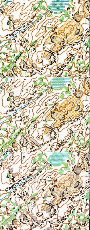
(click for larger version)
The top scan is from an original 1993 1:15000 WOC map.
The middle one is from the first map printed after the map was converted to 0CAD in 2003 (I think). It's also offset printed (spot color), but printed at 1:10000. I'm not 100% sure that this was printed from 0CAD, as opposed to the original Freehand file, but that's my recollection.
The bottom version is a 2009 version, also at 1:10000, probably printed by laser. I'm also not sure of the pedigree of this one, but I think the most likely possibility is that the 0CAD file was imported into Illustrator or something, with the symbol definitions coming from that program. That would explain the marshes being too fine, the cliffs being thicker and without the rounded ends, etc. There was no significant fieldwork update, just a few trail details.
Note that all three have been adjusted to be at the same scale.
Dec 1, 2014 12:30 AM
#
In the bottom one it is notable how the dot knolls seem to bleed when on top of bare rock.
Dec 1, 2014 12:59 AM
#
Ah, Surebridge. Gotta love it. Probably my favorite terrain of all time, anywhere. If not for annual pilgrimages to West Point and Harriman meets, I'd likely never have become so involved in orienteering over the years.
I like the second sample the best, but have honestly enjoyed most of the map prints of that terrain all through the years. The terrain is just that good.
Ok, time to go back to hibernating through the technical printing discussions...
I like the second sample the best, but have honestly enjoyed most of the map prints of that terrain all through the years. The terrain is just that good.
Ok, time to go back to hibernating through the technical printing discussions...
Dec 1, 2014 1:10 AM
#
I too find the second one easiest to read. OCAD to offset printing looks good.
This is what we essentially use at the Traverse each year, thanks to the work Ed puts in.
This is what we essentially use at the Traverse each year, thanks to the work Ed puts in.
Dec 1, 2014 1:41 AM
#
The middle one is clearly the best, having the advantages of both 1:10000 and offset. That one is actually labeled Hogencamp Mountain, and is a DVOA product, printed at the erstwhile Oxbow Press.
Dec 1, 2014 1:54 AM
#
It is interesting how the clarity of the middle print allows one to see some potential drafting imperfections, masked by the (relative) softness of the other two.
Dec 1, 2014 1:59 AM
#
There are a lot of differences in drafting between (1 and 2) and 3. Round dot knolls have changed into elongated dot knolls, and the dashes of the form lines are in different spots and have slightly different shapes. Its like 3 is a redrafting of everything from the old version.
The ocad file I have matches what is in 3 though. Do you have an ocad file that matches 2 JJ?
The ocad file I have matches what is in 3 though. Do you have an ocad file that matches 2 JJ?
Dec 1, 2014 3:11 AM
#
I'm not sure what I have in 0CAD right now, because I had to replace my laptop recently and haven't gotten around to getting 0CAD installed on the new one yet.
My best guess is that the form lines actually have the same defining points, but differences between the dash algorithms in the three programs makes them look substantially different. There may well also be differences in the dash algorithm between the current version of 0CAD and whatever I was using in 2003.
As for the elongated dot knolls, I suspect they were fieldchecked and drafted as elongated, but that the map controller did not allow that deviation from the standard that was in effect (I know something like that happened for "medium" boulders). So they had to get changed to regular dot knolls. It might be that all of the elongated ones were duplicated with regular ones, and the elongated versions were just hidden. If that was the case, I don't remember exactly what I did when I converted the data to 0CAD. What has happened since then, I also don't know. Does your file have an extra dot knoll symbol in the palette that's hidden?
Dec 1, 2014 4:21 AM
#
Offset contours look sooo good. It's just crazy how much better they are.
Dec 1, 2014 8:02 AM
#
it feels strange how cliffs can end up that much shorter. Can missing end rounding explain all of it? JJ, if you remove rounding in 0cad will cliffs look as short as in the third image.
Dec 1, 2014 8:16 AM
#
From 1 to 2, (many of?) the cliffs seem to have moved a little to the left. Some (beside knolls, bottom right) seem to move a little right again in version 3. Maybe it was just some printing offset.
Dec 1, 2014 8:46 AM
#
To me all black objects has moved up from 1 to 2 and back to 3. That's not something exceptional, it's spot colour offset printed after all, and that happens.
Dec 1, 2014 3:15 PM
#
Maybe I'm not understanding it correct but I thought JJ was saying there was no re-drafting between the three images. Just conversion from Microstation (?) to OCAD. And than, each printed differently.
Dec 1, 2014 7:58 PM
#
Yes, I agree that the alignment issues are just print tolerance, due to paper stretch and adjustments that the press operator made, since each color was done on a separate pass through the press, with time for the ink to dry between passes. If I had pulled a different map from the other end of the pile to scan, the results might have been different. This is one drawback of the old school offset printing, although with a good press operator, the effect was lessened. (Once in a while you'd get a map that had one or more colors way off.) Note that these effects would likely go unnoticed on an actual printed map, I did the scans at 1200 dpi, so this is pretty magnified.
For the length, I think it's a combination of the rounded ends, and the fact that the cliffs were thicker on the last one, which creates the illusion of them being shorter. If I had 0CAD running right now, I'd try exporting GIF images to compare them. Maybe Ed could do that.
You are correct, Carl: on this map (well, this part of this map, at least), no redrafting took place, it was all digital translation.
Dec 4, 2014 7:51 PM
#
Map #3 was done in Adobe Illustrator plus Mapstudio. I work on a Mac and this was the most productive way to go in 2007. I (ok, now I can admit it) adjusted a few symbol sizes. The intention was to have a map that was easy to read in the woods.
This was a pragmatic approach: The goal was to produce the most legible map with the resources I had. Which is a tremendous challenge on a complex map like Surebridge. As far as I heard after the A-meet, the runners liked the map printing.
Each laser printer responds differently to the files that are used. The contour color changes to a reddish hue, or goes too dark or the lines get too fat and drown out the rest of the map. The weirdest experience was when the marshes were transformed into polka dots.
Dec 5, 2014 12:31 AM
#
So is there a bottom line here? There seems to be a lot of factors at work, so do I just test print, make adjustments, retest until it looks right then print?
Dec 5, 2014 2:01 AM
#
Definitely lots of test prints well before hand, but not with the idea that you are just pounding away at the problem until a set of parameters happens to work.
For color, you really should be working in a color managed workflow, where profiles are created for your monitor and printer, and the calibration is done there instead of changing values in the ocad file. What this means is that a photo spectrometer is used to measure the actual color output of your screen and your printer and then creates calibration profiles for them so that what you see on the screen is what you get on the printer. Also then what you get on one printer is what you get on another printer, within the limitations of that printer color gamut which I always find to actually be the problem.
For feature sizes again, it should be fixing the output device, not having to change the input for every different printer. Print on a good coated paper, and tell the printer that it is coated paper not uncoated. The printer will adjust based on how much it expects the ink to bleed. On uncoated paper expect a lot more feature size variation due to bleed than on coated paper where the ink mostly stays on the surface. I think most of what we see as feature size problems are not due to the printer, but due to mistakes in setting up the ocad file. A difference of 10-15% on boulder sizes would be unnoticeable to most, but a difference of 50-100% is a big deal.
The best way I think to get started on getting good output is to create a relationship with a high quality full service print shop that employes press operators and designers/prepress people. They are used to working through the process of getting what you show them on the screen onto a piece of paper. It costs a lot more, because at the volumes we are running you are paying more for their time than you are for the printing, but you are also getting a guarantee from them to produce a quality job. I work with TPI here locally, and for small runs (say I only need 10 of a map) they frequently charge me $2/map. But in that cost I get a press operator who looks at everything coming off the press and I know is doing daily maintenance and calibration, and I get a prepress person who processes every incoming file looking for issues and setting up the sheets for printing. When things have gone wrong in the past, they have never had a problem reprinting to get what I need. For example getting the brown spot color setup for the troll cup printing was difficult because it had been sitting around for a long time, and probably 500 13x19 sheets went through the press and straight into the bin.
The map printing process is too often left until the last minute, and compared for pricing to what a sheet costs at a copy center. While what I advocate for is a lot more expensive and time consuming than that, it is still a small part of overall costs, especially when compared to what it costs to do the fieldwork for a map. If you hired a professional to do the fieldwork, also work with a professional to get that fieldwork off of the computer and back onto a piece of paper in the competitors hands.
Dec 5, 2014 2:38 AM
#
I agree with Ed. I work with a print shop where the owner has an old fashioned pride in craftsmanship. I bring a pdf (sometimes it goes right through, no problem). I also bring the Illustrator file and the employee can tweak the output from that file on the print shop computer.
We had to adjust files just because the machine had been been serviced and recalibrated and some of the parameters changed.
I print the maps used for course setting and for the vetters at my print shop, long before the courses are finalized and drawn. So I have time to test the maps and see what works in the woods.
I definitely encourage a field test at race speed on a rainy day. If I have to stop in the woods to read the map, something is wrong. E.g. stony ground can clutter the map image and often needs to be tuned down. Same with open rock (gray tone). Sometimes it turns black or is too light and invisible.
Dec 5, 2014 2:57 AM
#
I print the maps used for course setting and for the vetters at my print shop, long before the courses are finalized and drawn. So I have time to test the maps and see what works in the woods.
This is great, and I encourage more people to do this if possible. If you can get the vetters out running and testing on the same print process as the competitors will get, you will get a lot of feedback not just on if the controls are in the right places, but if the map is readable on the run in the vicinity of the controls.
This is great, and I encourage more people to do this if possible. If you can get the vetters out running and testing on the same print process as the competitors will get, you will get a lot of feedback not just on if the controls are in the right places, but if the map is readable on the run in the vicinity of the controls.
Dec 5, 2014 3:03 PM
#
What you are advocating means that there will be only a few people who can deal with printing maps. Very few are going to go though the sort of steps and process outlined above. This is nothing new, it's certainly how things worked when I got started in orienteering, and I handled a lot of map printing. Computer drafting brought the advantage that it was possible to print off informal test copies on an inkjet printer, and this led to a classic "slippery slope" situation (which I saw coming with dread) in which the standard practice became ended up as being that inexperienced people send maps off to some random printer and hope for the best, assuming that the details have been taken care of. This is the case for drafting as well, to an extent -- whereas there used to be a small set of people with the skills to turn fieldwork into a printable product, it's now that everybody drafts their own stuff with 0CAD, many of them not having a decent understanding of the standards or the use of the program. It's a deep hole that we're in, and the result is often crappy, illegible maps. If people have enough of an appreciation for good maps, they'll enlist the assistance of somebody like Ed just as we used to hire Pat Dunlavey et al. The solution won't come from hoping that the equipment and software get magical updates.
Dec 5, 2014 3:47 PM
#
If people have enough of an appreciation
They don't. It's been 40 years, and they don't. Just search AP for "wanton".
They don't. It's been 40 years, and they don't. Just search AP for "wanton".
This discussion thread is closed.