Discussion: Routegadget your traverse
in: 46th Blue Hills Traverse (Nov 19, 2017 - Milton, MA, US)
Nov 13, 2017 2:11 PM
#
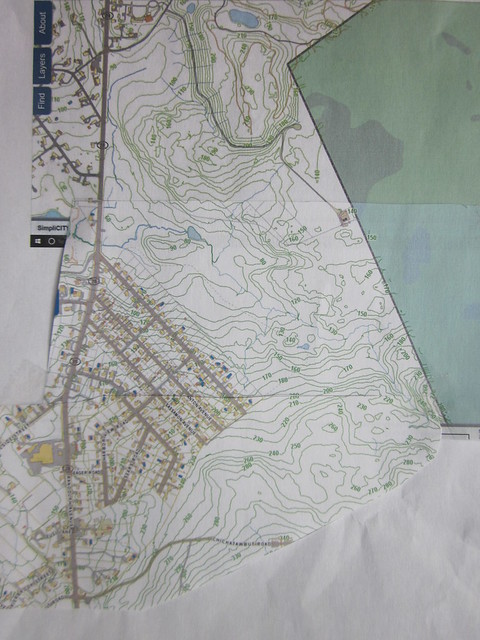
With some new terrain added to the legendary sprawling Blue Hills East and West maps, new adventures await those orienteers who accept the challenge.
Nov 15, 2017 8:37 PM
#
In further developments, I am considering shortening the course from 14.2K, taking about a Km. off. Opinions?
Nov 15, 2017 9:13 PM
#
tp:
It depends on the nature of the terrain you're sending us through. Parts of the Blue Hills can really be draining - blueberry, greenbriar, lots of rock underfoot. On the other hand, there are usually trail run sections. The Patriots game isn't til 4:25, so that's not a factor.
Nov 15, 2017 10:09 PM
#
Shortening it wouldn't be a problem, if that's what your asking. Few would complain that they were disappointed that it wasn't longer, in other words. Or at least, that's my guess.
The weather looks pretty nice.
The weather looks pretty nice.
Nov 15, 2017 11:16 PM
#
Well, it's hard for me to imagine thinking, after running the shorter 13.2k course: "damn, I wish this had been longer". But maybe that's just me.
Nov 16, 2017 12:34 AM
#
I'm already expecting to burn several extra kilometers just trying to regain contact with the map, so no complaints here. :)
Nov 16, 2017 2:47 AM
#
The Patriots game may not be until 4:25, but some of us will be out a lot longer than Tim, and have farther to drive to get home. Shorter is certainly fine for me.
Nov 16, 2017 7:33 AM
#
Hmmm I didn’t see this in time so it’s moot, but I was scared off by the 3 hour time limit.
Nov 16, 2017 10:29 AM
#
There’s a 3 hour time limit? That’s a new feature. It has been a few years since I have finished one in 3 hours, although I suppose it is possible that I might. Looking at the list of registrants I see a few names of people who would not be as speedy as o-maps, including me of course.
Nov 16, 2017 2:14 PM
#
I didn't notice the 3 hour time limit. Is that true? That may be a concern for me.
Nov 16, 2017 4:35 PM
#
I think the "courses close at 2:00" was probably just for the rec courses.
Nov 16, 2017 5:53 PM
#
Me to coach 3 weeks ago:
"NEOC web site says Traverse time limit is 3 hours ('all courses close at 2:00'). True?"
His reply:
"Hmm didn't notice that. I do want everyone in before too late.... maybe 2:30?"
That didn't sound too definitive, and 3 weeks later the web site still says 2:00. But even 3.5 hours is not a sure thing for me, or at least it I feared it might be a problem with the usual Traverse length of 15 km or so. I didn't see the talk about course shortening until after the extended deadline, although that sounds less than definitive, too.
I will admit that I was really teetering on the edge of doing the traverse or not, so that was my somewhat-welcome excuse not to. I'll kinda miss it, but I'll have fun doing the green. And won't be totally wiped when I start at 6am Monday on my holiday stint of 70-hour weeks delivering packages.
Nov 16, 2017 7:08 PM
#
OK, sorry to disappoint, but I hacked about 900 meters and 15 meters of climb off the original course, so now about 13.3Km and 385m climb.
The course close time stated on the website is for the rec. courses, I thought I had got that changed on the website, but I must have not done so.
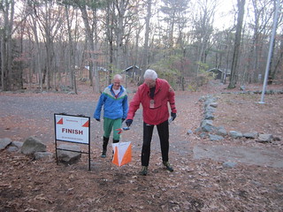
I will officially state that I want everyone back by 3:30.
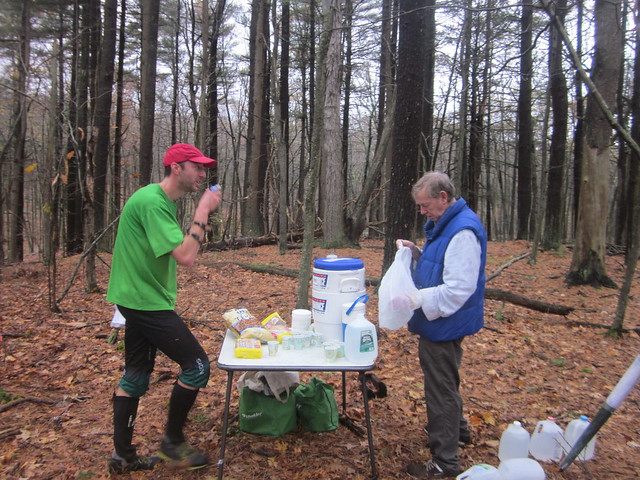
With the food and drinks at 5.5Km., I will have a 1pm cutoff at that point, not that I can really enforce that time.
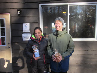
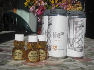
Swag this year is consumable, no more clothing to fill my, and your drawers.
We will car pool to the start at 10:45am, about a 10 minute drive.
The course close time stated on the website is for the rec. courses, I thought I had got that changed on the website, but I must have not done so.
I will officially state that I want everyone back by 3:30.
With the food and drinks at 5.5Km., I will have a 1pm cutoff at that point, not that I can really enforce that time.
Swag this year is consumable, no more clothing to fill my, and your drawers.
We will car pool to the start at 10:45am, about a 10 minute drive.
Nov 18, 2017 2:53 PM
#
Additional notes:
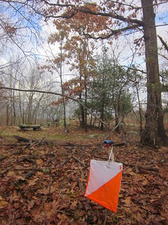
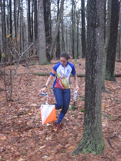
Final course- 13.2 Km., 340m. climb, 24 controls
2 drink stops, 5.5Km. & 9.3Km.
Map varies from many undermapped rocks (Blue Hills east) to overmapped rocks (Camp Sayre).
Final course- 13.2 Km., 340m. climb, 24 controls
2 drink stops, 5.5Km. & 9.3Km.
Map varies from many undermapped rocks (Blue Hills east) to overmapped rocks (Camp Sayre).


Nov 20, 2017 9:31 PM
#
The Blue Hills Traverse is a great tradition! I am sorry I could not be there.
Nov 21, 2017 1:15 AM
#
Oh, since you are here, Ian , something I forgot to mention earlier.
Controls 9 to 15 were a total re use of Ian's 2011 Traverse course!
As I was planning I needed a loop in the Houghton's Pond area, and there it was, on the 2011 map.
Great course design, so I just re used it....I wonder if anyone noticed?
Controls 9 to 15 were a total re use of Ian's 2011 Traverse course!
As I was planning I needed a loop in the Houghton's Pond area, and there it was, on the 2011 map.
Great course design, so I just re used it....I wonder if anyone noticed?
Nov 21, 2017 5:23 PM
#
tp:
Jeff, I had not realized til now that you'd added that section to BHE. Thanks for all the work you've put into this race over the years. And the locally-produced liquid rewards were a great idea.
Nov 22, 2017 2:38 PM
#
Routegadget is working for the Traverse (thanks Jim P.), I would love to see the routes.
Nov 22, 2017 4:00 PM
#
Thanks for a fun event! My first Traverse, and definitely not my last.
I uploaded my GPS route to Routegadget, but there still seem to be some issues. My full route displayed correctly after uploading, but upon returning it won't show. It's got the data, because it displays my location in the Animation playback mode.
I uploaded my GPS route to Routegadget, but there still seem to be some issues. My full route displayed correctly after uploading, but upon returning it won't show. It's got the data, because it displays my location in the Animation playback mode.
Nov 22, 2017 5:06 PM
#
Bo:
Jeff, thanks for a great event and a really nice course. As for route gadget - I entered my route manually and saved successfully, but my route entry does not seem to be on record/retrievable.
Nov 22, 2017 5:06 PM
#
tp:
I just put in my route manually, am pretty sure I got "saved successfully", and now can't see it either.
Nov 22, 2017 8:15 PM
#
It does seem like it is not working right. I put my route in via GPS, and it seems to be saved ok, but at the top of the list of names it shows "Traverse (0)" When I put it in, I could see my route and that of Dan Foster, who had also entered it by GPS. I just went back in now, and the only part of the map that seems to load is the part near the finish, although I can see my route and Dan's wandering through white space.
Nov 22, 2017 8:28 PM
#
I can't even get that far... Just a screen saying 'Sorry, Due to problems with RouteGadget, this event can not display routes'
Nov 22, 2017 10:06 PM
#
Even stranger. Now that I look, only controls 21, 22 and 23 have map under them, but the map that shows is Blue Hills East, so not lined up with the right controls anyway. The whole map is there, but it is not referenced to the course and it is much smaller than the course.
Nov 23, 2017 4:11 PM
#
Ok, we'll have to suspend this for now, we are working on it (well, Jim P. is).
Nov 23, 2017 4:49 PM
#
jimp:
Yes, NEOC's RouteGadget is hosed. It's been down all year -- Mark O. and I just haven't had time to sort it out.
Right now, the SplitsBrowser is working (link in the RG list of events, right side). It has the complete and correct times. (For some reason it omitted the last runner, but he doesn't mind.)
I replaced the map with a "can not display routes" graphic to warn off future inputs. Apologies to all who took the time to input a route only to have it disappear -- there's a chance those routes can be recovered. More later.
This discussion thread is closed.