Training Log Archive: veinbusterIn the 1 days ending Sep 28, 2016:
| |||||||||||||||||||||||||||||||||||||||||||||||||||||
| « | » |
| » now | ||||
| We |
Wednesday Sep 28, 2016 #
6 AM
flexibility 18:00 [1]
12 PM
Mountain bike long (FatBoy) 3:40:32 64.04 km (3:27 / km) +138m 3:24 / km
ahr:146 max:164
New Trail: Orangeville - Owen Sound - the middle (km 22 and north to 54)
After a meeting at my mom's residence, I hopped on to this trail to see what it was like. It was pretty straight and surprisingly flat. This is very much a snow mobile trail and not at all groomed for cycling. The surface had quite a bit of rock of varying depth and size - some rocks fist sized and spots with loose rock as much as 10 cm deep.
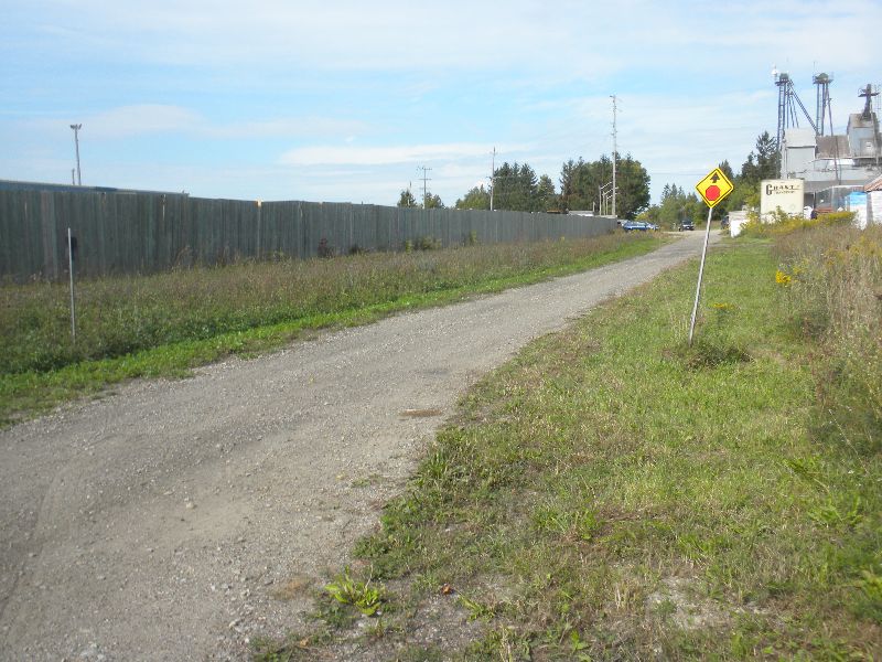
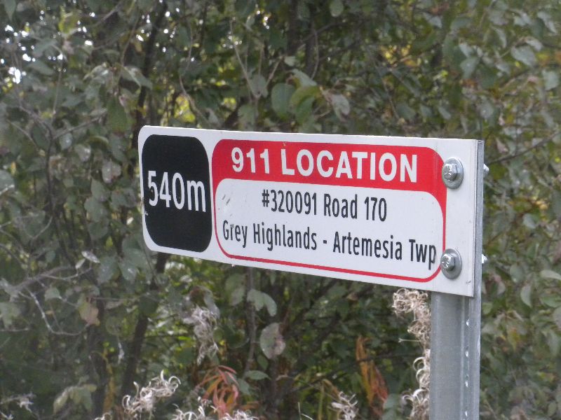
There was no sign of parking for the trail in Shelburne so I just road over from the seniors residence and joined it on what appeared to be an alley way with parking for a couple of local businesses. Note the little stop sign warning - in the next town this was the only way to tell where the trail was meant to be.
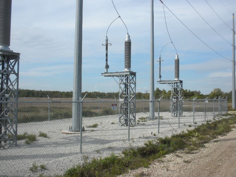
I quickly crossed hwy 89 heading north (where there is some street parking) and in a few kilometers came to the south edge of a bit wind farm. I believe these collectors condition the power.
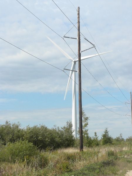
The mills are quite large. The blades are easily as wide as my bike is long.
The trail went along the wind farm for about 10km. The mills then branched off to the east for a bit. By the time I got past the wind farm, I was surprised to have not met anyone on the trail yet. Perhaps they were put off by the No Trespassing signs, or the trail being marked for snow mobiles. I had seen one sign showing a bike at 8 km and opted to interpret the no trespassing to mean don't go on the property beside the trail. Once I crossed into County of Grey, the trail was clearly marked for multi use.
The only services on the trail was a town 20km north of Shelburne. I crossed 3 streets and road through a few parking lots to get through, noting a deli just east of the south most street crossing. There was also an porta-pottie at the south end of town that looked like it might have been dropped off 10 years ago - the weeds were close to a meter tall at its door.
Continuing north, the trail become even more rugged with the addition of some mucky spots where water was ponded from recent rain. I met the first people on the trail at 25 km - two boys taking a horse and buggy south. We barely made it by each other.
I might have seen a small black bear 70-80m off the trail at 28km - it would have been last years cub if it was in fact a bear - I just carried on and didn't look closer. It was mostly note worthy because it reminded me that I had seen no wild life on the trail. This was getting close to when I should turn around. I had been expecting a big drop off the escarpment at some point, but it never came. I watched the 90 minute max turn around point pass as I approached the first spot the might have some fall colour coming soon.
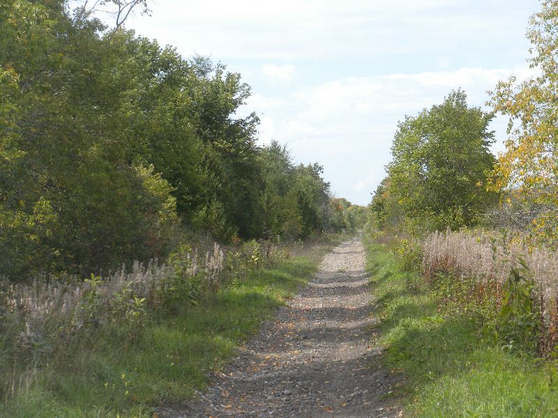
Most of the trail had mixed vegetation, none of which was note worthy (at least to me).
I stopped for a quick lunch after taking a photo of the trees finally showing on moth sides of the trail. I had forgot my power balls and chicken strips, so it was pretty meager. I didn't stay long because it was a standing lunch at this trail marker.
I'm used to clear street markers at trail crossings so didn't find these very useful. To be fair, there were very few roads to cross. Most crossings were driveways or dirt farm roads. I only stopped for traffic twice all day.
The return ride was into an increasing headwind. The forecast had indicated winds to 40km/hr from the east. They had been barely noticeable at my lunch stop but picked up progressively on the way back. My Garmin chart will likely show where I got a bit of shelter from the wind and could pick up the pace a bit.
About 8km into the return a guy zipped past me on an ATV. 7 km later two women on horseback came towards me - a grand total of 5 people on a trail I road for 64km.
The size of the wind mills really became apparent on the return. When I saw them, I felt like I was on the home stretch, even though I knew it hadn't been long enough since I went south through the little town to be back to them. It was over 5km before I actually made it to the wind mills. The head wind was very strong here - perhaps that is why the wind mills are located here. I decided to take an extra break before finishing up at the only spot I saw on the trail to sit down. It was quite relaxing listening to the sound of the nearest windmill. It pulsed at close to my sitting heart rate.
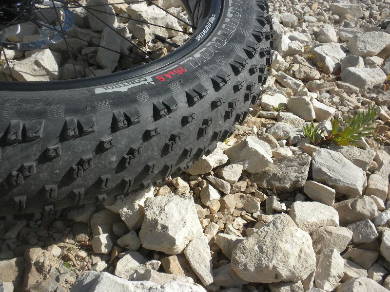
The 10 minute pause, finishing my drinks (1 bottle and a full Salomon back bladder) I was refreshed enough to finish up. Before leaving I noticed that the sharp rocks here were about the size of the other bigger trail rocks so took a photo for reference. The tire on the bike is 116 width. The rocks on most of the trail are more rounded.
A very long ride on a traditional bike. I might set my turn around time to 75 minutes in the future, with some allowance for outbound wind/elevation.
nutrition: 1 gel, 1 fig bar (much like 2 fig newtons), 1 HappyTot (mushed fruit in a squeeze pack), 3/4 tailwind
After a meeting at my mom's residence, I hopped on to this trail to see what it was like. It was pretty straight and surprisingly flat. This is very much a snow mobile trail and not at all groomed for cycling. The surface had quite a bit of rock of varying depth and size - some rocks fist sized and spots with loose rock as much as 10 cm deep.
There was no sign of parking for the trail in Shelburne so I just road over from the seniors residence and joined it on what appeared to be an alley way with parking for a couple of local businesses. Note the little stop sign warning - in the next town this was the only way to tell where the trail was meant to be.
I quickly crossed hwy 89 heading north (where there is some street parking) and in a few kilometers came to the south edge of a bit wind farm. I believe these collectors condition the power.
The mills are quite large. The blades are easily as wide as my bike is long.
The trail went along the wind farm for about 10km. The mills then branched off to the east for a bit. By the time I got past the wind farm, I was surprised to have not met anyone on the trail yet. Perhaps they were put off by the No Trespassing signs, or the trail being marked for snow mobiles. I had seen one sign showing a bike at 8 km and opted to interpret the no trespassing to mean don't go on the property beside the trail. Once I crossed into County of Grey, the trail was clearly marked for multi use.
The only services on the trail was a town 20km north of Shelburne. I crossed 3 streets and road through a few parking lots to get through, noting a deli just east of the south most street crossing. There was also an porta-pottie at the south end of town that looked like it might have been dropped off 10 years ago - the weeds were close to a meter tall at its door.
Continuing north, the trail become even more rugged with the addition of some mucky spots where water was ponded from recent rain. I met the first people on the trail at 25 km - two boys taking a horse and buggy south. We barely made it by each other.
I might have seen a small black bear 70-80m off the trail at 28km - it would have been last years cub if it was in fact a bear - I just carried on and didn't look closer. It was mostly note worthy because it reminded me that I had seen no wild life on the trail. This was getting close to when I should turn around. I had been expecting a big drop off the escarpment at some point, but it never came. I watched the 90 minute max turn around point pass as I approached the first spot the might have some fall colour coming soon.
Most of the trail had mixed vegetation, none of which was note worthy (at least to me).
I stopped for a quick lunch after taking a photo of the trees finally showing on moth sides of the trail. I had forgot my power balls and chicken strips, so it was pretty meager. I didn't stay long because it was a standing lunch at this trail marker.
I'm used to clear street markers at trail crossings so didn't find these very useful. To be fair, there were very few roads to cross. Most crossings were driveways or dirt farm roads. I only stopped for traffic twice all day.
The return ride was into an increasing headwind. The forecast had indicated winds to 40km/hr from the east. They had been barely noticeable at my lunch stop but picked up progressively on the way back. My Garmin chart will likely show where I got a bit of shelter from the wind and could pick up the pace a bit.
About 8km into the return a guy zipped past me on an ATV. 7 km later two women on horseback came towards me - a grand total of 5 people on a trail I road for 64km.
The size of the wind mills really became apparent on the return. When I saw them, I felt like I was on the home stretch, even though I knew it hadn't been long enough since I went south through the little town to be back to them. It was over 5km before I actually made it to the wind mills. The head wind was very strong here - perhaps that is why the wind mills are located here. I decided to take an extra break before finishing up at the only spot I saw on the trail to sit down. It was quite relaxing listening to the sound of the nearest windmill. It pulsed at close to my sitting heart rate.
The 10 minute pause, finishing my drinks (1 bottle and a full Salomon back bladder) I was refreshed enough to finish up. Before leaving I noticed that the sharp rocks here were about the size of the other bigger trail rocks so took a photo for reference. The tire on the bike is 116 width. The rocks on most of the trail are more rounded.
A very long ride on a traditional bike. I might set my turn around time to 75 minutes in the future, with some allowance for outbound wind/elevation.
nutrition: 1 gel, 1 fig bar (much like 2 fig newtons), 1 HappyTot (mushed fruit in a squeeze pack), 3/4 tailwind