Training Log Archive: veinbusterIn the 7 days ending Sep 4, 2016:
| |||||||||||||||||||||||||||||||||||||||||||||||||||||||||||||||||||||||||||||||
| « | » |
| » now | ||||||||||||||||||
| Mo | Tu | We | Th | Fr | Sa | Su | |||||||||||||||
Sunday Sep 4, 2016 #
flexibility 22:00 [1]
Mountain bike warm up/down (FatBoy ) 1:43:00 [2] 25.1 km (4:06 / km) +91m 4:02 / km
ahr:107 max:140
We went through the construction to the single track, which she isn't a big fan of but is willing to visit once in a while. It seems she lost most of the fluid out of her rear brake - still worked but had to be pulled right to the bars.
I need to get my seat dropper working properly. It needs to be tugged up. Might just need higher pressure.
Saturday Sep 3, 2016 #
flexibility 18:00 [1]
Road cycle tempo (Greenspeed) 2:11:00 [3] 49.5 km (2:39 / km) +170m 2:36 / km
ahr:128 max:161 shoes: DMT road
Thursday Sep 1, 2016 #
flexibility 15:00 [1]
weight training 36:00 [2]
Wednesday Aug 31, 2016 #
flexibility 18:00 [1]
Mountain bike (Stumpjumper) 3:07:08 60.55 km (3:05 / km) +134m 3:03 / km
ahr:127 max:144 shoes: Specialized Comp mountain
This was the nearest of the Simcoe off road trails that was long enough to make the drive to - ride was approximately double the drive time.
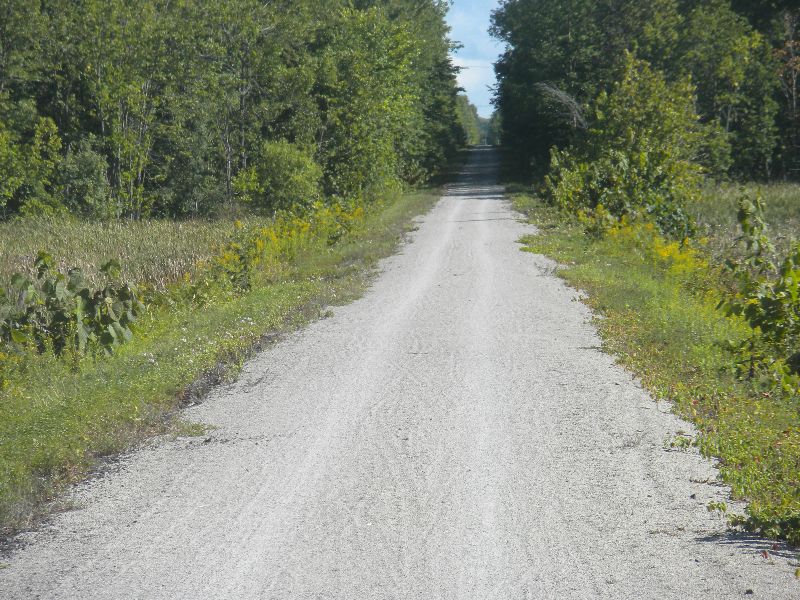
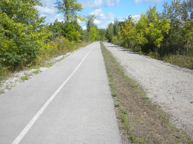
The trail was extremely flat and straight with very little on it other than periodic signs you could choose to read. Most of the trail is close to twice the width of the Caledon trail. It is very well maintained for use by snow mobiles in the winter - the only motorized vehicles allowed. Note even horses are allowed.
The entry to the trail was a bit tricky to find. I basically kept turning left towards the lake until a parking lot showed up here.
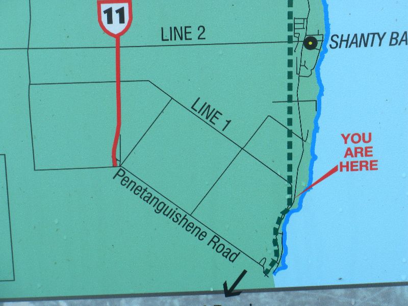
It was the only formal parking area I saw on the trail, though there is a small lot at 7th line S (space for 5 cars or so). Most people just parked on the side of the road a few car lengths away from the trail on one of the roads it crossed.
You could see forever, so it was easy to tell when a road was coming up. You couldn't always tell what road you were at. There wasn't much traffic at the crossings - I only paused for half a dozen cars. And this view was typical - I saw a small group of people about every 3km northbound and every 2km on the southbound return, which happened to be lunch time.
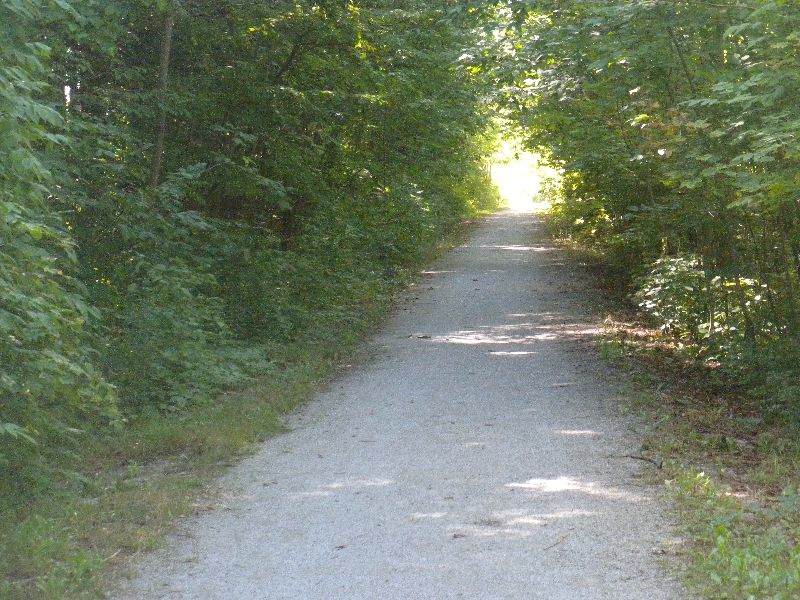
There was lots of shade in the middle third of the trail with trees forming nice cover for much of the trail. This section also had a fair bit of old forest so should be quite pretty when the leaves turn. If I take Mrs. up for that, I'll park at the small lot at 7th Line and ride north. This is a little over 10km for where I started and gets past the 7km stretch with just a thin row of trees on each side of the trail.
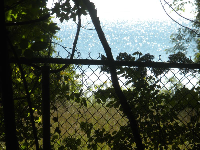
About 20km up the trail the light gravel became a fair bit deeper, so it became a bit more work. This is also where the look of the surrounding area became more typical northern Ontario (which it isn't) with bits of scruffy wetlands holding the forest at bay. I was a bit surprised to see so little of the lake given that the trail basically runs up the western shore. Most of the time you could only tell there was a lake to the east at road crossings, but generally couldn't actually see the water. It didn't show up until getting to the southern edge of Orillia.
A couple of hotels near the end of the trail provided access to the hotel - and signs reminding people they were there. The trail ended at James, just north of the overpass for Memorial. Here there were a few fast food restaurants for anyone who hadn't packed a lunch.
At that point the snow mobile trail was twinned for pedestrians. I decided to see where it went - just about a kilometer to a Home Hardware which would be a convenient place to park on the north end.
I took a relaxed interval to eat my power balls and fluid up a bit - testing the new bladder I got for my ancient Salomon thermal drink pack which works a charm and actually kept my water decently cool. I had only seen one porta-potty north bound at 20km, but going back I saw that there had also been one at 5 & 10 km, just obscured from view by trees at the pace I was going. I took most of the photos on the return (timer off for the stop, but deceleration and acceleration on the clock).
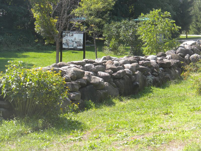
There was really only one spot on the trail set up for sitting for a while, and it was marked by typical Lake Simcoe rocks.
I definitely pushed my time limit on a traditional bike finishing this ride arriving back at my car spot on 3 hours. Normally I would consider that a hard cut off, but I expected no more than a kilometer of trail south of me, so thought I might as well see how it ended - big chunks of concrete and broken road half a km from the lot, so really nothing to see in that direction. That little extension put me over my target rolling exercise range of 14-16.5 hours by a few minutes, but it was deliberately at a super cool down pace so shouldn't have any material impact on my experiment.
Tuesday Aug 30, 2016 #
flexibility 19:00 [1]
Road cycle (Greenspeed) 2:05:00 [2] 45.2 km (2:46 / km) +136m 2:43 / km
ahr:120 max:158 shoes: DMT road
- there are coyotes
- don't feed them
- don't let your pet pick a fight with them
Mountain bike warm up/down (FatBoy ) 44:38 [2] 11.7 km (3:49 / km) +62m 3:43 / km
Monday Aug 29, 2016 #
flexibility 18:00 [1]
Road cycle (Smokie) 2:10:00 [4] 52.1 km (2:30 / km) +427m 2:24 / km
ahr:140 max:166 shoes: Specialized SWorks road
Temperature stayed close to 20C and skies were blue, so can't really complain.