Training Log Archive: TheInvisibleLogIn the 7 days ending May 30, 2010:
| |||||||||||||||||||||||||||||||||||||||||||||||||||||||||||||||||||||||||||||||||||||||||||||||||||||||||
| « | » |
| » now | |||||||||||||
| Mo | Tu | We | Th | Fr | Sa | Su | ||||||||||
Sunday May 30, 2010 #
Running 1:01:35 [3] 10.5 km (5:52 / km) +60m 5:42 / km
shoes: Nike Trail
Late evening run around the Maiden Gully bush, waiting for the phone to ring with emergency Windows rebuild request from no. 2 daughter. It didn't ring. Maybe she has solved her problem. Unlikely I suspect.
Note
Spent 90 minutes trying to get Julie's Garmin 405 to talk to a computer. It kept causing the computer to freeze. I hate the 405. Give me the direct USB cradle any day.
C • x05 5
Saturday May 29, 2010 #
Back, core and achilles 10:00 [1]
Real Orienteering race (One Tree Hill) 1:11:39 [4] **** 9.24 km (7:45 / km) +285m 6:43 / km
ahr:123 max:155 spiked:9/11c shoes: Saucony Xodus 9.5
7.3 straight line
Craig took the tracks off themap and demonstrated that bendigo orienteers are used to navigating with many tracks on the map, but fall over when there are few, even in spur gully. Shades of Inverary Easter 2002 when we were presented with spur gully maps without tracks. In that case there were no tracks on the ground either. I tried to maintain a high heart rate, and when I succeeded on this I failed on the navigation. Lost 6 minutes on those two errors. Not sure how much I lost on the decision to run to 10 instead of 7. Perhaps another 3-4 minutes.
Looking forward to when Craig puts up the RouteGadget.
Orienteering support (Newsletter) 4:00 [0]


Thursday May 27, 2010 #
Back, core and achilles 10:00 [1]
weight:78.4kg
Wednesday May 26, 2010 #
Back, core and achilles 10:00 [1]
weight:80kg
Running warm up/down 30:00 [2] 5.15 km (5:50 / km) +60m 5:30 / km
shoes: Saucony Xodus 9.5
Darkness running round Maiden Gully.
Tuesday May 25, 2010 #
Back, core and achilles 10:00 [1]
weight:78.6kg
I don't really want to drive to Mornington this morning.
Monday May 24, 2010 #
Back, core and achilles 5:00 [1]
weight:78.6kg
Running warm up/down 37:57 [2] 5.4 km (7:02 / km) +145m 6:12 / km
shoes: Nike Trail
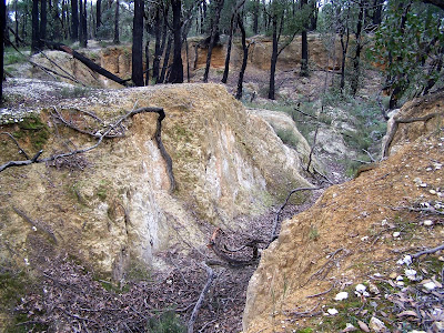
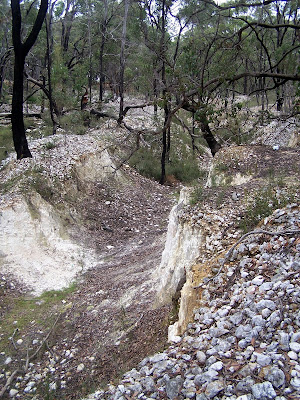
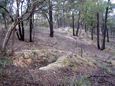
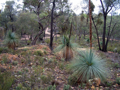
Another chapter in my quest to visit, run through and photograph all the unmapped terrain in various reports by Alex Tarr or that have been discovered in my travels through rural Victoria. Maybe its material for the next AGM?
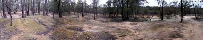
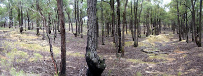
Today I had a work committment in Glenrowan. On the trip back to Bendigo I visited Reef Hills Park (near Benalla). It was not worth getting into running gear. Next was the area immediately to the south of Rushworth. This was much much better. Alex assessed it as suitable for an international short-O. We don't have short-O's now. But I ran 5+ k without revisiting anything and was in visible contact with surface mining features most of the time.
Later in week I have a drive to Hamilton. I might manage to visit some sluicing near Staffordshire Reef or the other Deep Lead near Stawell. Hoping for at least one. I don't have any aspirations for tomorrow's trip to Mornington.
 |
| From Rushworth |
 |
| From Rushworth |
 |
| From Rushworth |
 |
| From Rushworth |
 |
| From Rushworth |
 |
| From Rushworth |
 |
| From Rushworth |
 |
| From Rushworth |
 |
| From Rushworth |