Training Log Archive: TheInvisibleLogIn the 7 days ending Feb 6, 2011:
| ||||||||||||||||||||||||||||||||||||||||||||||||||||||||||||||||||
| « | » |
| » now | ||||||||||
| Mo | Tu | We | Th | Fr | Sa | Su | |||||||
Sunday Feb 6, 2011 #
Real Orienteering (Norfolk Hero) 1:02:02 [3] 7.95 km (7:48 / km) +230m 6:49 / km
weight:77.2kg shoes: Pretty blue mizuno trail shoes
Fowl and fizz event - start of the bush orienteering season! The hills felt easy after the SW and without a pack. Highlight was presentation of the noodle award trophy. It is a ripper!
 |
| From Noodle award |
 |
| From Noodle award |
Saturday Feb 5, 2011 #
Note
A day filled by nephew's wedding. The unanswered wedding question. Why does the hint of wedding turn all womens' minds to such mush that they focus on the dress opportunity and never think to check the weather forecast. I handed out two jackets and a blanket, and that was just within our family.
Friday Feb 4, 2011 #
Note
(rest day)
Trip back to Bendigo. Spent the morning in Hobart doing some serious window shopping for gear for next time. The list is long.
Thursday Feb 3, 2011 #
Walking 2:00:00 [3] 8.0 km (15:00 / km) +100m 14:07 / km
Easy strolls to various features of Bruny Island. The Cape Queen Elizabeth walk was pleasant, though we didn't finish it.
 |
| From Bruny Island 2011 |
Wednesday Feb 2, 2011 #
Walking 4:00:00 [3] 14.0 km (17:09 / km) +300m 15:29 / km
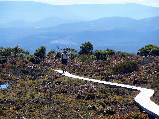
This was the blue sky day of the walk. It would have been magnificent to have been walking on a narrow ridge in the SW, but the price would have been camping through the previous day in torrential rain. So we chose the dilettante's - Hartz Mountain National Park. Climbed the peak, walked to Lake Osborne and finished with Arve falls.The tracks were the antithesis of the SW.
Julie defies the laws of physics!
 |
| From Hartz Mountain 2011 |
 |
| From Hartz Mountain 2011 |
 |
| From Hartz Mountain 2011 |
 |
| From Hartz Mountain 2011 |
 |
| From Hartz Mountain 2011 |
 |
| From Hartz Mountain 2011 |
 |
| From Hartz Mountain 2011 |
 |
| From Hartz Mountain 2011 |
Julie defies the laws of physics!
 |
| From Hartz Mountain 2011 |
 |
| From Hartz Mountain 2011 |
Tuesday Feb 1, 2011 #
Note
(rest day)
Recovery day for legs. Good day not to be in the SW. It poured in Hobart. Heavier rain where we had just come from.
Monday Jan 31, 2011 #
Walking 7:00:00 [3] 11.9 km (35:18 / km) +200m 32:33 / km
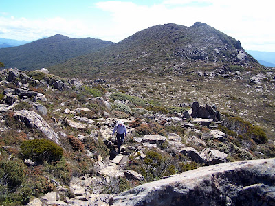
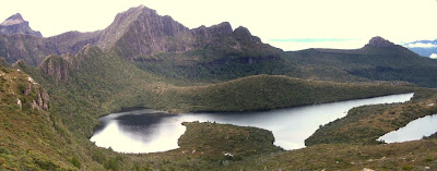
Day 3 Judd's Charm - Mt Sarah Jane Ridge - Judd Lake Track - Red Tape Creek
Another longer day than planned. The second half of the walk offered nowhere one would consider camping due to all the excess water. Further, we expected more bad weather was due that night. As it turned out, we were correct with 50 mm being recorded on the coast at Matsuuyker Island. So it was head down and go.
It was a day in two parts. The climb out of Judd's Charm was rewarded by impressive scenery. The Sarah Jane ridge offered a few more tarns and relatively easy walking. We had lunch before dropping down to the valley. That 'track' was a doozy. Initially it was along a rocky track. Soon it became a culvert rushing with water and rock slowly transformed to mud as the path barely allowed pack room through the scrub. After 90 minutes we reached the plains to be greeted with deep ooze in classic button-grass tedium. The guide suggested 4-6 hours and we couldn't see how this was possible if this was the general track standard. But the last hour was on a maintained track (of sorts) and we sped up. By then my quads were trashed and I couldn't react to any slips and was falling regularly. At the track end we were changing for the 8 k road bash to the car when I heard a distant engine. Grabbed the car keys and rushed for the road and was lucky to catch the only ride out for the afternoon.
All in all, we didn't plan to do the trip in less than 48 hours, but it was a sensible choice given the rain that fell the next day.
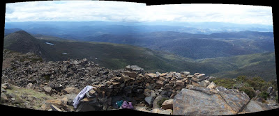
Sitting by Judd's Charm before the start of the day of work. Lightning Ridge looms behind.
Smiling again now the weather is clear.
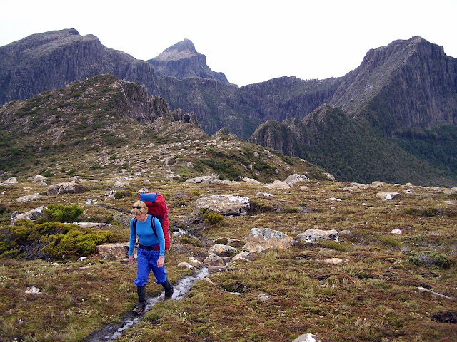
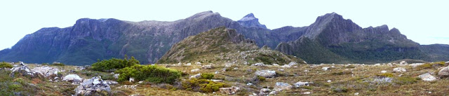
Cresting the first climb out of Judds Charm.
Onto the main ridge, with much of the previous day's route visible behind.
Unamed tarn.
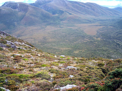
Traversing below Mt Sarah Jane on a field of cushion plants. Not sure where the track went.
Looking down the descent and the button grass beyond. After a morning of delights, it turns tough here.
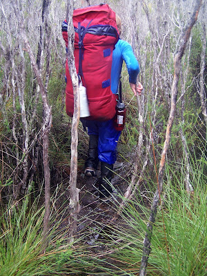
Clambering down a creek/track.
The 'track' through the mud. This was some of the better walking.
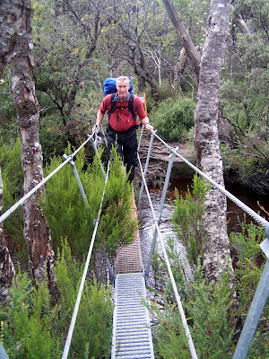
A track for the last few kilometres.
Escape.
But it was worth it.
Another longer day than planned. The second half of the walk offered nowhere one would consider camping due to all the excess water. Further, we expected more bad weather was due that night. As it turned out, we were correct with 50 mm being recorded on the coast at Matsuuyker Island. So it was head down and go.
It was a day in two parts. The climb out of Judd's Charm was rewarded by impressive scenery. The Sarah Jane ridge offered a few more tarns and relatively easy walking. We had lunch before dropping down to the valley. That 'track' was a doozy. Initially it was along a rocky track. Soon it became a culvert rushing with water and rock slowly transformed to mud as the path barely allowed pack room through the scrub. After 90 minutes we reached the plains to be greeted with deep ooze in classic button-grass tedium. The guide suggested 4-6 hours and we couldn't see how this was possible if this was the general track standard. But the last hour was on a maintained track (of sorts) and we sped up. By then my quads were trashed and I couldn't react to any slips and was falling regularly. At the track end we were changing for the 8 k road bash to the car when I heard a distant engine. Grabbed the car keys and rushed for the road and was lucky to catch the only ride out for the afternoon.
All in all, we didn't plan to do the trip in less than 48 hours, but it was a sensible choice given the rain that fell the next day.
 |
| From Mt Anne Circuit 2011 |
 |
| From Mt Anne Circuit 2011 |
 |
| From Mt Anne Circuit 2011 |
 |
| From Mt Anne Circuit 2011 |
Onto the main ridge, with much of the previous day's route visible behind.
 |
| From Mt Anne Circuit 2011 |
 |
| From Mt Anne Circuit 2011 |
 |
| From Mt Anne Circuit 2011 |
 |
| From Mt Anne Circuit 2011 |
 |
| From Mt Anne Circuit 2011 |
 |
| From Mt Anne Circuit 2011 |
 |
| From Mt Anne Circuit 2011 |
 |
| From Mt Anne Circuit 2011 |
But it was worth it.
 |
| From Mt Anne Circuit 2011 |
 |
| From Mt Anne Circuit 2011 |
 |
| From Mt Anne Circuit 2011 |