Training Log Archive: TheInvisibleLogIn the 7 days ending Jan 3, 2016:
| |||||||||||||||||||||||||||||||||||||||||||||||||||||
| « | » |
| » now | ||||||||||
| Mo | Tu | We | Th | Fr | Sa | Su | |||||||
Sunday Jan 3, 2016 #
9 AM
Running 32:56 [3] 5.0 km (6:35 / km) +60m 6:13 / km
Thursday Dec 31, 2015 #
Walking 4:15:00 [2] 16.0 km (15:56 / km) +660m 13:13 / km
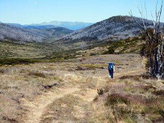
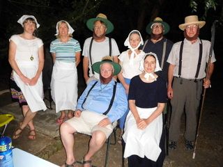
Decided to skip Jagungal and walk out a day early. Might come back outside March Fly season. When is that? The walk was shorter than the previous day and on tracks. So some of it was pleasant along the Farm Ridge. But the final climb up from Tumut River ensured we were ready to drop packs by the time we reached the car. Off to NYE celebrations at Dederang where the required dress was Amish.
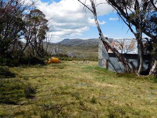
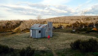
The best views from Round Mountain Hut are on the toilet.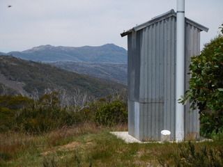
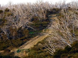
The last hill.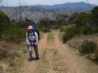


The best views from Round Mountain Hut are on the toilet.

The last hill.


Wednesday Dec 30, 2015 #
Walking 6:30:00 [2] 12.5 km (31:12 / km) +240m 28:28 / km
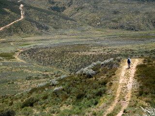
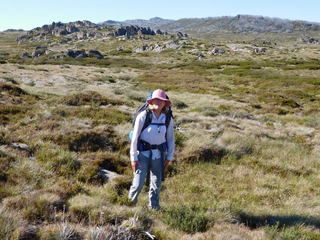
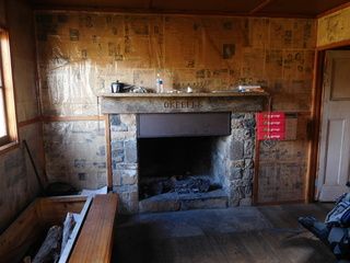
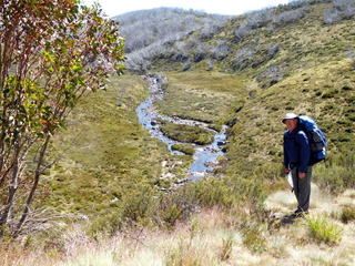
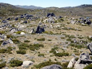
Our off-track day from Mawsons to O'Keefes Hut. Discovered early that vegetation on the map was very untrustworthy. Once we adjusted to that and the 20 metre contour interval, navigation was easy. The plan was to camp on Jagungal Saddle and the next day climb Jagungal before continuing to Mawsons. March Flies (and ants) put paid to that. We reached jagungal saddle early afternoon. Julie was pretty tired so we rested there an hour. At that stage I was willing to do anything other than act as fly bait. I put the options to Julie- climb Jagungal or go on to the hut. She chose the latter. It was less than 4ks. The going was easy enough following the Bogong Creek, until we reached the break of slope. We realised after a short while that following such a steep creek was less than safe. So we headed up the side of the valley in thick scrub, then sidled along heading towards an invisible open saddle that lead to the hut. Out of curiosity I pulled out the GPS we had carried and not used. It confirmed we were where we thought we were and the saddle was where we expected it to be. In fine conditions such as we were experiencing, the GPS was a waste of weight. But I can see how useful it would be in bad weather up on the plains. Reached the hut in a fatigued state and sort welcome refuge from flies by staying inside and reading newspapers from the 1930s.
Walk further down this... I think not.


Walk further down this... I think not.


Tuesday Dec 29, 2015 #
Walking 5:05:00 [3] 11.1 km (27:29 / km) +460m 22:46 / km
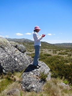
Grey Mare to Mawsons Hut. The second half was off track. We discovered that one can slow from 4k per hr to 1.5k per hour in the boggy valley we climbed up. Valentine Creek is great terrain for orienteering. Pity about the distance to the assembly area. I think even the Scandis would be unimpressed by that walk.


Monday Dec 28, 2015 #
9 AM
Walking 4:00:00 [3] 15.5 km (15:29 / km) +360m 13:52 / km
Onwards to Grey Mare Hut. At that point it was 2 in the afternoon and we had had enough after looking at the climb to the next hut on the map. So spent a lazy afternoon killing March Flies.