Training Log Archive: NadimIn the 7 days ending Jul 8, 2017:
| ||||||||||||||||||||||||||||||||||||||||||||||||||||||||||||||||||
| « | » |
| » now | ||||||||||
| Su | Mo | Tu | We | Th | Fr | Sa | |||||||
Saturday Jul 8, 2017 #
Note
weight:188.5lbs
I did a lot of yard work. My back and legs wern't feeling so good after that. In the evening, I watched a movie with Samantha. I'm still shaking a cold I got out west when on vacation.
Friday Jul 7, 2017 #
12 PM
Running (Street & Trail) 23:43 [3] 2.96 mi (8:01 / mi) +11m 7:55 / mi
slept:6.5 weight:188.5lbs
Washington, D.C. From 14th & Independence Ave., SW, Independence Ave. to the Reflecting Pool to Lincoln Memorial. Circle, to 23 St. NW., to Ohio Dr., and the Rock Creek Trail, to E. Basin Dr., on walkways along the Tidal Basin, and around the north side of the Jefferson Memorial, to 15th St., to Independence Ave., to 14th St. SW. I felt pretty well running as often is the case returning from higher altitudes. I had been rested and it was a pretty nice day. The low 80s F temperature was a lot warmer than I was used to. The downhill first mile was into the wind a bit, but a fair amount of tourist pedestrians to run around. The mile along the river was with a tailwind and fewer tourists. I felt like I was slowing down finishing up but I guess I pushed harder and ran faster, even though there were more tourist and it was a bit uphill.
Thursday Jul 6, 2017 #
Note
Back to work, I'd thought about working out, but I was jet lagged and it was raining hard (check out Peggy's log). I had a lot of catching-up to do at work too.
Wednesday Jul 5, 2017 #
Note
slept:4.0
Travel Day. We had an early flight and went through Chicago coming back.
Tuesday Jul 4, 2017 #
12 PM
Hiking 16:43 [1] 0.67 mi (24:57 / mi) +1m 24:50 / mi
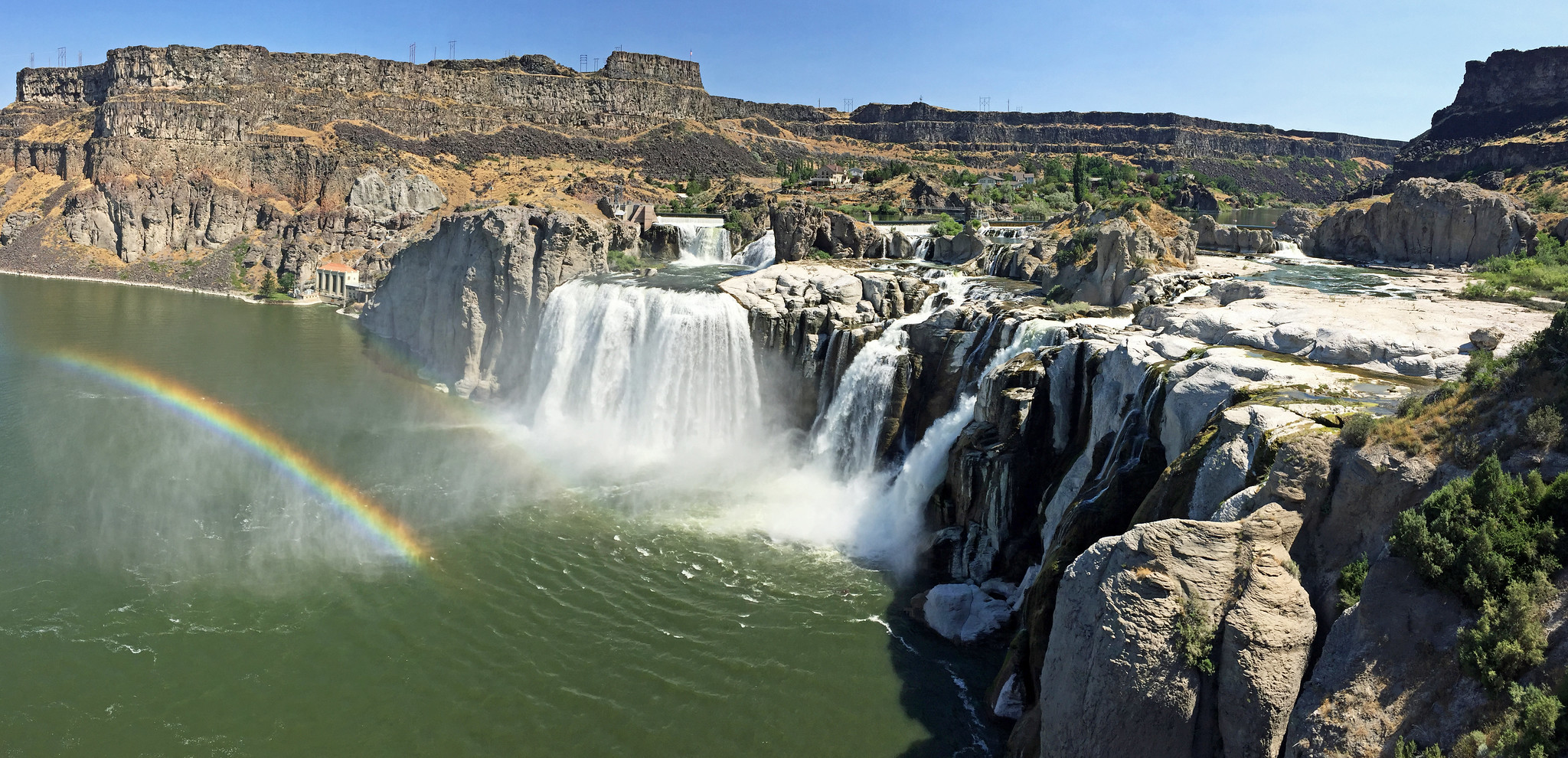
Twin Falls, ID - Perrine Coulee - Our helpful hotel desk clerk had told us that the canyon and falls were near our hotel and we had planned to see it. We wandered about a mile away on her directions and ended up in Perrine Coulee, a nice park in the Snake River canyon floor. We'd been following the Snake River more or less since we'd left Yellowstone a few days ago. The roads we took crossed the Snake many times and we'd even rafted in it in the Tetons. It was good to get to see it out here. The canyon was interesting but not complex. There were some falls that we only noticed on the side of the canyon when Max pointed it out. It being the 4th of July, there were a lot of people out and about. Almost all of them were kayaking. There may have been an event going on. There was an outfitter tent there. The people who weren't kayaking seemed to be local on their daily walk down and up the canyon road. We tried to get onto a rocky knoll. Though the morning, it was already hot and a path we tried to go to had signs indicating the way was closed for restoration. We just wandered a bit until I got directions to the namesake Twin Falls, which was about 6 miles away by car. So, after our wandering hike, we drove over. There was a sign before the paid entrance that made comparisons to Niagra Falls in height or something else--that seemed over stated but there was good volume flowing over the upper falls which we could see from a sort of observation deck, and the falls were beautiful. Like Niagra, it would have been even more so if the hydro-electric facility were not so prominent. The falls were very close and just upstream of where Evel Knievel jumped the river on a rocket.

After seeing the falls, we thought we'd get a drink and see one more sight before going to Boise. At the McDonald's we stopped at, a woman pointed out the our right front tire on our rental car was nearly flat. Filling it at a gas station only made the slow leak, leak faster. A call to the rental company for instruction wasn't very fruitful. The spare was a donut that was not going to get us to Boise and most places were closed. We found a Walmart that was open but busy. No other auto place or even a car rental office was open to help. We were told it'd take 3 hours since other car owners needing help all resorted to Walmart's automotive shop too. We ended up sitting around shopping 2 hours before the fixed it. I made good use of the time by forcing Samantha to learn how to tell time on a clock face. I used a bunch of cheap clocks on a shelf, most of which were set to 10:10 am/pm. I had to shame Samantha into focusing and I didn't feel too proud of it, but she did finish by being able to tell time.

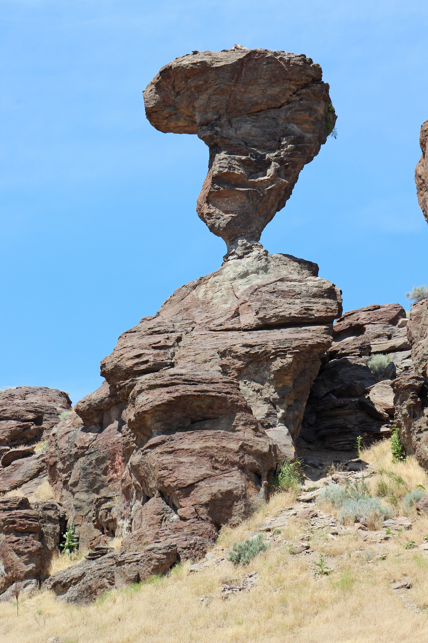
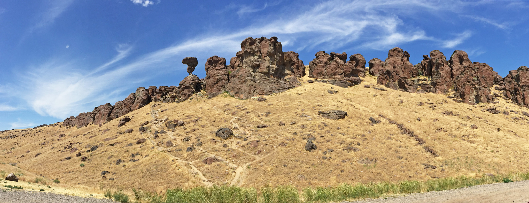
Finished with Walmart, I held out to to to Balanced Rock (40 minutes west) for a drive-by. I'd seen the picture and thought that looked interesting. However seeing in person and realizing that it was rather large did impress me. It was in on a ridge area of old lava flow that had been mostly eroded by a stream. A few other boulders there had a balanced appearance but none quite as extreme. If we had had time, I would have like to hike into the rocks as we could see one other guy doing.
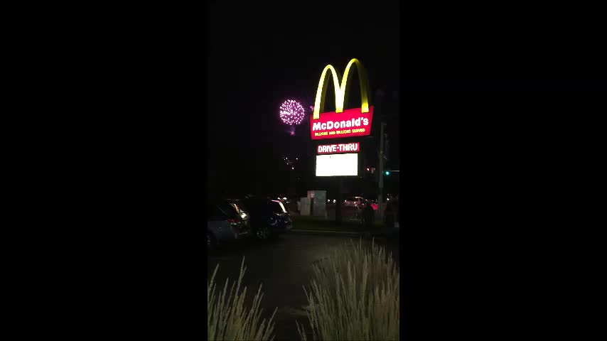
We finally got to Boise 2 more hours later. I felt like most of the day had been wasted. We did get to see the new Despicable Me 3 movie and eat dinner. All that was left was was going to the firework display. That had been moved due to high water in the place they normally display at. We arrived latish in traffic. I ended up having to park in a McDonald's parking lot where I waited in line to buy drinks as the show started. It was sort of funny watching from there--not at all ideal but I suppose it was very American. There was slow traffic getting out and back to the hotel after the show.
After seeing the falls, we thought we'd get a drink and see one more sight before going to Boise. At the McDonald's we stopped at, a woman pointed out the our right front tire on our rental car was nearly flat. Filling it at a gas station only made the slow leak, leak faster. A call to the rental company for instruction wasn't very fruitful. The spare was a donut that was not going to get us to Boise and most places were closed. We found a Walmart that was open but busy. No other auto place or even a car rental office was open to help. We were told it'd take 3 hours since other car owners needing help all resorted to Walmart's automotive shop too. We ended up sitting around shopping 2 hours before the fixed it. I made good use of the time by forcing Samantha to learn how to tell time on a clock face. I used a bunch of cheap clocks on a shelf, most of which were set to 10:10 am/pm. I had to shame Samantha into focusing and I didn't feel too proud of it, but she did finish by being able to tell time.
Finished with Walmart, I held out to to to Balanced Rock (40 minutes west) for a drive-by. I'd seen the picture and thought that looked interesting. However seeing in person and realizing that it was rather large did impress me. It was in on a ridge area of old lava flow that had been mostly eroded by a stream. A few other boulders there had a balanced appearance but none quite as extreme. If we had had time, I would have like to hike into the rocks as we could see one other guy doing.
We finally got to Boise 2 more hours later. I felt like most of the day had been wasted. We did get to see the new Despicable Me 3 movie and eat dinner. All that was left was was going to the firework display. That had been moved due to high water in the place they normally display at. We arrived latish in traffic. I ended up having to park in a McDonald's parking lot where I waited in line to buy drinks as the show started. It was sort of funny watching from there--not at all ideal but I suppose it was very American. There was slow traffic getting out and back to the hotel after the show.
Monday Jul 3, 2017 #
8 AM
Hiking (Street & Trail) 25:00 [1] 0.85 mi (29:25 / mi)
Lava Springs ID - After a morning in Jackson, WY, in which we mostly just shopped, we started our drive homeward.

The route went through the back roads to hot springs in Lava Springs ID. The country getting there was interesting with more volcanism dominating the terrain, and various large and small businesses. One large man-made land work near Soda Springs was a +1 mile long, 1/3 mile wide, and +100 foot tall, waste containment pool. I've stood next to the Great Pyramid in Egypt and the work it must have taken to build the pool walls reminded me of that pyramid. It was explained by our hotel registrar later on, that molten slag from an ore mining operation (Monsanto phosphate and other stuff?) was poured into it and that the sight of the molten slag being poured was "beautiful" at night. That place must have been 2 hours away from our hotel so it must have been coincidence, or something really big for the region for her to know about it.
Lava Hot Springs was like a sudden hidden oasis as we crossed long stretches of desert. A lot of people were there hauling innertubes and floats up to go down a fast flowing creek. Others like us came for the namesake hot springs--it was odd going into the hot water on a hot day but it worked for a while. When we bought our tickets, they explained that there was a cold pool options but it turned out to not be on the premises. Rather than get our shoes out and on for the described 4 block walk, I chose to just go barefoot with Max and Samantha. That was a mistake. The sidewalk was burning hot and when the sidewalk ended, there was gravel or tar to walk on. We were like bugs running to the safety of shadows on the walkways or an occasional grass spot, then resting and cooling our feet. We had wet our towels before going so that we could make our own safe ground and cool off, but it was so hot and dry that the towels even started drying out. The 4 blocks turned out to be 6 longish blocks too. I felt some burns on the ball of my feet. Max seemed less bothered but he did go from shadow to shadow too. Samantha worked at it but needed help. In a few spots. I had to carry her across gravel and tar. We finally got to the pool and cooled off--very busy with indoor and outdoor large pools, slides and even a climbing wall on a pool side that Max went up. Unfortunately we had to do our hot walk all again to get back--it was only slightly easier and both walks took mental toughness. Peggy said she had a good rest in the shade on the grass near the hot pools.
Driving on to Idaho Falls, I got indication of a tire pressure warning. The car was handling well at 84mph and +95 F temperatures so I figured it was getting over pressured from the heat.
Sunday Jul 2, 2017 #
8 AM
Running (Trail) 39:44 3.77 mi (10:32 / mi) +154m 9:21 / mi
Grand Teton National Park - From our Colter Bay cabin, I got out for a much needed run. Peggy had run earlier on a small trail we'd scouted on a map during an evening lakeside stroll. I figured that I'd do the same since I thought the trail I wanted to take had been closed--a bear had killed an elk in the area. To my surprise, I found a trail headed in the direction I'd wanted to go that was open. It was hilly initially but it got me to Heron Pond and Swan Lake. The pond was more of an inlet to the larger Jackson Lake. I hoped I'd see a moose but was a little worried about finding a bear. I'd run this trail in 2000 and liked it back then. Back then it felt a lot easier. I paused at a trail junction to read a map where the trail ahead was closed. A runner had come up from behind and turned toward Swan Lake from there. I pursued and caught him but it took me more effort than I thought it would. Luckily we both had to stop 2 times as groups of horses and riders came at us from the other direction.
4 PM
Hiking (Trail) 1:16:43 [2] 3.33 mi (23:02 / mi) +287m 18:10 / mi
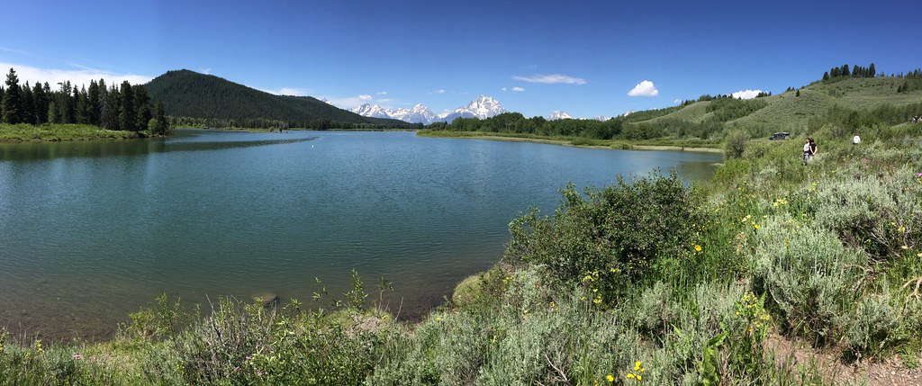
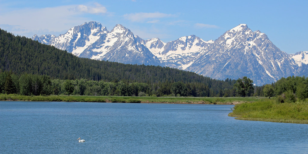
Grand Teton National Park, WY - Inspiration Point. After we got our sleepy kids going and checked out of Colter Bay, we stopped at the Oxbow Lake for some pictures. We didn't see any moose but there was a nice pelican and a lot of wild flowers to set off the Tetons in the distance.
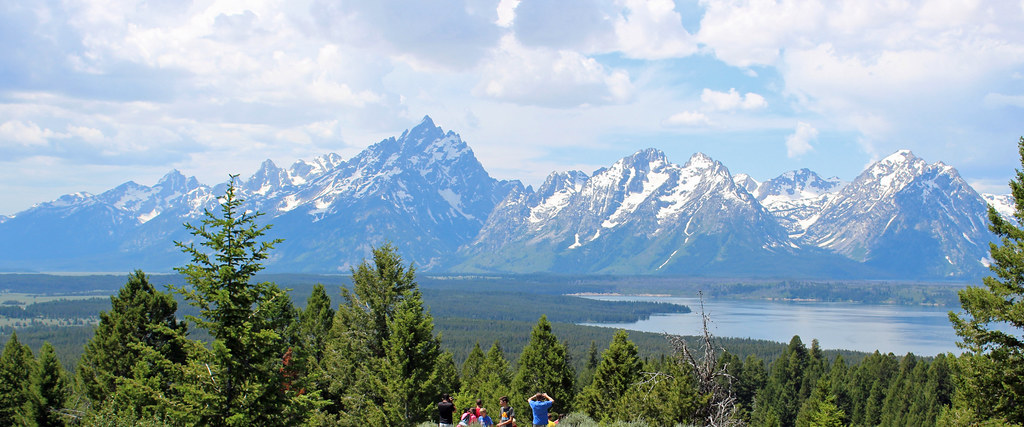
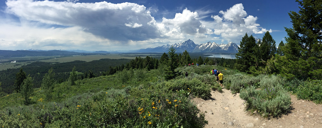
We also drove up to the top of Signal Mountain for views.


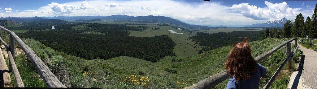
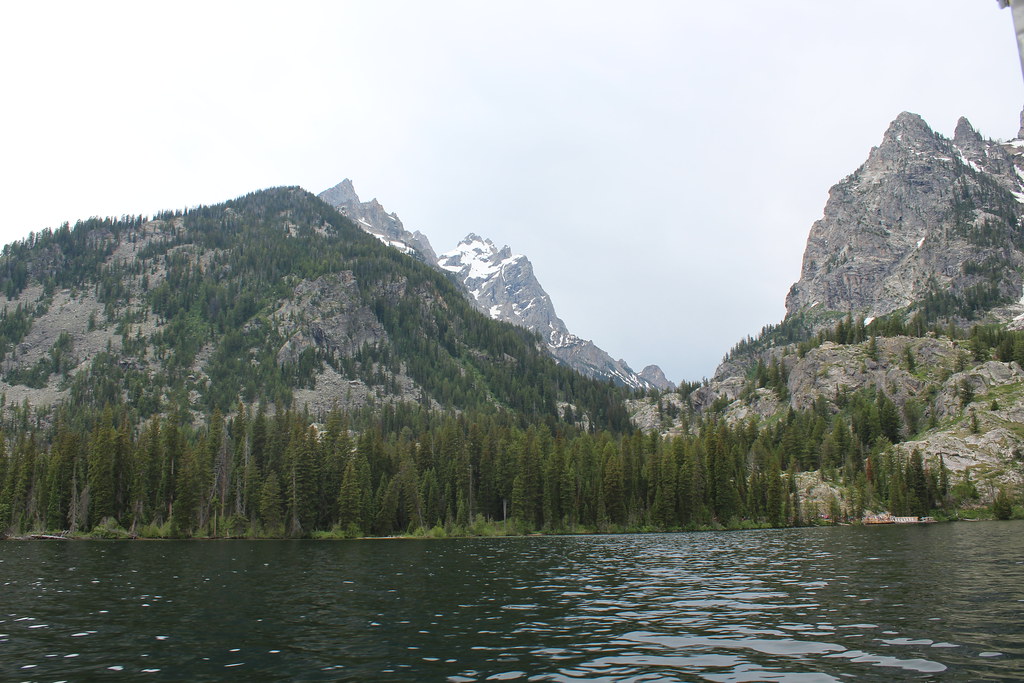
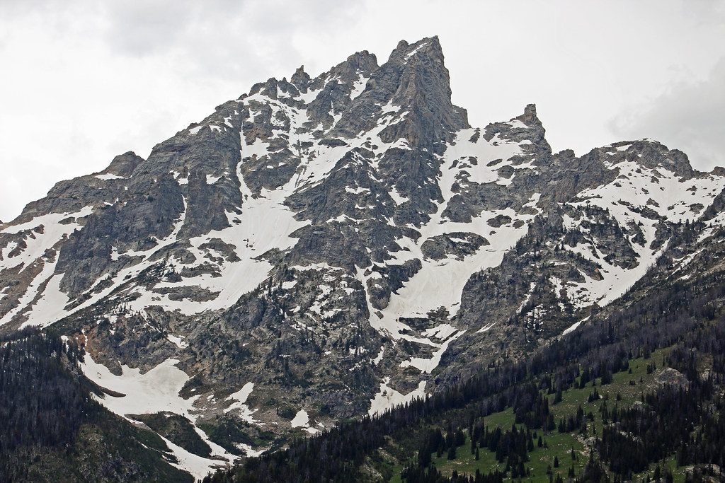
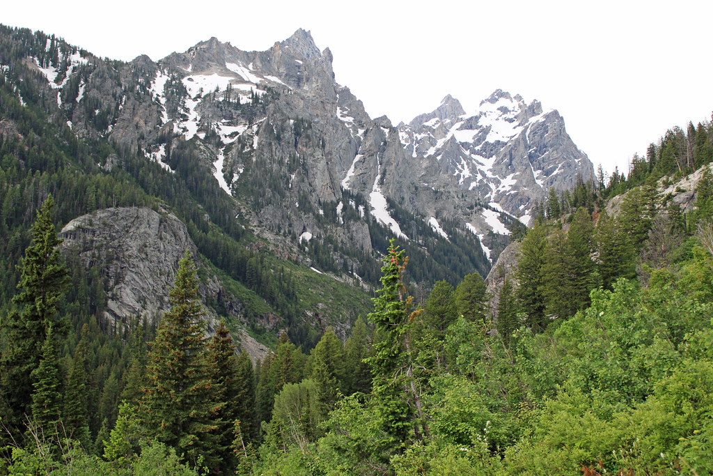
We were able to make a boat shuttle trip across Jenny Lake to start the Inspiration Point hike. The weather was looking risky but we were okay. We toyed with the thought of going to both Inspiration Point and Hidden Falls but in a continuing series of closures we had been running into, the connecting trail had been closed for changes--a gift of $19M had been given to make infrastructure changes all around this very popular lake. The hike was steep, but not so bad for me. Because I lingered taking pictures, I ended up with Samantha who had been rather uncooperative. I nudged her along and kept her from turning around. We had plenty of breaks so it wasn't a grueling thing for her. Still, I had to filter out the excuses. The hike climbed higher than Inspiration Point, and turned back downward to it. I would have been very tempted to go to the falls if I'd know how close we passed to them. The view were nice but we didn't stay long. We could see rain coming over the Tetons behind us. Fortunately it had been virga in the first sightings. As we got closer back to the the dock, it was clear that it was going to eventually reach the ground. It was light while we waited in line for a shuttle boat, but it did pour later.


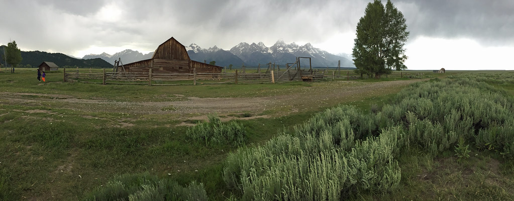
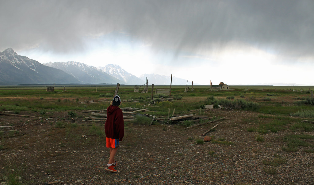
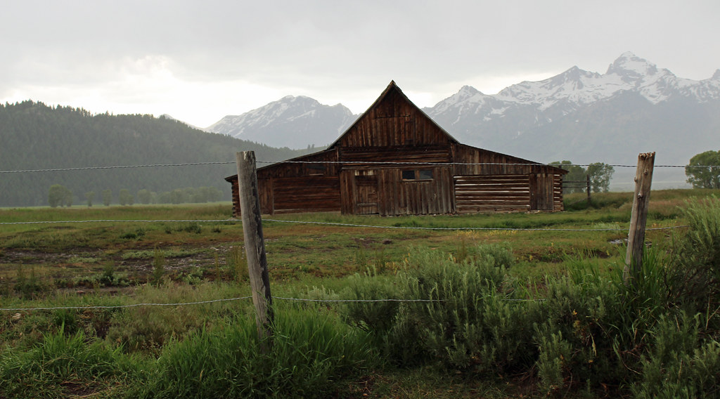
We were able to get to a group of Mormon homesteads and take some pictures but as we got to the Snake River and Glacier View road stops later, our views and my chances for picture


We were really hungry when we reached Jackson and got checked-in. It took us a while to find an affordable restaurant that didn't have a long wait. We walked to Wendy' from our hotel later for Frosty's for dessert, so least our night in Jackson was good. The kids and adults enjoyed having Internet access and TV again.
We also drove up to the top of Signal Mountain for views.
We were able to make a boat shuttle trip across Jenny Lake to start the Inspiration Point hike. The weather was looking risky but we were okay. We toyed with the thought of going to both Inspiration Point and Hidden Falls but in a continuing series of closures we had been running into, the connecting trail had been closed for changes--a gift of $19M had been given to make infrastructure changes all around this very popular lake. The hike was steep, but not so bad for me. Because I lingered taking pictures, I ended up with Samantha who had been rather uncooperative. I nudged her along and kept her from turning around. We had plenty of breaks so it wasn't a grueling thing for her. Still, I had to filter out the excuses. The hike climbed higher than Inspiration Point, and turned back downward to it. I would have been very tempted to go to the falls if I'd know how close we passed to them. The view were nice but we didn't stay long. We could see rain coming over the Tetons behind us. Fortunately it had been virga in the first sightings. As we got closer back to the the dock, it was clear that it was going to eventually reach the ground. It was light while we waited in line for a shuttle boat, but it did pour later.
We were able to get to a group of Mormon homesteads and take some pictures but as we got to the Snake River and Glacier View road stops later, our views and my chances for picture
We were really hungry when we reached Jackson and got checked-in. It took us a while to find an affordable restaurant that didn't have a long wait. We walked to Wendy' from our hotel later for Frosty's for dessert, so least our night in Jackson was good. The kids and adults enjoyed having Internet access and TV again.