Training Log Archive: NadimIn the 7 days ending Apr 13, 2019:
| ||||||||||||||||||||||||||||||||||||||||||||||||||||||||||||||||||
| « | » |
| » now | ||||||||||
| Su | Mo | Tu | We | Th | Fr | Sa | |||||||
Saturday Apr 13, 2019 #
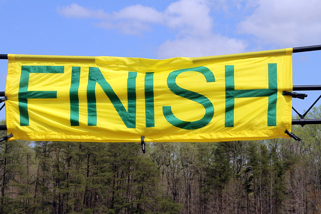
Orienteering race (Foot) 46:19 [4] 4.6 km (10:04 / km) +80m 9:16 / km
slept:6.5 weight:202lbs (injured)
I was a bit excited at the start, and also feeling heavy. On the way to #1, I went for using the road instead of going straight at the control. It got me running and got me into reading the map. I was pretty good knowing where I was when crossing the creek near the spur. I have confidence in being able to follow a bearing through QOC's terrain and did so to a marsh. I followed that to the first control.
The 2nd control required just being just a little careful to get on the right side of a ridge. The 3rd control was a short straight shot over a ridge. I took the 4th going straight too; I didn't see the stream confluence but could tell it was below the first stream I crossed. For the 5th control, I sought to save climb by crossing the ridge early and going up the next reentrant. By this point, my glasses were fogged-up pretty well. I resorted to reading the map by looking over them (the glasses are cut with no glass on the top half).
Leg 5-6 was the longest on the Green Middle Course. I wasn't feeling fast to gain advantage by going around to the right. I probably also didn't fully explore that option before starting. Instead, I sought to go as straight as I could while still getting further north of the green vegetation. I executed this well, finishing with a run down the spur, but I hear the route on the ride further north was best.
I think I started catching-up with Dennis Dougherty on the way to #8, but first I passed Florence Tan. I was a little less direct on this leg. I cut right after the stream crossing, and came up the spur to the control. Florence went a straighter route and probably got there not long after me.
I lost site of Dennis Dougherty as I went left to get around the green vegetation. Going left put me on the wrong side of a ridge, so cut back when I saw a gap. I was unsure if I'd gone far enough, but when I didn't see #9, I cut left until I did.
Going to #10, I zig-zagged around vegetation, but was fairly solid getting there. Leaving #10, I made a 90 degree error. I knew there should be a change in direction but since I lined my compass up on the leg line from 9-10 instead of the meridians, I lost time--I realized it in 15-20 seconds, and then corrected. Dennis was ahead of me as we closed in on #11. For #12, I passed Dennis and went to the right to save climb and use the creek. After passing a spur, and adjusting direction again, I picked my way to the other side of the stream and was hesitant until I hit the control. Dennis was close behind. We left #12 differently; I backtracked. Dennis went high initially and got to the road ahead of me. We both cut in on ride. I passed him in the woods and used the edge of the field to know where I was and punch.
Finishing-up I ran right around some green, but when it went too far, I cut through it. I used the hillside to pick my entrance to the field. I had at first thought the control was in the forest but re-reading the map corrected that notion. I kept ahead of Dennis for the run-in but was feeling the heat and not pushing all the way. I was fairly clean on this run, and just lost time when leaving #10. I got 2nd in my age group, and 4th on the course.
Orienteering (Foot) 24:36 [4] 3.0 km (8:12 / km) +86m 7:11 / km
(injured)
I went out running okay. The run in the morning was past me and I'd eaten 90 minutes earlier. Riley Culberg, former QOC member, passed me on the way to my #1, though he was going to a different control. I moved okay but not so fast through the next several controls. I had only one hesitation when I was on a saddle and could not see the next control which was in a depression. The woods to this point were mostly more open than the run in the morning. As it got greener in the controls prior to the spectator control, I got caught and passed by another person or 2 though I may have passed others. I decided to contour around leaving the spectator control. It was a little greener gong that way than expected, getting to the creek. I crossed the stream where a nice ditch was emptying into it, but in retrospect this ditch is not the one that I saw which had been mapped. I was more to the right. I climbed up to a change in steepness, before a small field, and bounced off that to get to the next control. A junior from BAOC was nearby. We were close to each other for the next few controls at least one of which was forked. I was sure he'd sprint past me on the run in so when I was going for #9 and he asked me, I didn't tell him which control code I was going for. He got to #9 just ahead of me, but I got ahead of him later as was leaving #9. Heading to our last control in the forest, I was doing well but decided to go around some green vegetation, on the right side. If mapped right, I should have ended up at the base of the hill with the control. There was more green there than mapped so I climbed most of the wrong hill before correcting. I chased the Junior from BAOC into the field and watched him pull away on the home stretch. I also got passed by 2 other Juniors on the run-in. It was a nice run for me except for the bobble at the end. I held up physically and that was the best part. My team with Boris and Allison finished 3rd in the 3 point category. Max's team came in well behind us.
Thursday Apr 11, 2019 #
Bicycling (Commute) 6:04 [3] 1.41 mi (4:18 / mi) +12m 4:12 / mi
slept:6.5 weight:200.5lbs (injured)
Bicycling (Commute) 6:30 [3] 1.41 mi (4:37 / mi)
(injured)
Wednesday Apr 10, 2019 #
Bicycling (Commute) 39:48 [3] 12.2 mi (3:16 / mi) +22m 3:15 / mi
weight:201lbs (injured)
Bicycling (Commute) 47:03 [3] 12.0 mi (3:55 / mi) +115m 3:48 / mi
(injured)
Tuesday Apr 9, 2019 #
Bicycling (Commute) 6:22 [3] 1.41 mi (4:31 / mi) +18m 4:21 / mi
slept:5.5 weight:200.5lbs (injured)
Bicycling (Commute) 5:49 [3] 1.41 mi (4:08 / mi) +18m 3:58 / mi
(injured)
Monday Apr 8, 2019 #
Bicycling (Commute) 5:50 [3] 1.41 mi (4:08 / mi) +19m 3:58 / mi
slept:5.0 weight:200lbs (injured)
Bicycling (Commute) 5:52 [3] 1.41 mi (4:10 / mi) +14m 4:02 / mi
(injured)
Sunday Apr 7, 2019 #
Orienteering (Commute) 7:10:58 [3] 15.42 mi (27:57 / mi)
slept:4.5 weight:200.5lbs (injured)
The format was much like the Stumble races that SVO started, only one had to get to a required control before getting another map with optional controls. Each group of optional controls became like the Stumble format's windows. This was an Adventure Race, not standard OUSA orienteering. Between some occasional verbal and non-verbal cursing, Peggy, I, and others used to OUSA orienteering mused that the Adventure was discovering many obstacles not on the map and other disconnects. I figured that most of the controls were marked on the map according to coordinates, rather than in relation to the features that were shown or not shown.
As Peggy returned from the Prologue, we both walked out with other teams walking behind us. Two of those teams had some excited happy dogs running back and forth. Experience over the last month of being injured proved it to be better for me to walk a while before trying to do any running.
Once leaving a paved road, I intended to follow a bearing to the first mandatory control but I needed to go a little left to get around deadfall. Once we hit a hillside the detail we could see was a little hard to match-up with the general contours the map showed. Peggy tried to navigate with the contours on the map and that led us much higher than we needed to be for where the control was set. We were also getting used to having to adjust for magnetic declination on this leg. With our first control past us we got our map with optional controls. It was 1:7,500 scale, instead of the slightly improved standard USGS 1:24,000 quadrangle based map that we started on. With the adjustment in scale it was another rough adaptation. I was still uncertain how long this event would be. 2 controls on this map were high and 2 were low, so we opted to skip the 2 high ones. I'm sure we could have gotten them but if other maps had controls this far apart, I figured we'd be in jeopardy of not completing enough controls later on. The first low control we went for wasn't that hard but again, even at 1:7,500, the contours didn't make it clear where it'd be. The clue (Peggy read it, not me) was the most help--an eroded knoll. I'd never seen one like it. It was like a small dirt replica of Sugarloaf Mountain in Brazil, and around 80 ft tall. We walked through messy vegetation the long way around to avoid dropping and scrambling up from the low point where there was a marsh. The next control was not good for our navigation either. The terrain had interesting contours but with continued vegetation issues. We saw Phil Bricker on the leg, going higher. I kept thinking we'd see 2 streams but when we hit a field with a road and houses just beyond, Peggy figured we'd gone too far. We rose up the road to where the hillside got steeper and started climbing it at an angle on a ride, since the map showed the circle centered above where the hill starts getting steeper. Looking back down, I saw it hanging really high on no feature. We took the road to the next control, climbing the mountain gently and much more happily after that. We took some pictures with a DVOA runner who was going solo and spiked the second required control.
We figured the next set of controls was more achievable. The one that was away from the rest was fairly straight up a reentrant that made the climbing easier so we did that. When we got to the cluster of controls around Cat Rock (there were several rocky ridge clusters there), we were fortunate to have others nearby, including Joe Brautigam's team. We got these controls efficiently, but some were in some gnarly boulders. With the bad maps, and without others there it'd have much harder to find some controls--Joe got lead away while trying to read it properly as an OUSA orienteer would. I started relying on bearings and clue descriptions much more. We enjoyed getting to the next required control which was mostly an easy trail run. By this point, I tried doing some jogging and Peggy seemed pleased about that.
With a new set of controls and another new map we were set. Going downhill in relatively open terrain was great. We moved well. I even passed some people running down the slope to an old dam near the road. I splashed through the water rather than cross on a log. We hit a control on a boulder next to a stream below an functioning dam for the big lake well. Peggy led us to the left and up a road. I think I'd have gone right and up a different road, but Peggy's way looked okay too. From what was printed, it seemed like we'd be able to cross the dam on a road. When we got to the dam, we saw a ranger walking by, and then a fence at the spillway. We could see the fence and a wall going a long way below the dam. It looked like we'd have to swim to go left of the fence (it turned out that Sandy Fillebrown, Barb Bryant, and even the DVOA guy we'd taken a picture with earlier crossed on the left side by easily splashing through. What Peggy and I did instead, was to go all the way around the lake clockwise. Another group came behind us and did it too. It turned out not to be that hard. After climbing high enough we could jog the road and there was another road on the other side of the lake that took us right to the next control. We lost some time (15 minutes) but not a whole lot considering the length of the race.
A few people including Joe Barrett and Joe Brautigam's team could be seen leaving as we had a brief break and got an a new map. We went through the Houck area near Cunningham Falls. The controls were all streamers instead of flags. We had no problem with them. Peggy, I, and others in QOC had checked out this area years ago for possible mapping. I still like the idea of doing that, though the club decided against it at the time--maybe I'll do it myself one day.
After leaving the next mandatory control, we had a long climb. We did most of it up a trail. Michael Dickey and most others we'd seen had used the trail less. Again, we may have lost a little time due to that but we also saved having to pick our way through the mountain laurel that was at the higher elevations. We departed the trail a little past the bend and hit a stream right where control Z was shown to be placed on the map at a change in steepness. The clue was at the end of a rocky ridge. We went past the stream to the foot of that rocky ridge and still didn't see it. A minute later, I saw it hanging high--about 70 ft up, on top of the ridge. Getting there was easier on the SE side, since that was less rocky. We'd thought about doing this set of controls counter-clockwise, but because of the rocks,we decided to go to Y next. That turned out to be slow--deadfall, rock an rhododendron. We debated the way a bit but we hit the trail at a bend about where I had hoped to. Leaving Y, I got a Facetime call from our daughter Samantha who was home alone. Strange days these are to be in a race on a rough mountain while doing video calls. Samantha gets anxiety when alone and my sister hadn't showed-up there yet. Peggy led us on as I talked to her and tried to reach my sister. We hit what we thought was Bob's hill and turned SW toward control W--the hill was the long extension of the ridge we were on earlier at Z. The ridge was rocky and unpleasantly thick. We were tired and Peggy again was putting faith in the map, feeling we should turn around. We did that eventually, even after I'd gone ahead to see if i could find it. getting near a trail, we knew we'd gone too far the wrong way. We headed back up the unpleasant Bob's Hill ridge. Ken Walker Sr. passed us walking along the bottom of the ridge in the better, but still deadfall ridden forest. He was actually going for a different control but led us to W. Peggy was still upset about the ridge so rather than go for U directly, we went round about leaving Bob's hill on the wrong side and crossing it where it was easier. Both of our feet were weak and aching at this point. I'd picked up a new ailment on my left foot--it felt like a stress fracture along the top of my foot to my big toe. We hit U easily and saw Ken Walker Sr. coming back from it just before we'd gotten there. Getting the next 2 controls involved a lot of thick forest and even some rock scrambling. We hit them well. Others coming the opposite direction were having a lot of trouble since they confused one ridge for another. The map just didn't show 2 there. Peggy found the last one before we'd gotten to the end of a ridge that looked like it might be the "overlook" in the control description.
From that last control, we practically ran the whole way down the mountain to the finish. We passed some groups while getting passed by others who were younger. We took the Blue trail when the trail forked and got ahead of one of the groups that'd passed us. It was nice to have finished the race, without my calf holding me up too much. We enjoyed pizza and drinks, and chatting with friends who were still there. Some QOC friends like Dasa Merkova and Alexis (all women team) placed and got awards.