Training Log Archive: revyIn the 11 days ending Aug 1, 2011:
| ||||||||||||||||||||||||||||||||||||||||||||||||||||||||||||||||||
| « | » |
| » now | ||||||||||||||||||||
| Fr | Sa | Su | Mo | Tu | We | Th | Fr | Sa | Su | Mo | |||||||||||||
Friday Jul 29, 2011 #
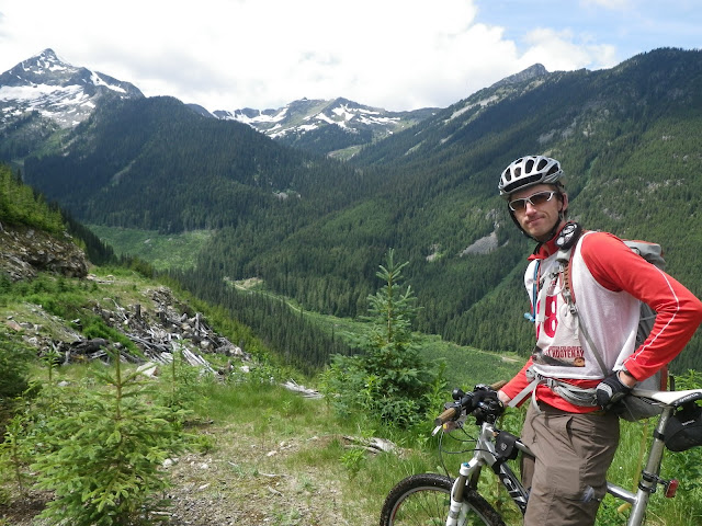
Bike race 11:30:00 [3] +2100m
As we pull into the TA we have a bit of a conversation about how long to sleep. The finish seems close yet I know it is still far away and sleep now may still do us in good stead. We decide that an hour will be enough and tuck into our sleeping bags for a snooze. I wake up to the sight of Mike frantically waking us up. "We've overslept". "How long?" I ask. "30 minutes". I shrug it off - it doesn't seem to bother me at the time. I think I was voting for a longer sleep anyway so it may actually help us. No sign of DART yet so we are still in second for the time being. We don't know yet that they have had issues on the previous hike and need to wait for daylight to relocate themselves. We are still racing like they are right behind us.
We set off in the night - the road brightly lit by our new Lupine lights. I've been using them for years but the rest of the team picked some up this year and it made the techincal night riding a breeze. Right off the bat we are climbing and the pace seems brisk. Sleep has done us good - at least for now. We need to hit a saddle between two peaks and then follow "trails and roads" to a waypoint on the otherside. The only problem is that examination of satellite photos has failed to show me a route that will lead us to the WP without bushwhacking. This will be one of those sections... unknown until we are actually there... kind of like AR before the days of Google Earth.
The road climbs steeply and we make a wrong turn ending up on a road too high up that ends. Not happy as it looked like the right road on the map but none of the junctions were mapped so some tough luck. The choice is to backtrack and lose alot of elevation or bushwhack 500m and 500ft down. We decide to bushwhack. I think this makes Mike really happy as I think this is his favorite AR event:) We find the road and continue climbing but it soon ends and we are following a very rough ATV trail and then just a route cut through the forest. More hike a bike but at least it is open. On the other side we find another ATV trail and at first it seems to be going the right direction but it soon turns left and away from our intended WP. In retrospect it might have made more sense to avoid dropping down here and bushwhack some more to contour and join another logging road. Or perhaps in the daytime some other ATV trails would have been more obvious. In any case the lights of Rossland and Trail directly in front of us confirm that we are going in the wrong direction. We soon hit a major logging road and I know where we are. It seems like the safest choice is to climb up this new road and then again bushwhack 500m over to another logging road. The only downside to this plan is that we need to climb back up the mountain. As the sun rises I can see the other logging road beneath us and we descend through the cutblock to find it. We soon hit the waypoint and begin the climb up to the Seven Summits trail. We are following the old road that climbs to Plewman Basin. The actual Seven SUmmits trail starts from a trailhead just a little east of here. I can see why they added the first section of singletrack as the road is steep - often too steep to ride. We think we see a big bear run across the road but given that we have been racing for five days who knows if we actually did or not. We eventually merge with the singletrack and up we go.
At this point Mike is lagging as he is very sleepy. As I hike behind him I decide to try and shock him awake. Without warning I yell at the top of my lungs "Mike!". Not sure howe well it worked but I think I startled him for sure. Sorry if I scared you too much:) At the best of times certain sections of the seven summits are a tough climb but in our weakened state even the easier sections seem cruelly difficult. As an added challenge fatigue has robbed me of my balance and techincal sections seem doubly hard. The climb doesn't seem too bad though and soon we are emerging on the ridge and enjoying the expansive view. At this point I am kicking myself for not bringing my camera. I had wanted to save the weight and I thought we'd do alot of this in the dark. It is early morning and the light is perfect though. Opportunity lost - it will have to live on in my memory banks.
I've only ridden the trail once before and my memory was that it was rather choppy. The first section surprises me though and flows nicely through the alpine along the ridge crest. Life is great again. We hit the junction with the Old Glory trail and aren't surprised to find no CP staff. We drop our bikes trusting that no one will be out hiking at such an early hour and do the short out and back to the top of Old Glory. The view is almost worth the pointlessness of the out and back. The mountains here are gentler and we are on the highest point around. We can see across all the terrain we've covered in the last few days. We can even see the jagged peaks of the Valhallas off in the distance. Back on our bikes the trail descends a bit - it seems like some trailwork has been done as it is less rocky than I remember - eventually the rocks return though. We climb up towards the ski hill. It seems like this section is taking us forever. We pass hikers who recognize us as teamWild Rose - cool - must have been in the local news. For some reason I thought WT had finished before midnight so I am wondering why it is taking us 3-4 hours longer than them to ride this section. It turns out they finished at 4 am so that makes me feel better afterwards.
We aren't riding the whole seven summits trail so once we hit the ski hill we descend down the south side road to the base. It is all downhill from here but it isn't a walk in the park quite yet. The road is rough and rocky and requires attention. It seems to take forever but we finally hit the last CP where Chris is waiting for us. The end is in sight. I lead the team through Rossland. After some previous races where I didn't spend enough time making sure I knew the route through town to get ot the finish I have all the turns written down for this one. We weave through Rossland - you don't want to make a wrong turn as every road is hilly and invariably you'd be climbing back up hill. We need to follow an old wagon road part way down towards Trail and luckily it is smooth and fast.
Soon we are onto the pavement and coasting down into Trail. It feels surreal. The sounds and smells are all foreign, oppressive almost. We have spent days on our own and now the cars around us seem intrusive. It truly is like culture shock. It isn't a surprise but the finish is anti-climactic as always, only a few people there to cheer us in. There is always a mix of feelings at the finish - relief, sadness, elation. It seems to take a while to sink in how well we've done. Even weeks later it is hard for me to put my finger on exactly why we did so well. We just went out there, put our heads down and kept moving. Everyone pulled their weight, there was very little conflict, we just got the job done. Can't ask for much more from a team:)
If you have made it this far in the story I commend you:) This was certainly one of the hardest races I have done. Of course I seem to say that after alot of races so maybe I just have a short memory. I am glad I got to experience the terrain we covered. It truly was epic. I wish Geoff had managed to run the race a bit more smoothly as I worry that too many other racers went home with a sour taste in their mouths. He is lucky he was hosting the race in such a spectacular location as that may have soothed some of the hard feelings. During this race I think I only quit adventure racing once... better than most races I do I think. On to the AR Worlds in November!
Hike race 1:40:00 [3] 6.0 km (16:40 / km) +300m 13:20 / km
Thursday Jul 28, 2011 #
Bike race 6:00:00 [3] +1000m
So at this point we felt a little lost and unsure what to do. Do we wait and hope we hear something? Do we sleep? Although sleep seemed appealing I was worried that stopping here felt like we were putting the race on hold. moving forward meant that we were still in race mode and we would hopefully get to an area where we had better radio contact or there was someone who knew what was going on. So in light of that I think I made the execituve deicison that we were moving forward. A quick review of our gear revealed that we had two backpacks, no bike shoes or helmets (but at least we all had either running shoes or techamphibians), were missing the map for the next TA. We still had some food though and I knid of knew where the TA was so I wasn't too worried about the lack of map. The next climb looked steep so a possible hike a bike so the lack of bike shoes might not be that big a deal. Turns out we were in better shape than DART as they had no backpacks and had some team members in neoprene booties. I guess they duct taped rocks to their egg beaters to create a better platform
So after wasting a couple hours trying to figure out what the hell was going on we left Renata. Quite a pleasant place actually in the light of morning. Not sure I'd want to live there - a bit remote - but a nice place for a cabin. The climb up Bulldog mountain was streightfoward and like the map contours suggested did end up being mainly a hike a bike. Good thing it was as riding without bike shoes was tricky. I was lagging a bit on this climb as VJ and James disapeared ahead. mentally it was a tough climb as since we were walking the elevation seemed to count down too slowly. One downshide of holding the map is that you always know just how big the climb is and it can be painful to watch the altimeter turn over slowly. Eventually we did crest the summit and carefully descended the other side. it felt weird to be riding with no helmets. We made our way to the kettle Valley rail grade and passed through a long tunnel. It was a bit weird and surreal especially since you couldn't see the other end when you entered it due to a curve in the tunnel. Once again at the next CP there was no staff so we kept on moving forward.
I found the next section quite tough. It was a slight uphill on a rail grade and it seemed like the surface was soft and sapped my leg strength. Eventually the summit was reached and the grade turned negative. At this point we were off the map that I had but I knew that the TA was somewhere on this rail grade. We descended all the way to the highway bridge and didn't see anything though and I was pretty sure we should have passed it by now so we turned around. more frustration as we tried to figure out what to do next. We climbed a steep road that went towards the highway and eventually managed to raise Chris on the radio. He promised to meet us in 5 minutes at the TA location which we had in fact already passed. One of the funniest memories I have of this race is Chris speeding up to us with 5 bins in the back of his pickup all pointind in various directions and a crazy look in his eye that seemed to say "ha ha - you are lucky I found you!". It was getting hot now as we were nearing midday and I felt like I was moving in slow motion in the TA. The fact that we had skipped a sleep probably had something to do with this as well. WT was slowly extending their lead on us but given the next section had some nav choices we still felt like we had a chance to catch them and had to kep pushing. It owuld be tough to make up several hours but we had to try. On top of that we still were constantly wondering where DART was. We had our own time credits now which helped us a bit however we still thought they were just a few hours behind us.
Hike 10:00:00 [3] +600m
The next section was not long but it covered an area that was criss crossed with logging roads, cut blocks and ski trails. I had spent alot of time looking at Google earth and thought I had a good plan of attack. We were going to stay north and follow a series of logging roads before doing a short bushwhack across the upper part of a drainage that bisected the route. At this point we should be in the Categar nordic ski trails and we would be able to follow these for a few km before doing a short one km bushwhack to hit some other logging roads that would take us to the CP.
initially we had to follow the rail trail to a waypoint before climbing steeply out of the drainage that the railway followed. I thought our climb out of the drainage was quite elegant - it got steep but no cliffs. Looking at out track afterwards it seems like we didn't quite hit the waypoint which surprises me as I thought we were close. Might have been thinking less than clearly at that point. Once the climb was out of the way we had to cross an old cutblock and find the road we would follow next. It was quite hot and I tried to stay in the shade as much as possible. I had an incredibly strong sense of deja vu on this section. I was sure I had been here before. So weird how this always happens. We did find the road we were looking for and proceeded east. The heat was unrelenting and I felt like I was going to melt or my head was going to explode or both. We stopped for a bit in the shade and I guess I fell into a deep sleep right away so the team let me sleep for half an hour. I felt way better after that and it seemed like even that short break got us past the warmest part of the day. The roads we followed seemed to match what I expcted. There was some new sections but nothing too confusing. We started our bushwhack across the creek drainage and had no problems finding the road system on the other side. XC ski trail maps confirmed that we were where we thought we were. A few km on the ski trails and we had another short bushwhack. Again we found the road we expected and another few km on logging roads brought us to the CP. We hadn't gained much time but we also hadn't lost any to WT.
From here we jogged down the road to the highway. I developed a sudden pain in my right heel - a blister had just popped so spent a little time fixing that. Overall though my feet stayed in pretty good shape during the race. Only think I will have one lost toenail and only two blisters - neither which bothered me too much. I am sure that not walking down that road from the valhalla's helped our feet. Anyway jogging didn't seem to bad however Mike took my pack as he seemed to be moving faster and that evened us out a bit. Road sections are not my forte. one last little wrinkle on this section was the instructions that the highway was off limits. it seemed like we had to bushwhack just off the hwy for a km or so before hitting the hiking trail around nancy greene lake. james thought this was rather dumb and arbitrary given that we could just walk on the shoulder of the highway. not wanting to get penalized we bushwhacked though - looking at the times for some of the other teams on this section I am not sure many other teams did. A short jaunt along Nancy Greene lake and then across the hwy to the TA which we hit as the sun was setting.
Wednesday Jul 27, 2011 #
Hike 2:00:00 [3]
The remainder of the walk out from Gwillim went fine. We soon popped out on the FSR. Somehow I ended up out front from the rest of the team - they had stopped to do something or another. As I walked down the road I was quite sleepy and a couple of times almost walked off the road. Interestingly this was one of the only times in the race that I was sleepy while trekking or biking. Sleepmonsters were pretty rare in this race for me. As soon as the rest of the team caught up to me we started jogging down the road and this seemed to wake me up.
We soon hit the new TA and proceeded to set up our tent, It was around 1 or 2 and despite just sleeping that afternoon our original schedule would have had us sleep now so we stuck with it. As we were prepping Chris Collard showed up and threw us a curveball. It turns out the decision to move the TA was Geoff's - he had in fact wanted it there from the start. After all who wants to walk 20 extra km down a logging road? Problem was that moving the TA meant that the gear trucks would have an extra 40km trip on a rough road making logistics even more challenging. Chris was moving the TA back down the road and overruling Geoff. Luckily since we had beat him there he was letting us ride down the road. Since we were planning to sleep he let us pack up and keep our drop bag to leave our tent in once we were done. He then packed all the bins and bikes up and moved the TA back down the road. While we were sleeping DART came by and I guess they were rather pissed off. Tom Zidek would have told them to expect their stuff higher up so I am sure they were disapointed. All the teams other than WT and us were supposed to get a time credit for the difference between riding and walking plus some sort of fatigue credit. We were happy to ride but it did mean we would now be a ways in front of the teams chasing us but they would have time credits so it would impossible for us to know exactly if we were still in second.
We soon hit the new TA and proceeded to set up our tent, It was around 1 or 2 and despite just sleeping that afternoon our original schedule would have had us sleep now so we stuck with it. As we were prepping Chris Collard showed up and threw us a curveball. It turns out the decision to move the TA was Geoff's - he had in fact wanted it there from the start. After all who wants to walk 20 extra km down a logging road? Problem was that moving the TA meant that the gear trucks would have an extra 40km trip on a rough road making logistics even more challenging. Chris was moving the TA back down the road and overruling Geoff. Luckily since we had beat him there he was letting us ride down the road. Since we were planning to sleep he let us pack up and keep our drop bag to leave our tent in once we were done. He then packed all the bins and bikes up and moved the TA back down the road. While we were sleeping DART came by and I guess they were rather pissed off. Tom Zidek would have told them to expect their stuff higher up so I am sure they were disapointed. All the teams other than WT and us were supposed to get a time credit for the difference between riding and walking plus some sort of fatigue credit. We were happy to ride but it did mean we would now be a ways in front of the teams chasing us but they would have time credits so it would impossible for us to know exactly if we were still in second.
Bike 8:00:00 [3] 95.0 km (11.9 kph) +1500m
We woke up, packed the tent and bundeled up for the initial chilly ride down the road. Several km down we passed DART and exchanged pleasantries. No other team had passed us while we were sleeping so we had at least a two hour lead on the teams behind DART. It was about 18km down to the new TA where we ditched some of our warm gear and then proceeded along a flattish FSR to the ropes section. This was about 10km and we pacelined it pretty efficiently. The rope section was kind of pointless. We biked to the ropes, went across, bushwhacked to the road, went back up the road, crossed the river on a bridge, turned left onto a different road 50m from the point we left it earlier. I guess the original plan was for a really cool rappel off Gimli Peak above Gwillim Lakes but the snow levels made getting there too dangerous. In my opinion they should just ditch the rope section in that sort of scenario. They could have made better use of the 4 volunteers that were stationed at the ropes. As an added headache the ropes guys were not ready when we arrived and then they hooked up VJ wrong the first time and had to pull her back across and redo things.
Anyway we spent an hour or so at the ropes and then continued with our ride. This was the longest ride of the race and took us back north up a long valley before we had to find our way into a different drainage that would then take us down to Burton on the shores of Arrow Lakes. This is valley that we just climbed.

The initial climb was pretty mellow and then the road narrowed and got pretty overgrown for the last bit. It was still rideable but required a little more techincal skill. Geoff had mentioned that there were three different ways to make it to Burton however I only saw one route that made sense. A low pass where logging roads from each side came within a km of each other. If necessary we could bushwhack to connect them but as I suspected there was an ATV trail that connected the two valleys. Here we are looking down the other side.
The next section of ATV trail was actaully pretty fun and required some technical skill to ride. Once we popped out on the FSR though it was a quick easy 20 km descent down the valley to Burton. I realized that I had a broken spoke at this point however it didn't seem to be causing any issues so left it alone.
Anyway we spent an hour or so at the ropes and then continued with our ride. This was the longest ride of the race and took us back north up a long valley before we had to find our way into a different drainage that would then take us down to Burton on the shores of Arrow Lakes. This is valley that we just climbed.
The initial climb was pretty mellow and then the road narrowed and got pretty overgrown for the last bit. It was still rideable but required a little more techincal skill. Geoff had mentioned that there were three different ways to make it to Burton however I only saw one route that made sense. A low pass where logging roads from each side came within a km of each other. If necessary we could bushwhack to connect them but as I suspected there was an ATV trail that connected the two valleys. Here we are looking down the other side.
The next section of ATV trail was actaully pretty fun and required some technical skill to ride. Once we popped out on the FSR though it was a quick easy 20 km descent down the valley to Burton. I realized that I had a broken spoke at this point however it didn't seem to be causing any issues so left it alone.
Paddle 11:30:00 [3] 72.0 km (6.3 kph)
Burton is a little cabin community on the shores of Arrow Lake. One of my dad's original ski partners retired to live in Burton and one of my high school buddies has a cabin here. Bit of a coincidence considering Burton is pretty small. Arrow Lakes is a long straight reservoir that extends from Revelstoke all the way to Castelgar. This was not shaping up to be an exciting paddle. We got to the TA in the heat of the day and I think that slowed our TA time down as bit as we seemed to be moving in slow motion. I took the time to jump in the lake and wash off which felt good however I still stunk as I think all the cuts and scrapes I had collected were giving me a nice "eau de staph". We had to pack out bikes into the canoes as it would impossible for the bikes to get moved in time otherwise. Although out paddle was 72 km the drive to the next TA was at least twice as far. Actually turned out the bikes fit in the boats pretty well.
We had a good choice of boats again and despite our slow motion movement (I was just as guilty of this) we eventually got out of the TA. There was a slight bit of wind and VJ and James decided to pull out their sail. It seemed to Mike and I that this wasn't worth the effort and this proved to be the case. I think I had jinxed myself on the previous paddle when I had commented on how good I felt. It is rare I feel great during AR paddles and after feeling great on Slocan Lake I felt terrible now, My left lat was incredibly tight and with every paddle a sharp pain would shoot through my back. I could barely put any power into the stroke. On top of that I was feeling quite sleepy (the only other time during the race I was really struggling with fatigue). The combo made me quite miserable and really put me in on of my lowest points of the race. I couldn't wrap my mind around paddling like this for the next 70km. I took some painkillers and tried to shut the pain out. I also changed my technique which hlped a little but it wasn't a very powerful stroke.
The first 20km of the paddle followed the highway however after the Needles ferry the shoreline become pretty empty. Despite my lily dipping we weren't getting dropped by the other boat so I figured our pace was pretty slow. Eventually after a couple hours things did start to improve and our pace picked up a bit. We passed the one CP on the lake - there was no one there so we figured we were stretching the race logistics a bit too much. After the CP the lakeshore got quite empty and actually fairly scenic. Lots of cliffs and rocks descending right down to the water. Would have been a nice place to camp and spend the night but not in this race. Soon night fell and we followed the dark outline of the shoreline as a handrail. As we neared the next CP (and TA) cabins started to appear on the shoreline again. I thought we were a little ways from the CP however just in case we pulled in closer to the shore so that we wouldn't miss it in the dark. I think we woke some vacationers up with my bright light. I'll bet to this day some people are still wondering what the hell those bright lights were that night. At one point we even met some pleasant campers who yelled out to us "are you the guys from Alberta?". This confused us a little as it seemed like they were expecting us. "Are you guys with RTN?" No answer but they seemed to be considering it. I presumed that they weren't associated with the race and apologized for waking them (it was 1 in the morning) but the guy laughed andsaid they were still up and then asked if we wanted to join them for some whiskey. The alcohol was making him quite talkative and he wouldn't shut up as we tried to continue on our way. Another km of paddling and we hit where the CP (and TA) was supposed to be. No obvious TA though other than a truck parked by the water so we went a little further to check out a different spot. The houses on the shoreline disapeared so we headed back to the truck - it was in fact the TA. A sign on the truck would have been nice.
This was supposed to be a TA where we had access to our bins before paddling across the lake to the tiny community of Renata and leaving the canoes there. We asked where our bins were and the CP staff tells us that we won't see our bins until the next TA?! That would have been fine if someone had mentioned that before we started the paddle as we would have packed differently however finding out now was not very helpful. VJ was quite cold so she jumped in the truck to warm up while we tried to figure out what to do next. The CP staffer really didn't know anything so we pulled out the radio and tried to contact someone. No luck. We decided to drive a little higher up the hill and see if the reception was better. Still no luck. We spent almost an hour here before deciding to paddle across the shore to Renata. The staffer seemed to think they had food and a fire which sounded more appealing than what was on this side of the lake.
Twenty minutes later we did in fact find that there was a nice fire on the other side. We also found two super keen teenagers manning the paddle gear drop. They had hotdogs and other food to sell. They seemed super impressed by what we were doing which was quite sweet. Eating some fresh vegetables and sandwhiches on nice bread was great. James and VJ napped next to the bonfire while Mike and I headed up to their house to see if we could get ahold of someone associated with the race on their phone or the internet. I think I sent Geoff an email and a facebook message but really didn't get anywhere in solving whether we would get access to our bins here.
Tuesday Jul 26, 2011 #
Hike 22:00:00 [3] 25.0 km (52:48 / km) +1500m 40:37 / km
The next section of the course seemed to be the crux of the race. We arrived at Beatrice Lake after midnight. If the trail we had been told about was there travel would be easy but if not... As we neared the lake we saw headlamps coming back toward us. Confused at first we then recognized Custom Cellular coming towards us. Tom explained that Lucy was not feeling well having reaggravated a lung issue from a previous race. They had decided to pull the plug rather than venture further into Valhalla Park. Tom proceeded to tell me he had spent quite a while looking for a trail on the north shore and hadn't seen anything. Not good news to hear. They wished us luck and headed back down the trail. They also told us that they hadn't seen anyone else so they presumed that we were in second place. VJ tells me she saw Yoaslackers sleeping under a tarp somewhere along the way. DART told us they slept under a cliff.
It was raining quite heavily now and since we needed to regroup and create a new plan of action we restarted the fire custom cellular had just put out (the embers were still warm) and dried off a bit. The decision to make was north shore or south shore. North was loner but looked less steep. It also had a few bigger creek crossings that worried me a bit. South was steeper, slightly shorter and no creek crossings. At some point DAR|T came by and continued on down the lake but I am not sure exactly when. We decided south side and left the warmth of the fire and pushed on. In retrospect we probably could have saved 45-60 minutes here. We quickly found ourselves in some terrible bush. It was hard to maintain a constant elevation above the lake as small rock outcroppings would block the way. We were constantly climbin up or down as well as trying to move forward. Lots of thick bush and very quickly we realized this would take a while. James was freezing and in an effort to stay warm he kept disapearin ahead of us as I tried to keep both him in site in front and Mike and VJ behind. This became frustrating and eventually came to a head when we reached a stream where it seemed we were cliffed out. It was one of those places where I thought we could make it by but wasn't sure if we could make it back if necessary. After a bunch of yelling we managed to sort out that James had one higher and eventually we regrouped. At this point it was starting to get light and I could see we had only travelled about a third of the lake in a couple hours (500m an hour for alot of this section). After a short discussion about the merits of continuing versus backtrackin and takin the other shore (it looked less steep but the creeks looked crappy) we continued to move forward this time a bit closer together. The terrain actually seemed to improve a bit (it is all relative I suppose as it was still thick) we finally made it to the end of the lake. It is hard to convey how hard this section was - it was one of the hardest sections I have done when you combine the context, the weather and the terrain. There is in fact a trail along the north shore of the lake however it follows the rocky shoreline and with the wet and late spring it was under a meter of water. This would have been a very different race if this section took 1-2 hours instead of 8-10. I never asked Geoff if he actually tested the section this year or only last year. Had he known he should have shortened some other section of the course.
Anyway we were beyond the lake but the difficulty was not finished. We climbed a rock slide to partially make it up the first headwall and then slithered our way through a steep alder slope to finally make it to the first of the lakes in the Demers chain.

Once above the lake the terrain flattened however the vegetation was still thick - waist and shoulder height bushes. We arrived at the next lake and got aa good view at the bext headwall we had to climb. It looked ridiculously steep. At first glance there didn't appear to be any easy way to make it up. To the left was a steep snow slope that looked deadly. Just ot the right was a cliff. To the right of this and just to the left of the waterfall was the only weakness in the slope - a steep area covered in alder and a few trees.
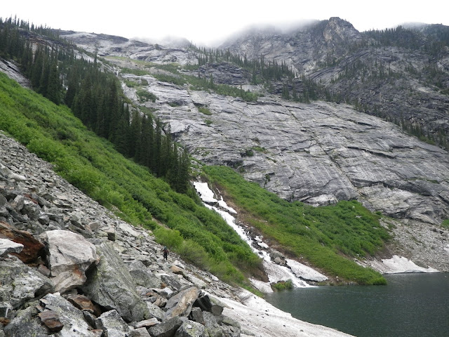
This is a view from closer up which actually makes the slope look more reasonable. My first impression was "holy **** are we supposed to go up that?!" My second thought was are we in the right valley?? There was no tracks in the snow along the lake so it seemed like a reasonable question. Being a couple days into a race and being sleep deprived probably didn't help my state of mind but I am pretty sure I had a mini meltdown. The other issue was the need to cross the said snow slopes and any slip would lead to a slide into an icy lake. After taking a few minutes and convincing ourselves that the route did go we carefully made our way across the snow and started up the alder. James must have thought we were crazy to be so worried about falling into the lake but when you are tired your brain does funny stuff. Again we probably wasted 30-45 minutes here. As we started climbing we saw two teams appear behind us near the lake (DART and Momar it turns out) and this actually made me feel better as we no longer felt so alone in the middle of nowhere - weird but true.
The climb actually went OK - it was an upper body work out as we pulled ourselves up using alder and trees - and eventually we made it up the headwall. At some point in the morning the rain had stopped so that helped as well though all the underbrush was still quite wet.

ONce at the top travel improved drastically as we were now in the subalpine and we were travelling on snow. Interestingly I could see no footprints in the snow so was confused as to where WT had gone. It turns out they followed the north side of the lakes while we followed the south. We had a little difficulty descending down to Ice Creek Lodge as we got cliffed out right away. Although it wasn't raining the clouds were thick and it was impossible to see into the valley to get a glimpse of the lodge. We moved a bit north and dropped down directly to the lodge with no problems with that approach. The lodge was a nice oasis. We hadn't slept the previous night - the weather hadn't been condusive to sleeping - and really were hoping to sleep at the lodge. Luckily they let us use the bunks and we settled for an hour nap. We couldn't sleep for too long as it was afternoon already and I didn't want to waste too much daylight for the next alpine section.
It was nice to sleep in the warmth of the lodge however when I woke up I felt terrible. Feet hurt, hands hurt, eyes hurt, groggy. Typical wake up from an AR sleep I guess but seemed worse than usual. While we had slept DART had arrived and was also sleeping. The next team had gone by the lodge and was still descending according to the CP staff (turned out to be MOMAR). We left with DART still asleep and started the climb up the rist pass between. No huge difficulties but the clouds did open up a bit which really helped. Here we are reaching the col - lodge is somewhere 1500 feet below.

Passing through the col we were treated to an amazing view of the Devil's Range. This is one of the reasons you do races like this - to see views like this. Such a rem ote spot but such spectcular peaks.
We had another couple hours of daylight and we could scope out our route across the valley and then up Lucifer Pass.
Even got to enjoy a cool rainbow.

Travel across the valley went fast - lots of snow - as we contoured around a couple lakes. It started to get dark as we started the next climb. Halfway up I noticed lights behind us. I thought I saw three teams but I think in reality it was only two and they seemed a couple hours behind. AS we climbed the weather turned and the wind picked up. Rain turned to sleet and then ice crystals. James was cold again and he disapeared off in the distance and down the other side looking for shelter. I waited at the col for Mike and VJ. The wind was crazy and as soon as you turned into it your face got pelted with ice - I needed goggles. Another one of those AR moments where you think to yourself what the hell are you doing up here in the middle of the night. As soon as the rest of the team arrived we high tailed it down the other side and found James sporting a very stylish emergency blanket dress. Luckily the wind died down as soon as we dropped some elevation.
The next section was rather confusing in the dark and I am glad that we had some prints I could trust to follow. I knew WT had been there in the day time and I figured they knew where they were going so we followed their prints as best we could. As the snow petered out we did lose them and had to downclimb one sketchy little gully to reach the lake. I know how much VJ hates these sections so I felt bad I hadn't found something easier. I was amazed at how much snow there still was in the basin. We were now at the Gwillim Lakes which is a popular hike in the park. It is one of the few hikes that takes you high up into the range. It was late July and the campground was covered by a meter of snow still!
In the original course design I think we were supposed to climb Gimli peak and rappel down the other side but too much snow (what else) changed that plan. We now had to hike out the summer access trail (6 km) and then 20km down an FSR. We were not looking forward to it. The summer access trail actually turned out to be confusing as well. The first bit was hard to follow especially as we were running low on light having not expected to still be out here. After descending for a while we started climbing which was really confusing. Looking at it afterwards it all makes alot more sense but at the time you kind of feel like you are in the twilight zone and nothing makes much sense. Eventually we snapped out of it when we ran into Tom Zidek and his teamate. They were hiking in to volunteer at the Gwilliim Lkes CP. They confirmed we were heading in the ight direction and gave us the good news that our bikes were much higher on the road and only a couple km walk from the end of the trail. That gave us a boost for sure.
TBC on next day...
It was raining quite heavily now and since we needed to regroup and create a new plan of action we restarted the fire custom cellular had just put out (the embers were still warm) and dried off a bit. The decision to make was north shore or south shore. North was loner but looked less steep. It also had a few bigger creek crossings that worried me a bit. South was steeper, slightly shorter and no creek crossings. At some point DAR|T came by and continued on down the lake but I am not sure exactly when. We decided south side and left the warmth of the fire and pushed on. In retrospect we probably could have saved 45-60 minutes here. We quickly found ourselves in some terrible bush. It was hard to maintain a constant elevation above the lake as small rock outcroppings would block the way. We were constantly climbin up or down as well as trying to move forward. Lots of thick bush and very quickly we realized this would take a while. James was freezing and in an effort to stay warm he kept disapearin ahead of us as I tried to keep both him in site in front and Mike and VJ behind. This became frustrating and eventually came to a head when we reached a stream where it seemed we were cliffed out. It was one of those places where I thought we could make it by but wasn't sure if we could make it back if necessary. After a bunch of yelling we managed to sort out that James had one higher and eventually we regrouped. At this point it was starting to get light and I could see we had only travelled about a third of the lake in a couple hours (500m an hour for alot of this section). After a short discussion about the merits of continuing versus backtrackin and takin the other shore (it looked less steep but the creeks looked crappy) we continued to move forward this time a bit closer together. The terrain actually seemed to improve a bit (it is all relative I suppose as it was still thick) we finally made it to the end of the lake. It is hard to convey how hard this section was - it was one of the hardest sections I have done when you combine the context, the weather and the terrain. There is in fact a trail along the north shore of the lake however it follows the rocky shoreline and with the wet and late spring it was under a meter of water. This would have been a very different race if this section took 1-2 hours instead of 8-10. I never asked Geoff if he actually tested the section this year or only last year. Had he known he should have shortened some other section of the course.
Anyway we were beyond the lake but the difficulty was not finished. We climbed a rock slide to partially make it up the first headwall and then slithered our way through a steep alder slope to finally make it to the first of the lakes in the Demers chain.
Once above the lake the terrain flattened however the vegetation was still thick - waist and shoulder height bushes. We arrived at the next lake and got aa good view at the bext headwall we had to climb. It looked ridiculously steep. At first glance there didn't appear to be any easy way to make it up. To the left was a steep snow slope that looked deadly. Just ot the right was a cliff. To the right of this and just to the left of the waterfall was the only weakness in the slope - a steep area covered in alder and a few trees.
This is a view from closer up which actually makes the slope look more reasonable. My first impression was "holy **** are we supposed to go up that?!" My second thought was are we in the right valley?? There was no tracks in the snow along the lake so it seemed like a reasonable question. Being a couple days into a race and being sleep deprived probably didn't help my state of mind but I am pretty sure I had a mini meltdown. The other issue was the need to cross the said snow slopes and any slip would lead to a slide into an icy lake. After taking a few minutes and convincing ourselves that the route did go we carefully made our way across the snow and started up the alder. James must have thought we were crazy to be so worried about falling into the lake but when you are tired your brain does funny stuff. Again we probably wasted 30-45 minutes here. As we started climbing we saw two teams appear behind us near the lake (DART and Momar it turns out) and this actually made me feel better as we no longer felt so alone in the middle of nowhere - weird but true.
The climb actually went OK - it was an upper body work out as we pulled ourselves up using alder and trees - and eventually we made it up the headwall. At some point in the morning the rain had stopped so that helped as well though all the underbrush was still quite wet.
ONce at the top travel improved drastically as we were now in the subalpine and we were travelling on snow. Interestingly I could see no footprints in the snow so was confused as to where WT had gone. It turns out they followed the north side of the lakes while we followed the south. We had a little difficulty descending down to Ice Creek Lodge as we got cliffed out right away. Although it wasn't raining the clouds were thick and it was impossible to see into the valley to get a glimpse of the lodge. We moved a bit north and dropped down directly to the lodge with no problems with that approach. The lodge was a nice oasis. We hadn't slept the previous night - the weather hadn't been condusive to sleeping - and really were hoping to sleep at the lodge. Luckily they let us use the bunks and we settled for an hour nap. We couldn't sleep for too long as it was afternoon already and I didn't want to waste too much daylight for the next alpine section.
It was nice to sleep in the warmth of the lodge however when I woke up I felt terrible. Feet hurt, hands hurt, eyes hurt, groggy. Typical wake up from an AR sleep I guess but seemed worse than usual. While we had slept DART had arrived and was also sleeping. The next team had gone by the lodge and was still descending according to the CP staff (turned out to be MOMAR). We left with DART still asleep and started the climb up the rist pass between. No huge difficulties but the clouds did open up a bit which really helped. Here we are reaching the col - lodge is somewhere 1500 feet below.
Passing through the col we were treated to an amazing view of the Devil's Range. This is one of the reasons you do races like this - to see views like this. Such a rem
ote spot but such spectcular peaks.
We had another couple hours of daylight and we could scope out our route across the valley and then up Lucifer Pass.
Even got to enjoy a cool rainbow.
Travel across the valley went fast - lots of snow - as we contoured around a couple lakes. It started to get dark as we started the next climb. Halfway up I noticed lights behind us. I thought I saw three teams but I think in reality it was only two and they seemed a couple hours behind. AS we climbed the weather turned and the wind picked up. Rain turned to sleet and then ice crystals. James was cold again and he disapeared off in the distance and down the other side looking for shelter. I waited at the col for Mike and VJ. The wind was crazy and as soon as you turned into it your face got pelted with ice - I needed goggles. Another one of those AR moments where you think to yourself what the hell are you doing up here in the middle of the night. As soon as the rest of the team arrived we high tailed it down the other side and found James sporting a very stylish emergency blanket dress. Luckily the wind died down as soon as we dropped some elevation.
The next section was rather confusing in the dark and I am glad that we had some prints I could trust to follow. I knew WT had been there in the day time and I figured they knew where they were going so we followed their prints as best we could. As the snow petered out we did lose them and had to downclimb one sketchy little gully to reach the lake. I know how much VJ hates these sections so I felt bad I hadn't found something easier. I was amazed at how much snow there still was in the basin. We were now at the Gwillim Lakes which is a popular hike in the park. It is one of the few hikes that takes you high up into the range. It was late July and the campground was covered by a meter of snow still!
In the original course design I think we were supposed to climb Gimli peak and rappel down the other side but too much snow (what else) changed that plan. We now had to hike out the summer access trail (6 km) and then 20km down an FSR. We were not looking forward to it. The summer access trail actually turned out to be confusing as well. The first bit was hard to follow especially as we were running low on light having not expected to still be out here. After descending for a while we started climbing which was really confusing. Looking at it afterwards it all makes alot more sense but at the time you kind of feel like you are in the twilight zone and nothing makes much sense. Eventually we snapped out of it when we ran into Tom Zidek and his teamate. They were hiking in to volunteer at the Gwilliim Lkes CP. They confirmed we were heading in the ight direction and gave us the good news that our bikes were much higher on the road and only a couple km walk from the end of the trail. That gave us a boost for sure.
TBC on next day...
Monday Jul 25, 2011 #
Bike 6:30:00 [3] 50.0 km (7.7 kph) +2200m
We spent 2.5 hours in the TA. Surpisingly I felt better already and was able to tolerate a couple bowls of soup. Not sure what the problem was in the end? Heat? Possibly not being used to the Aquatabs we were using to purify our water? I had used pristine for years so I hadn't thought to test the aqautabs. I also used it double strength in a couple bottles. The fact that I had felt alot better after dry heaving made it seem more like and ingestion of something? Strange but I wasn't complaining that I was feeling better.
We slept for almost an hour and a half (or at least James and I did, not sure if Mike and VJ got some sleep). We had decided that we were going to do most of our sleeping during this race in TA's. Too much crappy sleep in previous races meant the tradeoff of noise or possible slow TA times was worth it. Certainly I felt like the sleep I got this race was much higher quality than in previous races as I was able to use a sleeping bag and sleeping pad almost always and often a tent as well. DART was still in the TA waiting for a missing bike bag when we arrived (giving them an hour and a half time bonus) and MOMAR arrived and left while we were sleeping.
The next section was a relatively short bike ride of about 50km but with no flat sections at all, just two big climbs and descents. We left the Retallack Lodge (which is another cat skiing operation by the way) and quickly started making up time on the climb. Wasted 15 minutes looking for a road that didn't exist any more before continuing on the obvious newer road. It was too steep to ride in many spots so we pushed our bikes up and eventually gained the shoulder of Reco mountain.


Down the other side we followed an old mining road down to the abandoned mine towns of Cody and Sandon. Lots of cool old mine machinery and history in this section. Sandon used to be one of the biggest towns on the west side of the continent during its silver boom.


Not a photo of us but better than anything I took. The next climb up the Idaho Peak road was straightforward and three of us had done it before and the road is quite well used. Our pace was steady with only the occasional stop to dunk our heads in the creeks, It was warm but overcast so not too bad in terms of temperatures. I felt bad for those teams that came through here 12-24 hours later as the rain moved in. Near the top we hit some snow patches as the road climbs through a north facing sub alpine basin. We also saw a team a head of us and that spurred VJ on and she took off up front. Turns out it was Momar and we had managed to make up an hour over the bike ride.

The road pretty much reaches the summit. It is a great place to bring you non active family members in the summer as the walk to the summit through wild flowers is short and scenic. We weren't going to ride to the summit but we were taking a left and descending the Wakefield trail which is an old mining trail. Since it started life as a hiking trail some of the swtichbacks are a bit tight to ride but for the most part it is a fun ride. Some of the crossings of avy paths are exciting as the trail is only several inches wide.
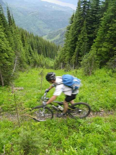

Had some excitement on one avy path as both Mike and VJ almost took some long rides down some snow remnants. Would have been nice if the trail had been dug out a bit for us - wouldn't have taken much to do so. Overall the trail was a bit overgrown as no one had probably ridden it yet this year due to the snow on the access road. There were some tough deadfall to manouevre around however overall being 5th down the trail meant that conditions were easier for us than the leaders - thanks:) We left Momar behind - turns out they had a flat tire and popped out on an old double track and then a logging road that took us directly into Silverton on the shores of Slocan Lake. I wanted to stop at the local cafe and get a smoothie however I got voted down by the remainder of the team who were suddenly in full on race mode and wanted to beat Momar to the TA to get a better choice of boats. I think I was a bit cranky in this TA as though I was feeling better I still hadn't eaten that much on the ride and wanted to get some more food in me while everyone else was rushing to take off. The big issue was we hadn't talked ahead of time and decided what the plan was for this TA so that didn't help. ANyway I got some ichiban noodles in me and a can of ravioli and 40 minutes later we were on the water. A nice touch this race was that hot water was often provided at TA's.
We slept for almost an hour and a half (or at least James and I did, not sure if Mike and VJ got some sleep). We had decided that we were going to do most of our sleeping during this race in TA's. Too much crappy sleep in previous races meant the tradeoff of noise or possible slow TA times was worth it. Certainly I felt like the sleep I got this race was much higher quality than in previous races as I was able to use a sleeping bag and sleeping pad almost always and often a tent as well. DART was still in the TA waiting for a missing bike bag when we arrived (giving them an hour and a half time bonus) and MOMAR arrived and left while we were sleeping.
The next section was a relatively short bike ride of about 50km but with no flat sections at all, just two big climbs and descents. We left the Retallack Lodge (which is another cat skiing operation by the way) and quickly started making up time on the climb. Wasted 15 minutes looking for a road that didn't exist any more before continuing on the obvious newer road. It was too steep to ride in many spots so we pushed our bikes up and eventually gained the shoulder of Reco mountain.
Down the other side we followed an old mining road down to the abandoned mine towns of Cody and Sandon. Lots of cool old mine machinery and history in this section. Sandon used to be one of the biggest towns on the west side of the continent during its silver boom.
Not a photo of us but better than anything I took. The next climb up the Idaho Peak road was straightforward and three of us had done it before and the road is quite well used. Our pace was steady with only the occasional stop to dunk our heads in the creeks, It was warm but overcast so not too bad in terms of temperatures. I felt bad for those teams that came through here 12-24 hours later as the rain moved in. Near the top we hit some snow patches as the road climbs through a north facing sub alpine basin. We also saw a team a head of us and that spurred VJ on and she took off up front. Turns out it was Momar and we had managed to make up an hour over the bike ride.
The road pretty much reaches the summit. It is a great place to bring you non active family members in the summer as the walk to the summit through wild flowers is short and scenic. We weren't going to ride to the summit but we were taking a left and descending the Wakefield trail which is an old mining trail. Since it started life as a hiking trail some of the swtichbacks are a bit tight to ride but for the most part it is a fun ride. Some of the crossings of avy paths are exciting as the trail is only several inches wide.
Had some excitement on one avy path as both Mike and VJ almost took some long rides down some snow remnants. Would have been nice if the trail had been dug out a bit for us - wouldn't have taken much to do so. Overall the trail was a bit overgrown as no one had probably ridden it yet this year due to the snow on the access road. There were some tough deadfall to manouevre around however overall being 5th down the trail meant that conditions were easier for us than the leaders - thanks:) We left Momar behind - turns out they had a flat tire and popped out on an old double track and then a logging road that took us directly into Silverton on the shores of Slocan Lake. I wanted to stop at the local cafe and get a smoothie however I got voted down by the remainder of the team who were suddenly in full on race mode and wanted to beat Momar to the TA to get a better choice of boats. I think I was a bit cranky in this TA as though I was feeling better I still hadn't eaten that much on the ride and wanted to get some more food in me while everyone else was rushing to take off. The big issue was we hadn't talked ahead of time and decided what the plan was for this TA so that didn't help. ANyway I got some ichiban noodles in me and a can of ravioli and 40 minutes later we were on the water. A nice touch this race was that hot water was often provided at TA's.
Paddle 3:10:00 [3] 23.0 km (7.3 kph)
Short and sweet paddle down Slocan Lake. Last time we paddled this lake in RTN Nelson we were treated to naked people cliff jumping but alas no such show this time. Does anyone actually follow the 100m from shore rule? Not that it means much on this lake as for much of its length the cliffs do not allow you access to the shore anyway. We left right before Momar and got a couple decent boats - Hellman prospectors. I was paddling with Mike and we dropped James and VJ pretty quickly. Turned out James was just sleepy and once he woke up our speed was alot more even. I'd be interested to see the contraption that WT built to attach their boats togather. A few squalls blew through while we were out there and we had the occasional head wind. The sun came out in between to dry us out. It was only right at the end that the rain really started right as we were pulling off at the take out.
Hike 5:00:00 [3] 20.0 km (15:00 / km) +1000m 12:00 / km
Luckily there was some sheltered areas to use for the TA as the rain was really coming down now. The staff told us the bad news that the forecast called for rain over the next couple of days. We spent a little over an hour in the TA and eventually Momar came in as well. Dart had just left when we arrived and WT, slackers, and Custome cellular were 3-4 hours ahead. I was counting on 20-30 hours for this section and we were hoping to make it to Ice Creek lodge in the early morning and sleep there. A girl who lived near the take out gave me some local beta telling me that there was a trail along the north side of Beatrice Lake (where our trails would end). I also seem to remember her telling me that there was a rough trail beyond the lake from when David Suzuki had been there a few years ago? Not sure if I was sleep deprived when she told me that as it still doesn't make sense to me.
We had to backtrack along the west shore of Slocan Lake for 8km before turning west up the Beatrice Creek valley and climbing about 12 km up to the lake.

We had just paddled down the east side of this lake. The Slocan lake shore trail is actually quite pleasant as it follows the rocky shore of the lake. It was built by loggers for access to their logging camps in the Beatrics and Evans watersheds. Weather and night was moving in so the light was erie as we trekked. VJ was itching to run however the rest of the team wasn't quite up to it as we kept losing Mike. We maintained a decent pace though and soon reached the turn off up the valley. One of the most amazing sites I saw in the whole race was Beatrice Creek in full flood as we crossed it on a metal bridge. It was dark so no pics but the force of the water was incredible - imagine an open floodgate on a dam - hard to describe. I just hoped we didn't have to cross any major creeks. I was feeling great and did a fair bit of towing on the climb up to Beatrice Lake as Mike was sleepy and dropping behind. The grade was fairly gradual however we did climb quite a bit. I was surprised at the quality of the trail as often it seemed like an old road but in retrospsct it probably was on old road from the logging days 80 years ago. Not a super scenic trail as we were in the trees the whole time so we didn't miss too much doing it at night.
We had to backtrack along the west shore of Slocan Lake for 8km before turning west up the Beatrice Creek valley and climbing about 12 km up to the lake.
We had just paddled down the east side of this lake. The Slocan lake shore trail is actually quite pleasant as it follows the rocky shore of the lake. It was built by loggers for access to their logging camps in the Beatrics and Evans watersheds. Weather and night was moving in so the light was erie as we trekked. VJ was itching to run however the rest of the team wasn't quite up to it as we kept losing Mike. We maintained a decent pace though and soon reached the turn off up the valley. One of the most amazing sites I saw in the whole race was Beatrice Creek in full flood as we crossed it on a metal bridge. It was dark so no pics but the force of the water was incredible - imagine an open floodgate on a dam - hard to describe. I just hoped we didn't have to cross any major creeks. I was feeling great and did a fair bit of towing on the climb up to Beatrice Lake as Mike was sleepy and dropping behind. The grade was fairly gradual however we did climb quite a bit. I was surprised at the quality of the trail as often it seemed like an old road but in retrospsct it probably was on old road from the logging days 80 years ago. Not a super scenic trail as we were in the trees the whole time so we didn't miss too much doing it at night.
Sunday Jul 24, 2011 #
Bike 2:36:00 [4] 25.0 km (9.6 kph) +1500m
First stage of RTNX Kootenays. FIrst expedition race in 4 years- it had been a while. Even longer break for the rest of the team but we all felt confident going into the race. You don't forget how these things play out. Expected some strong competition - looked like at least 10 teams that I figured could be top five.
Had a good sleep the previous night in Kaslo - declined the "free" camping and stayed at the Kaslo Hotel. Quite a nice hotel actually. Made good use of the wifi availability there. Defenitely a course where it was helpful to make use of additional resources. Not sure how some of the other teams managed while camping. Didn't find the race briefing that useful and in retrospect I think Geoff could have done a better job with this.
In the morning we hopped on buses for the short ride to Meadow Creek north of Kaslo. Our first objective was near the summit of Meadow Mountain, 25 km away on logging roads and about 1500m in climbing.

This is the view of the Meadow Creek community centre with Meadow Mountain in the background.
We lined up in the front row and not too many other teams seemed that interested in being right at the front. There was a narrow muddy spot a few hundred metres from the start and I didn't want to get stuck there so we raced off the line pretty fast. Once onto the main road I slowed expecting a slew of teams to be right behind but a quick glance behind showed that all the other teams were content to follow. This definetely wasn't a BC Bike Race start:)
Within a few km of the start we missed our first junction - I was following the race photographer vehicle and thought to myself shouldn't we be turning there? Kept going the wrong way and realized a minute later that yes we definetely missed a turn. Luckily every single team missed the same turn - weird - and we caused a traffic jam backtracking up the road. This did give us a small lead and we rode most of the climb on our own. The road soon turned uphill quite steeply and I was riding in granny gear much earlier than I thought I should be. It was hot and the pack was heavy with trekking gear so I guess the difficulty wasn't surprising. We passed Meadow Creek Lodge - a cat skiing operation - where there appeared to be an option to shortcut the road on some cat roads but we stayed conservative and continued on the main road. I was surprised that we were leading for so long but near the top we were finally passed by WT. We reached the bike drop a few minutes behind with DART right on our tail.
Had a good sleep the previous night in Kaslo - declined the "free" camping and stayed at the Kaslo Hotel. Quite a nice hotel actually. Made good use of the wifi availability there. Defenitely a course where it was helpful to make use of additional resources. Not sure how some of the other teams managed while camping. Didn't find the race briefing that useful and in retrospect I think Geoff could have done a better job with this.
In the morning we hopped on buses for the short ride to Meadow Creek north of Kaslo. Our first objective was near the summit of Meadow Mountain, 25 km away on logging roads and about 1500m in climbing.
This is the view of the Meadow Creek community centre with Meadow Mountain in the background.
We lined up in the front row and not too many other teams seemed that interested in being right at the front. There was a narrow muddy spot a few hundred metres from the start and I didn't want to get stuck there so we raced off the line pretty fast. Once onto the main road I slowed expecting a slew of teams to be right behind but a quick glance behind showed that all the other teams were content to follow. This definetely wasn't a BC Bike Race start:)
Within a few km of the start we missed our first junction - I was following the race photographer vehicle and thought to myself shouldn't we be turning there? Kept going the wrong way and realized a minute later that yes we definetely missed a turn. Luckily every single team missed the same turn - weird - and we caused a traffic jam backtracking up the road. This did give us a small lead and we rode most of the climb on our own. The road soon turned uphill quite steeply and I was riding in granny gear much earlier than I thought I should be. It was hot and the pack was heavy with trekking gear so I guess the difficulty wasn't surprising. We passed Meadow Creek Lodge - a cat skiing operation - where there appeared to be an option to shortcut the road on some cat roads but we stayed conservative and continued on the main road. I was surprised that we were leading for so long but near the top we were finally passed by WT. We reached the bike drop a few minutes behind with DART right on our tail.
Hike race 16:00:00 [3] 35.0 km (27:26 / km) +1500m 22:35 / km
After dropping our bikes the route took us south into Goat Range Provincial Park. Right off the bat I think we retook first place by shortcutting across some subalpine meadows over to a spur ridge heading southeast off of Meadow Mountain. Here is the view back towards where we had ridden up.

We had to drop down into a valley, cross a creek and then follow a different creek fsouth for several km to reach the alpine. Not alot of route choice involved. You can see where we are heading in this photo - the drainage bearing left.

Our initial route into the first valley was going to drop between two smaller drainages. Not a great choice as the space I was trying to hit was rather small and we kept getting sucked into the drainage which made for slow travel - either in the creek or off camber on the side. We were passed by Custom Cellular and another team on the descent. Eventually we escaped the drainage and hit the old logging road we were aiming for. Hitting the confluence of the creek we needed to follow was easy and luckily there was a nice tree that we could use to cross.

It would have been an impossible crossing otherwise. We saw some flagging tape early on but lost it right away so decided to continue on the north side of the creek. Travel was tough at times as the bank steepened. Eventually we crossed over to the south side on another log and were dispointed to find that a rough trail existed on that bank. Not a great trail but would have been faster than what we had just done. We followed this trail until it petered out where the next major creek joined. We passed Momar on this section doing some foot care. We turned left up this new creek and again it wa a question of what side of the creek to take. I really didn't enjoy this section. It is a bit luck of the draw whether you'll luck out with vegetation and it was pretty much a boring slog up a long valley. The bush was thick and slow going.

The first thoughts of why the hell am I doing this crept into my head. It didn't help that I was starting to feel like crap. My stomach was not doing well and slowly getting worse. I wasn't sure if it was the heat and going to hard on the bike or something else. I was still peeing and I had done well with fluids up to this point so dehydration seemed less likely. In any case I knew I needed to eat and drink but the more I tried the worse I felt. I was rather uselss for the next few hours and although I managed to keep up I was not leading the charge like I often do through the bush. VJ and James did a great job maintaining the pace. We travelled for a bit with Custom Cell and the Slackers but they dropped us slowly. As night fell travel became quite frustrating since we would hit thick patches of alder that would really slow our progress. You could just imagine that 100m further to the left or right the travel was better but you just couldn't see.
We were starting to enter the subalpine and could see lights of teams far ahead and above of us. A set of lights caught us and it turned out to be Momar. I was really feeling weka as I had not been able to eat much for 3-4 hours now. We stopped for 20 minutes to see if that helped. After we got going again I dry heaved several times and interestingly that seemed to help and I perked up again. After trying to eat some more I felt crappy again - more dry heaving and I felt better. We climbed up some steep scree slopes and eventually into snow. A better line into the CP allowed us to pass MOMAR and arrive at CP 2 in 5th place.
It would have been a spectacular location in the daytime but in the dark all we could see was snow fields and dark masses rising around us. We glissaded down the first few snow slopes and then found the trail that would take us 10km down to the TA. I was still not moving as fast as I could have been if healthy so we lost more time on the descent. The trail was in excellent shape and then turned into a road for the last few km. At this point it was the middle of the night and although we hadn't planned to stop tosleep yet I was not in any shape to go on if I couldn't keep anything down so we decided a short nap would be a good idea in the TA. We arrived at the TA in 5th 4 hours behind WT.
We had to drop down into a valley, cross a creek and then follow a different creek fsouth for several km to reach the alpine. Not alot of route choice involved. You can see where we are heading in this photo - the drainage bearing left.
Our initial route into the first valley was going to drop between two smaller drainages. Not a great choice as the space I was trying to hit was rather small and we kept getting sucked into the drainage which made for slow travel - either in the creek or off camber on the side. We were passed by Custom Cellular and another team on the descent. Eventually we escaped the drainage and hit the old logging road we were aiming for. Hitting the confluence of the creek we needed to follow was easy and luckily there was a nice tree that we could use to cross.
It would have been an impossible crossing otherwise. We saw some flagging tape early on but lost it right away so decided to continue on the north side of the creek. Travel was tough at times as the bank steepened. Eventually we crossed over to the south side on another log and were dispointed to find that a rough trail existed on that bank. Not a great trail but would have been faster than what we had just done. We followed this trail until it petered out where the next major creek joined. We passed Momar on this section doing some foot care. We turned left up this new creek and again it wa a question of what side of the creek to take. I really didn't enjoy this section. It is a bit luck of the draw whether you'll luck out with vegetation and it was pretty much a boring slog up a long valley. The bush was thick and slow going.
The first thoughts of why the hell am I doing this crept into my head. It didn't help that I was starting to feel like crap. My stomach was not doing well and slowly getting worse. I wasn't sure if it was the heat and going to hard on the bike or something else. I was still peeing and I had done well with fluids up to this point so dehydration seemed less likely. In any case I knew I needed to eat and drink but the more I tried the worse I felt. I was rather uselss for the next few hours and although I managed to keep up I was not leading the charge like I often do through the bush. VJ and James did a great job maintaining the pace. We travelled for a bit with Custom Cell and the Slackers but they dropped us slowly. As night fell travel became quite frustrating since we would hit thick patches of alder that would really slow our progress. You could just imagine that 100m further to the left or right the travel was better but you just couldn't see.
We were starting to enter the subalpine and could see lights of teams far ahead and above of us. A set of lights caught us and it turned out to be Momar. I was really feeling weka as I had not been able to eat much for 3-4 hours now. We stopped for 20 minutes to see if that helped. After we got going again I dry heaved several times and interestingly that seemed to help and I perked up again. After trying to eat some more I felt crappy again - more dry heaving and I felt better. We climbed up some steep scree slopes and eventually into snow. A better line into the CP allowed us to pass MOMAR and arrive at CP 2 in 5th place.
It would have been a spectacular location in the daytime but in the dark all we could see was snow fields and dark masses rising around us. We glissaded down the first few snow slopes and then found the trail that would take us 10km down to the TA. I was still not moving as fast as I could have been if healthy so we lost more time on the descent. The trail was in excellent shape and then turned into a road for the last few km. At this point it was the middle of the night and although we hadn't planned to stop tosleep yet I was not in any shape to go on if I couldn't keep anything down so we decided a short nap would be a good idea in the TA. We arrived at the TA in 5th 4 hours behind WT.
Saturday Jul 23, 2011 #
Event: Raid the North Extreme
Note
Well we are checked in, maps are pretty much done, just have to rearrange the gear bins before heading over to Kaslo. Hopefully it can be a more relaxing evening today and we can get a good nights sleep.
Course looks great. Not a huge amount of route choice on a larger scale but a few shorter sections with some unmapped logging roads may be tricky. Typical mountain course where the general route often has to follow a valley and how you choose the route within the bush may be more important.
I think the scenery should be amazing - we are trekking through part of Goat Range Provincial Park and Valhalla Provincial Park. These parks have no trails and should be true wilderness (and thick bush). Lots of biking which should be good for us. There are five climbs of 1000-1500m so the climbing legs will get a work out. Some fun singletrack as well on the Wakefield trail and the Seven Summits trail.
Looking forward to it!