Training Log Archive: hughmac4In the 1 days ending Jul 20, 2019:
| |||||||||||||||||||||||||||||||||||||||||||||||||||||
| « | » |
| » now | ||||
| Sa |
Saturday Jul 20, 2019 #
Note
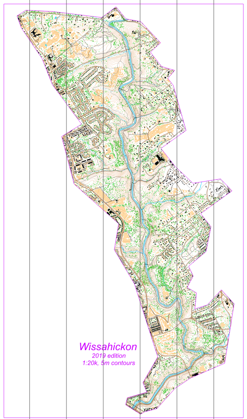
Using a mix of the new data mentioned here (buildings and KP contours / veg), OpenDataPhilly's Hydrology Shape data (all water), and BBike OpenStreetMap data (streets, trails, etc). Used OpenOrienteering Mapper. Awesome!
Prints on a single 11"x17" sheet at 1:20k (no scaling). Scale and print your favorite bits @200% for 1x10k. Came out pretty good! I'm so impressed by these free datasets. OSM data really filled out the trails, too. I'm sure there are more in the park, but not too many.
Let me know what you think, Swedes and Sandy! It's scaled from 1:10k > 1:20k purely by shrinkage in Export > PDF, so likely pretty challenging to read 'at speed' ...
7 AM
Running 53:01 5.16 mi (10:16 / mi) +460ft 9:28 / mi
ahr:136 max:166 weight:162lbs shoes: Topo MT-2 (10) Blue #3
Already warm, but terror of what’s to come shortly got me rolling early.