Training Log Archive: JayXCIn the 7 days ending Jun 11, 2016:
| ||||||||||||||||||||||||||||||||||||||||||||||||||||||||||||||||||||||||||||||||||||||||||||||||||||||||||||||||||||||||||||||||||||||||||||||||
| « | » |
| » now | ||||||||||||||||
| Su | Mo | Tu | We | Th | Fr | Sa | |||||||||||||
Saturday Jun 11, 2016 #
Run 22:00 [3] 2.0 mi (11:00 / mi)
slept:7.0 shoes: Hoka Speedgoat
Race started with a run to the Housatonic River with paddle and trekking gear using Map 1.
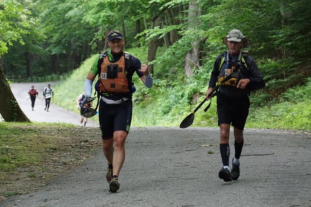
Jeff appears happy to have Dave back racing
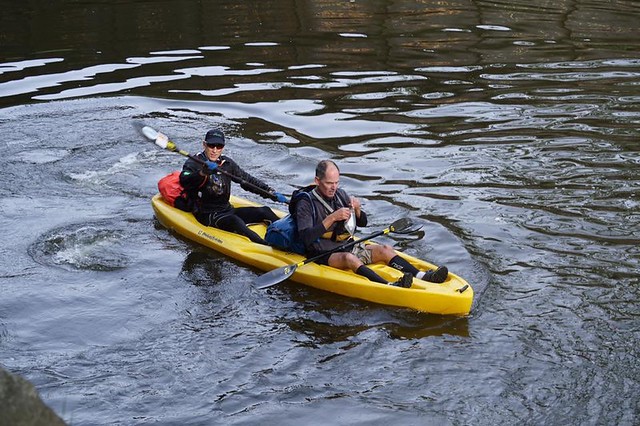
Kayak 2:30:00 [3] 12.2 mi (4.9 mph)
Orienteering 1:15:00 [3] 5.0 mi (15:00 / mi)
shoes: Hoka Speedgoat
Kayak 1:00:00 [3] 4.2 mi (4.2 mph)
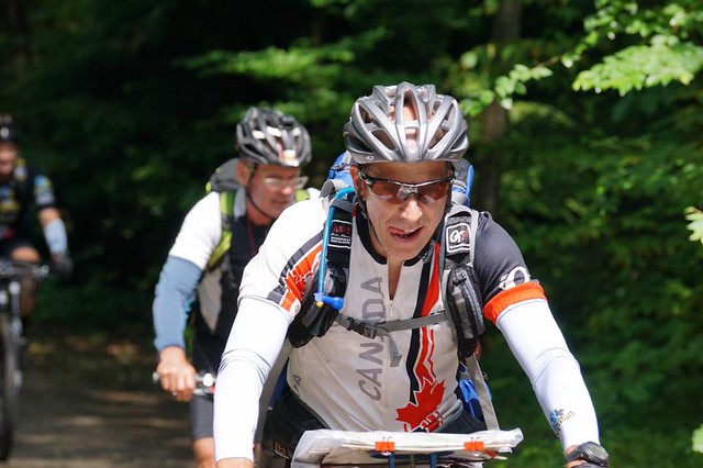
Mtn Bike 10:25:00 [3] 50.0 mi (4.8 mph)
Prior to getting to any of the trusts however we got to enjoy a loop around the local mtb park (Waldo) which was pretty fun.
Finding these controls proved difficult as they were somewhat hidden in each location. You basically had to be on top of them to find them. No reflective tape made the night controls especially challenging but this was somewhat expected. Fortunately Dave and Jeff are solid and hunting for them.
The terrain in Western CT was surprisingly rugged. It reminded me of Ohiopyle SP and took us much longer to get around than I was expecting.
Trek 28:00 [3] 2.5 mi (11:12 / mi)
shoes: Salomon Speedcross
At CP 9 for the trek we met up with Joe for the maps with the remaining controls. There was quite a few more remaining but with time running short and a long way to go we decided to pick up just 2 more on our way to the finish and the win.
Great course with challenging nav! Fun to race with Jeff and Dave again.
Friday Jun 10, 2016 #
Note
slept:7.5 (rest day)
Thursday Jun 9, 2016 #
Run 46:14 [3] 6.01 mi (7:42 / mi) +328ft 7:19 / mi
slept:7.0 shoes: Hoka Stinson ATR
Wednesday Jun 8, 2016 #
Swimming 1:05:00 [4] 1.8 km (36:07 / km)
slept:6.5
6x75 pull, 1-3 fr on 1:15, 4-6 50 fr/25 ba on 1:30
4x100 fr on 1:50
then videotaping fr and ba
4x100 fr on 1:50
200 br
5x50 fr on 1:00
Tuesday Jun 7, 2016 #
Strength (Maplewood Y) 38:00 [3]
slept:7.5
Road Bike 1:35:27 [3] 28.99 mi (18.2 mph) +1162ft
205W NP
Monday Jun 6, 2016 #
Kayak (V10) 1:04:15 [3] 6.16 mi (5.8 mph)
slept:7.5
Sunday Jun 5, 2016 #
Kayak (V10) 2:17:42 [3] 12.62 mi (5.5 mph) +9ft
Orienteering 54:22 [4] 4.52 mi (12:02 / mi) +704ft 10:29 / mi
slept:8.0 shoes: Salomon Speedcross