Training Log Archive: kissyIn the 7 days ending Sep 26, 2016:
| |||||||||||||||||||||||||||||||||||||||||||||||||||||
| « | » |
| » now | ||||||||||
| Tu | We | Th | Fr | Sa | Su | Mo | |||||||
Friday Sep 23, 2016 #
2 PM
Orienteering race 51:40 [4] 2.77 mi (18:39 / mi) +69m 17:19 / mi
I forgot to stop my watch.
Thursday Sep 22, 2016 #
2 PM
Orienteering 34:01 [3] 1.14 mi (29:50 / mi) +26m 27:50 / mi
Middle Model at NAOC.
I went to a few controls at the middle model. I'm hoping that the model was not 100% representative of where we'll be running tomorrow.
I went to a few controls at the middle model. I'm hoping that the model was not 100% representative of where we'll be running tomorrow.
Orienteering 30:22 [3] 1.01 mi (30:04 / mi) +35m 27:08 / mi
Long Model at NAOC.
This was much nicer. Very technical and the woods seemed wide open, but the footing was pretty uneven, and there were plenty of dead tree limbs sticking out, ready to poke out an eye. I think pace counting will be a handy back-up tool for the long.
This was much nicer. Very technical and the woods seemed wide open, but the footing was pretty uneven, and there were plenty of dead tree limbs sticking out, ready to poke out an eye. I think pace counting will be a handy back-up tool for the long.
Wednesday Sep 21, 2016 #
Hiking 3:32:00 [3] 7.6 mi (27:54 / mi) +2000m 15:21 / mi
I woke up this morning thinking that I was going to drive to Portland, ME, for the day. But, as I was eating breakfast, the thought of driving that far was too daunting. Plus, I'm trying not to let my log stay so empty, so I decided that some exercise was needed. One of my other planned day trips was to the White Mts. for a hike, so that's where I headed instead. Peter Goodwin had suggested climbing Mt. Chocorua from a southern trail head. Due to my late departure, plus my plan to also drive the Kancamagus Highway, I decided to use the Champney Falls trail.
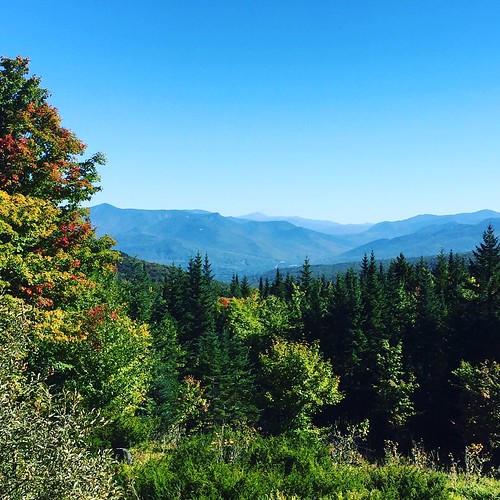
I drove through some beautiful woods on my way there and had a teaser scenic view on the way.
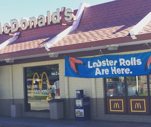
I got to Lincoln, NH, and was greeted by something that seemed very wrong:
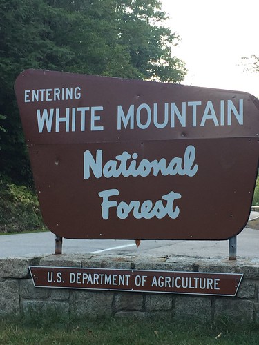
And something that seemed very right:
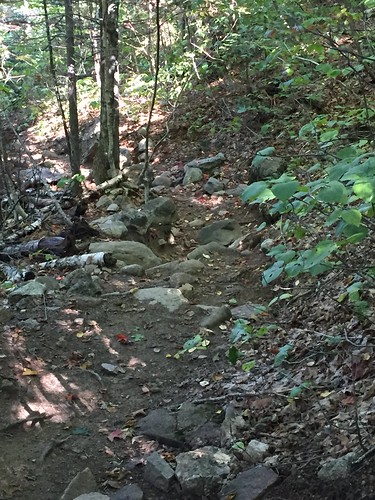
I got to the trailhead around 12:00 and realized that I had left my water bottle back at the cabin. Ack! It was too far to anywhere to get water, so I decided that I would survive, and I took off. The beginning of the trail was quite nice, but after about 1.5 miles, it became very steep and very rocky. I was so glad that it was not a rainy day because I don't think I would have made it.
It took me about an hour and forty minutes to make it to the top.
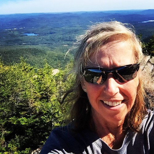
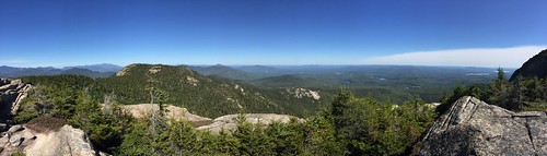
Well, almost to the top.
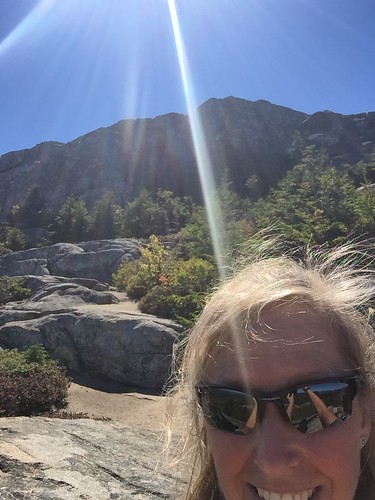
The trail was too hard to follow on the rocks at the top. Plus, I was already worried about making it back down on the rocky trail. Plenty of places to fall and get hurt!
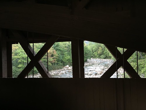
But, I didn't fall even one time! That must be a record for me. On the way home, I stopped at a covered bridge, which was pretty cool.
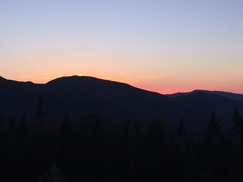
And then the sun was setting, and it was time to go home.
I drove through some beautiful woods on my way there and had a teaser scenic view on the way.
I got to Lincoln, NH, and was greeted by something that seemed very wrong:
And something that seemed very right:
I got to the trailhead around 12:00 and realized that I had left my water bottle back at the cabin. Ack! It was too far to anywhere to get water, so I decided that I would survive, and I took off. The beginning of the trail was quite nice, but after about 1.5 miles, it became very steep and very rocky. I was so glad that it was not a rainy day because I don't think I would have made it.
It took me about an hour and forty minutes to make it to the top.
Well, almost to the top.
The trail was too hard to follow on the rocks at the top. Plus, I was already worried about making it back down on the rocky trail. Plenty of places to fall and get hurt!
But, I didn't fall even one time! That must be a record for me. On the way home, I stopped at a covered bridge, which was pretty cool.
And then the sun was setting, and it was time to go home.
C • Pics 1
Tuesday Sep 20, 2016 #
Note
I was going to go mountain biking today until I realized that the trails that my Airbnb host had told me about were on Burnt Mt. So I spent some time picking the last of the cactus thorns out of my tires so I would stop puncturing the tubes. I'll try to find some non-embargoed trails.