Training Log Archive: BashIn the 30 days ending Jun 30, 2010:
| |||||||||||||||||||||||||||||||||||||||||||||||||||||||||||||||||||||||||||||||||||||||||||||||||||||||||
| « | » |
| » now | |||||||||||||||||||||||||||||||||||||||||||||||||
| Tu | We | Th | Fr | Sa | Su | Mo | Tu | We | Th | Fr | Sa | Su | Mo | Tu | We | Th | Fr | Sa | Su | Mo | Tu | We | Th | Fr | Sa | Su | Mo | Tu | We | |||||||||||||||||||||||
Wednesday Jun 30, 2010 #
Note
Note
Note
Hamilton-area Attackpointers, I'm sure she'd love to have some friendly, supportive visitors along the trail or at roadside stops. I can provide a cell phone # for the support crew if you write me. (But they often don't have signal so it can be easier to go looking for her.)
Note
Tuesday Jun 29, 2010 #
Note
Running (Trail) 1:28:42 11.15 km (7:57 / km) +105m 7:36 / km
shoes: Salomon XA Pro Ultra - Cherry
Monday Jun 28, 2010 #
Running (Trail) 4:20:10 ** 20.17 km (12:54 / km)
shoes: Salomon XA Pro Ultra - Cherry
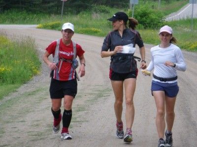
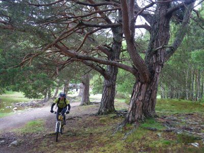
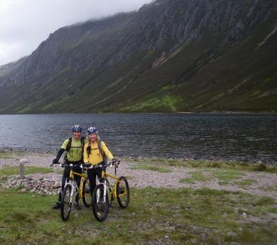
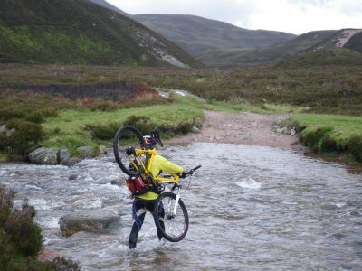
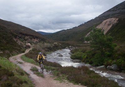
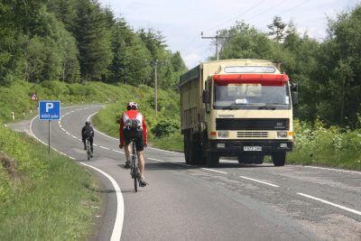
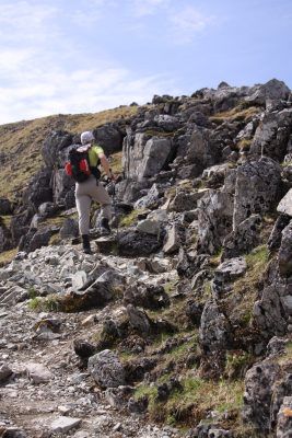
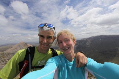
Goose and Turbo took the first shift of pacing, then Baloney ran through Forks of the Credit. Then Ron Gehl and I took over for the afternoon, starting with the climb up Devil's Pulpit on the Niagara Escarpment, then continuing through mostly rocky, muddy terrain to the far side of Terra Cotta Conservation Area. Char ran more today but the humidity and 27C temperature made her a little queasy by mid-afternoon. At the 50K mark, ThreePinJim, her longtime training partner, took over alone in hopes that the injection of new blood might inspire her to put in some extra kilometers in the evening. It worked - she did 72 km today and got most of the way to Milton. Almost 700 km down, about 200 km to go!
If any Milton/Hamilton trail runners have time available during the day on Tues/Wed of this week, write me for ThreePinJim's cell phone. I think he may be overworked in the next couple of days.
It was fun to meet longtime ultrarunner Ron Gehl. There is absolutely *no* mystery as to how his daughter Laurie McGrath became one of the top ultrarunners in North America. Whereas most people might get to know you by asking things like, "How do you know Charlotte?" or "How long have you lived in Caledon?", one of Ron's first questions to me was, "When are you doing a 100-miler?" I laughed and said that I'm working toward my first 50K. He immediately started discussing the race calendar, recommending a good candidate event and talking about the strategy I should use to run four 20K laps. "Wait a minute, Ron - 4 laps would be a 50-miler. I'm just thinking about a 50K." "Oh, don't bother with that. Once you get going, you might as well just do the 50-miler. And then you should do a 100-miler. And here's how you'll prepare for that..." I get the feeling that it would be virtually impossible to grow up in his household and *not* become an ultrarunner!
Kudos to Char for her amazing effort. She will break the record if she finishes by Saturday morning, and with "only" a little over 200 km left, things are looking very, very good.
A special tip of the hat to Baloney and Trav, whose calm, organized, experienced approach to both the base camps and the trail running contributed hugely to the success of Char's last couple of days. ThreePinJim will be the team leader over the next few days and is doing a bang-up job too.
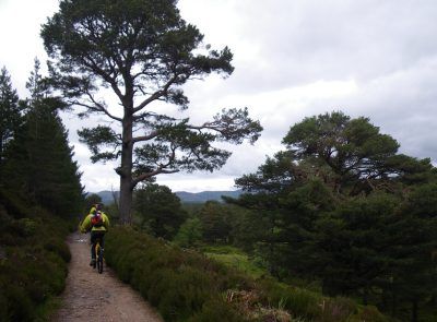
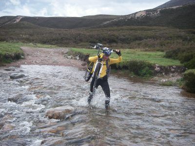
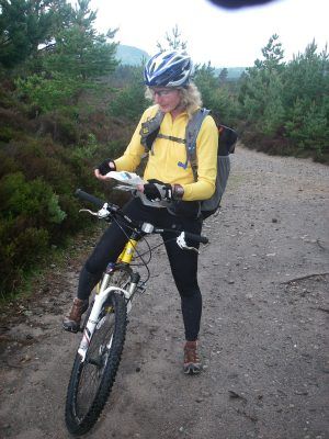
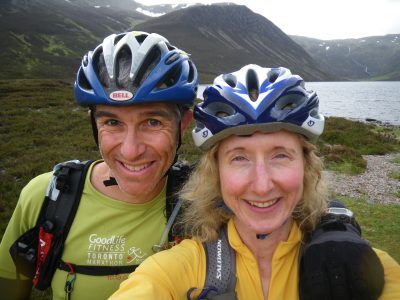
Here are some random photos showing Char and crew, including Laurie McGrath, Goose, Ron, Baloney, ThreePinJim and me.


Sunday Jun 27, 2010 #
Note
Running (Trail) 5:01:33 ** 22.94 km (13:09 / km)
shoes: Salomon XA Pro Ultra - Cherry
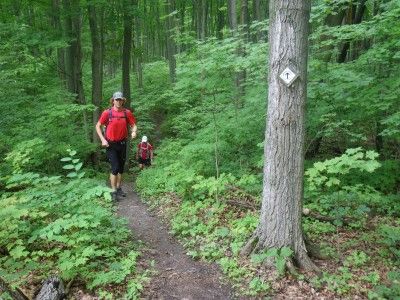
We started at Mono Centre and came down through Hockley Valley, then across Airport Road and south to 5th Sideroad. Char was a total rock star. She has run approximately 600 km in 9 days with 394 km to go. Her knees don't bend very far and her feet are blistered but she just keeps on trucking.
Goose was an awesome coach and motivator, pacing 5 meters in front of her and encouraging her to run whenever the trail was good. I stayed a short distance ahead of them. My job was to read the map and watch for blazes to make absolutely certain that we didn't make any wrong turns. 894 km is far enough and Char doesn't want to do any more. I also provided updates from the Garmin data, e.g. "3 km till we see your support crew". Thunderstorms swept in and we got thoroughly soaked. Lots of hills, roots and mud and even some stinging nettles. Can't think of a finer way to spend an afternoon! :-)
Saturday Jun 26, 2010 #
Note
- 'Bent managed to squeeze in an MRI on his knee while doing the 24 Hrs of Summer Solstice mountain bike relay with ThreePinJim. His first lap was 1:02 so he's doing fine. I also checked in on 2-Min and her faithful support crew, PhattyJR. Unfortunately, a rude biker knocked her over on her first lap; fortunately, he went down as well. Just missed seeing Crash but she was leading the Women's Solo category after 3 laps so I've got my fingers crossed for her. The race started 2 hours late due to heavy rain and will only be a 22-hr event this year. The trails looked pretty slick - hope everyone stays safe.
- Charlotte Vasarhelyi and support crew are here for the night during their Bruce Trail run and will be back tomorrow night for base camp once again. Lots of activity, food, tasks, blister repair, massage, laundry and planning. Char is doing very well for someone who has run over 500 km in 8 days. It's awesome having Trav and Baloney here to share their ultra experience with the team and roll up their sleeves to help out with whatever needs doing.
- Thanks to Dee, I'm also keeping an eye on the tough competition in the Ultimate XC stage race in Quebec. Going into tomorrow's challenging 100 km mountain bike race, Benoit has a 1 minute 25 second lead over Getawaystix. Benoit was ahead on the paddle and Getawaystix was ahead on the run. Relentless and Harps are up with the leaders too and M&M finished 2nd female in today's 56K trail run. Lots of great racing by our Ontario friends - hope tomorrow goes well for all!
Friday Jun 25, 2010 #
Note
Running (Trail) 50:35 [3] 8.13 km (6:13 / km) +41m 6:04 / km
shoes: Salomon SLAB-2 XT Wings
Thursday Jun 24, 2010 #
Note
Strength & Mobility (Upper body) 25:00 [2]
Wednesday Jun 23, 2010 #
Note
[Edit - Yup, apparently it was an earthquake.
http://www.theglobeandmail.com/news/national/repor...]
Note
Mountain Biking (Trail) 2:05:00 29.0 km (13.9 kph)
Tuesday Jun 22, 2010 #
Note
Running intervals (Treadmill) 30:00
Interesting new thing learned while running today: Benford's Rule:
"Most people intuitively believe that in any string of numbers of a naturally occurring data set each digit, one through nine, has an equal probability of being the first digit. Benford’s distribution showed that this intuition is incorrect. It is this belief and practice of the fraudster that all digits should be regular that creates data sets which evoke suspicions of fraud."
"...Benford’s probability distribution (in percent) of the first digit of any number within a database that meets the criteria described above should be as follows:
1 = 30.10
2 = 17.61
3 = 12.49
4 = 9.69
5 = 7.92
6 = 6.69
7 = 5.80
8 = 5.12
9 = 4.58"
What this means is that the first digit of a person's bank account balance is far more likely to be 1 than 9 - and this rule applies to many kinds of numerical databases. Even the IRS uses it to look for financial fraud, e.g. fake tax deductions. Cool. (And a little geeky, I guess.) (P.S. Fellow geeks should click here.)
Strength & Mobility (Legs) 30:00 [2]
Monday Jun 21, 2010 #
Running (Trail) 1:30:05 [3] 14.23 km (6:20 / km) +104m 6:06 / km
shoes: Salomon XA Pro Ultra - Cherry
First time wearing my new Salomon Exo calf compression sleeves. The only negative was that they added warmth but otherwise they felt great and I really like that they're not compression socks, which feel funny on my feet. They also fend off weeds and poison ivy and, of course, they make me look almost as cool as Phatty.
Today was a test run to see if I will be able to help pace Charlotte Vasarhelyi in her attempt to break the Bruce Trail solo speed record. She's aiming for 11 days - the previous record is 14 days, 10 hrs. The base camp is at our place on Friday night. She has (hopefully) just completed her 3rd day of running 80-90 km/day.
Sunday Jun 20, 2010 #
Note
Note
Mountain Biking (Trail) 3:43:30 66.18 km (17.8 kph)
We chatted with Caron and Trent running on the rail trail, Joe (hard working MTB trail maintenance volunteer) on the bike trail near Inglewood, Dave Corner and Bruce Day at The Shed (wearing the cool new Shed bike clothing), Nikki and Cheryl at The Shed in their tennis gear, Don & Jeff & Leigh outside Caledon Hills Cycling after their road ride, and Wayne after his MTB ride in Palgrave.
We also stopped at the first-ever Lemonade and Cherry Juice stand we've seen along the rail trail. How could anyone make that decision? I had to mix it half and half. Great day. (Yeah I know, I said that already.) 'Bent had jet engines in his legs and Coach LD is always strong, so I worked to hang onto the back!
Saturday Jun 19, 2010 #
Orienteering 1:27:00 [3] *** 8.23 km (10:34 / km)
shoes: Salomon XA Pro Ultra - Cherry
I decided to use my thumb compass for the first time in an event and it was hilarious how it messed with my mind. I know it will get easier with practice but I found myself doing everything differently, even when there was no reason to. Need to run due south? Well, it shouldn't be any different with a thumb compass - except it was, at first.
I found it distracting to constantly re-orient the map and I was ignoring important things like contours because of my obsession with using the thumb compass. None of this was unexpected and I laughed at myself a lot. I made a huge blunder between #1 and #2 so I was by myself after that. There was a 90-minute maximum and I had to bail to the finish with a few controls left to go to avoid being overtime. It was still a great time and a necessary learning experience. I'll try the thumb compass again soon. (Although I have to say that it is *much* easier using it when Hammer is at my elbow coaching me. Too bad I can't hire him to shadow me.)
Congrats to Phatty on placing 3rd overall and the first finisher with no errors in the micro-O.
Strength & Mobility (Core) 40:00 [2]
Friday Jun 18, 2010 #
Note
There was another interesting report written by a pair of repentant adventure racers who signed up for the A course because they were strong physically, but their lack of nav experience combined with Sunday's foggy weather conditions and a sore knee to mess them up. Another call for the busy Arrochar Mountain Rescue Team with lots of action by the SportIdent team trying to establish their location. Some good introspection: "The real problem is quite common among fellow Adventure Racers. We left it too late to call it a day and head for home. This was not an Adventure Race after all."
Running tempo 29:00 [4] 5.05 km (5:44 / km) +10m 5:41 / km
shoes: Salomon SLAB-2 XT Wings
Strength & Mobility (Legs) 22:00 [2]
Strength & Mobility (Upper body) 15:00 [2]
Thursday Jun 17, 2010 #
Note
Running (Trail) 51:06 [3] 8.11 km (6:18 / km) +42m 6:09 / km
shoes: Salomon XT Wings - Tomato
Wednesday Jun 16, 2010 #
Power Yoga 23:00 [1]
Sunday Jun 13, 2010 #
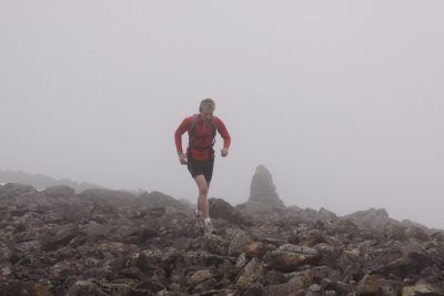
Orienteering race (Mountain Marathon) 7:24:55 [3] ** 23.0 km (19:21 / km) +950m 16:02 / km
shoes: Salomon XA Pros - Tomato
Lowe Alpine Mountain Marathon (LAMM)
Glen Fyne, Scotland
Warning: long report!
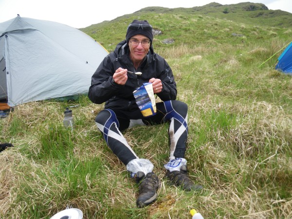
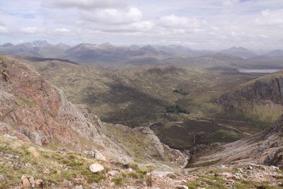
Richard and I did the Björkliden Arctic Mountain Marathon in Sweden last year. That was our first experience with this race format where teams of two navigate a point-to-point course on foot through mountainous terrain over 5-10 hours on Day 1 of a 2-day event. The final checkpoint is a remote site where all competitors spend the night. Teams must carry camping gear including tent, stove, sleeping bags, meals, etc. Top teams have 4-5 kg packs, carrying very little water and using specialized gear like balloon-based sleeping pads. On the second morning, racers receive a map with another point-to-point course that takes them to the finish line. In addition to the usual challenges of a long navigation event, the mountain environment injects some extra elements - cliffs, swollen rivers, loose rock, steep slopes, fog and weather extremes. Racers also need to carry enough gear to stay warm and fed for 12-16 hours while they're stopped.
Mountain marathons originated in the U.K. and last year's British BAMM winners recommended LAMM to us because of its consistently good course setting and long June daylight hours.
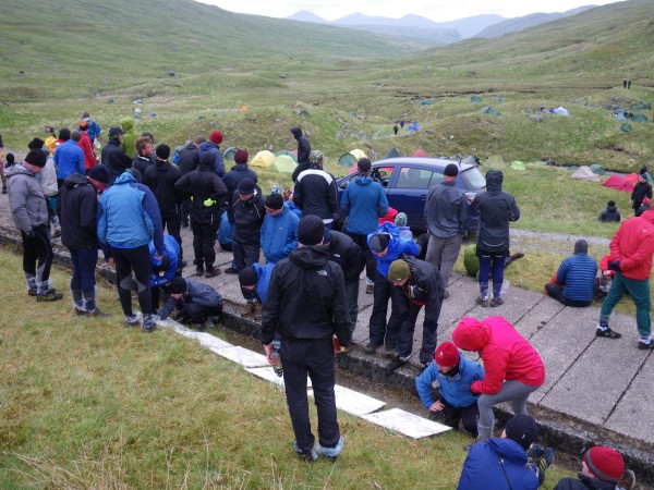
We expected Richard's gimpy knee to feel better by now but, sadly, it didn't, so we couldn't "race" LAMM. Still, it was an excellent adventure built into a vacation. After much angst we selected the B course from the range of Elite, A, B, C, D, and Score-O. Almost 75% of teams race C, D, or Score-O, including some very fit, experienced people. Fewer than 10% of teams do Elite or A. None of the courses is easy; in fact, the highest altitude control was on the D course.
There was free camping at the event centre. Organizers recommended a second tent for this base camp which enabled racers to pack their nice, dry tents for the race. We only had one tent and it looked like rain, so we splurged on another night in the converted church in Inveraray.

Day 1
Saturday morning dawned clear and sunny with an excellent forecast. We'd been assigned an "assembly time" of 7:40 a.m. They don't tell you exactly what will happen; this year we were put on buses to the appropriate start location, which was different by course.

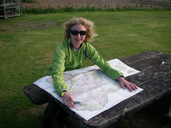
We were handed our race maps as we approached the bus waiting area. There were circles marking all the controls for all the courses, but we still had no idea which controls were ours, where the start was or where the camp was. At 66 cm X 77 cm, this 1:40,000 laminated map was big and unwieldy but it was high quality and great to use.
We were bused to Inveruglas on the bonnie, bonnie banks of Loch Lomond, then immediately took the high road.

At the start line, teams were sent out at intervals. There were lots of shorts and capris on the B course. It was chilly so we knew that our competitors weren't planning to limp along with trekking poles!

After punching the start control, we were handed control descriptions - 8 controls on our course plus the finish. Each control had a UTM and we used it to mark the course on our map. Most people knelt on the ground for several minutes to do map work on the clock.

You can see Richard's SportIdent card strapped to his wrist with a non-removable band.

Like last year in Sweden, each racer carried an SI card for the entire weekend and it was cut off at the finish line. Both teammates had to punch each control. I like this system a lot better than the honour system, which unfortunately doesn't work very well for some teams.
We were still all together as we headed up (up, up) to the 1st control. As the day went on, teams spread out.

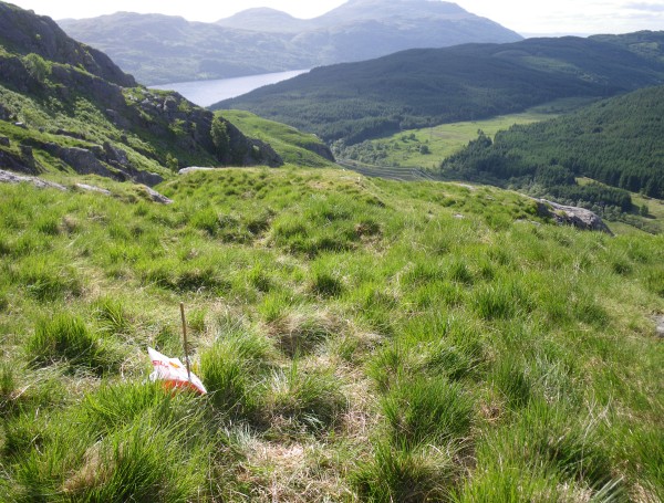
In other events where we've used maps with similar scale and detail, the controls have normally been placed on big, obvious features with the flags hung high. The emphasis has been on route choice, not on fine navigation within the control circle. At LAMM, it's both. Some of the controls were placed on more subtle features although they were accurately placed and supported by the map. The flags, often faded, were on the ground held down with rocks. I suppose that's because there are no trees and it would be difficult to use control stands in rocky terrain. The flags were sometimes hard to see even when we were close by, so as we approached, we watched for smiling racers leaving the control. For some reason, a few people liked to sit by the control flags to plan their route to the next control, which was occasionally helpful as we approached. Can you see control #1 in this photo?
After #1, we continued up a beautiful ridge as Loch Lomond receded in the distance.
Spectacular scenery! There was only one place in this area where I worried about slipping and plunging down a mountain side. (Which seems to happen a little too often in Scotland, according to the newspapers.)


Richard had a new toy for this race, which concerned me, since there is nothing more distracting to a boy than a new toy. It was a UV water purifier. 45 seconds to do a bottle. No waiting. Very cool. So cool that he marched 5 minutes up the steep slope toward this lake (actually a "lochan") before he realized that his map was still lying beside the stream at the bottom of the hill. :-(

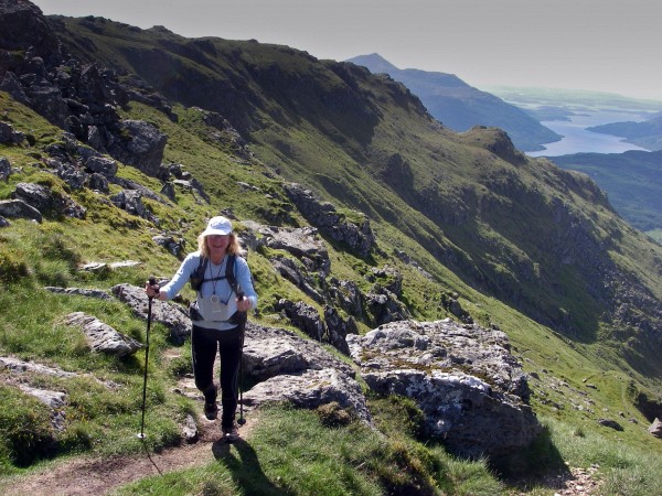
Here's a rare moment of running. Unfortunately, Richard's good knee started to hurt along with the bad one as a result of the steep descents, so we reverted to hiking.

Here's a cool stream junction control. It was so subtle that we saw a team 50 meters away who didn't realize that the control was down here.

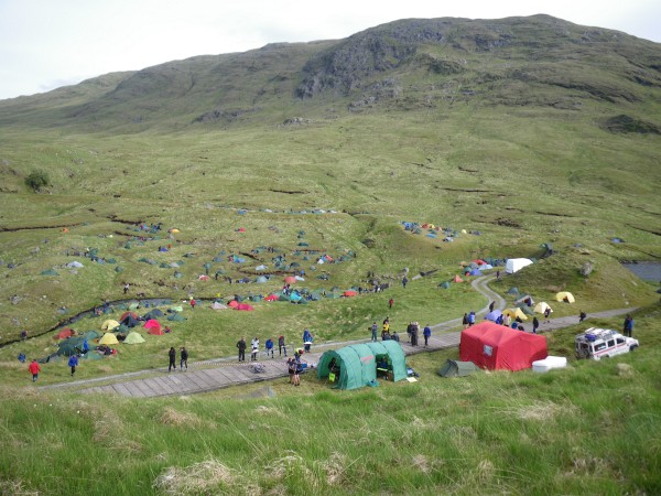
Soon after, Richard's knees both began to protest loudly so we took our time coming up the long valley to the finish line. These photos show only part of the camp from the high point where we put our tent. By the end, there were about 500 racer tents plus big tents for organizers and the mountain rescue team.

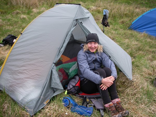
Before we cooled down, we got our tent set up and put our cozy layers on.
Boiled some water on our Heineken can stove and had dinner in a foil bag.
A close-up of Richard's feet. Note the essential piece of gear for a mountain marathon - the thing we didn't know to bring to BAMM. Plastic bags for your feet so you can wear your dry Sunday socks in your wet Saturday shoes. Simple and brilliant! We got plastic foot bags with a sponsor's name as race swag.

We chatted with people in the tents around us, some of whom raised their eyebrows to hear that we'd tried the B course on our first go. Since we placed 66th of 84 teams today, I can see why!
I guiltily confessed to having brought a luxury item to while away the long evening - an iPod loaded with podcasts. The other racers laughed - turns out most of them had brought iPods too. One guy was getting updates on the England/U.S.A. World Cup soccer game on his iPhone as we talked. Down at the main tents, people were gathered around a car radio listening to the same game and cheering. Others were looking at the Saturday maps with the course setter's preferred route marked on each one. Results were posted and continually updated as latecomers drifted in. The atmosphere was social as people compared stories of their day.
We fell asleep easily and were too warm - quite different from Sweden.
Day 2
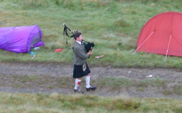
It rained hard in the night. Around 5:50 a.m., a bagpiper began marching among the tents to deliver a wake-up call over the next 15 minutes. Fantastic!
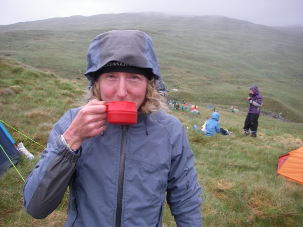
We made a quick breakfast including surprisingly good Starbucks instant coffee. The clouds were sitting low on the hills. I was definitely going to need my compass today! (And my coffee.)

There was a chasing start for teams within 90 minutes of the leaders but the rest of us could start any time between 7-8 a.m. Once again, we were handed control descriptions with UTMs after we had punched the start control, then we had to figure out where we were going.

At first, we mostly had light rain.

Then visibility got very limited. At times, we could be 100 meters away from a mountain and not know it. Compass, compass, compass.

We passed over a hydro dam.

You can imagine how easy it was to see this flag on a foggy day.

Must. Trust. Compass.

Shortly after this, we needed to put on more layers. Even the racers in short shorts started to dress like they were in the mountains. Some of them, anyway.

I'm happy in this photo because the clouds have lifted enough at a pass to confirm that the terrain ahead looks correct. Also, my new waterproof Sealskinz toque is working very well, even though it makes me look like a Dr. Seuss character.

This ridge was stunningly beautiful in a misty, Lord of the Rings sort of way.


The last part of today's course was a steep, slippery descent - first toward a control at a stream junction, then down to sea level to the finish line. I felt soooo sorry for Richard, who had been eating ibuprofen like it was candy.


And we made it! Not exactly a stellar performance but that wasn't the point, given Richard's injury. We were 66th on both days and 66th overall of 84 teams on the B course. We finished in 150% of the winner's time, which is the unofficial guideline for whether you should be on the B course. It's a *very* good thing we dropped down from the A - yikes. The B course had low numbers of women and rookies (I am both!), and the courses above us had even fewer. There were a bunch of drop-outs and mispunches in today's bad weather, and most people were doing a shorter course than ours. So we're trying not to be too embarrassed about placing 66th! :-)

Our SPOT GPS tracker worked on Day 2 but not on Day 1.
Lots of other info and photos, including maps showing the courses, are on the LAMM website.
I chatted with Andy Symonds, a runner on the Salomon U.K. team who spent some time at Salomon HQ with Phil Villeneuve in France this year. He was one of the BAMM winners who suggested that we do the LAMM. This year he won the Elite category of LAMM for the 2nd year in a row. Must be all that great Salomon gear! :-)
This was great fun and the story may not be over. We talked to a top racer on the A course and he said we also have to try the Highlander Mountain Marathon in Scotland. It's in April when it can be much colder, so organizers provide a hot meal at the mid-camp. The coolest thing is, they hold a ceilidh at night! (Check out Pete and Leanne's wedding photos to see a ceilidh in action.) So we may need to go back again some time soon. Maybe with a few more Canadian friends?
Saturday Jun 12, 2010 #
Orienteering (Mountain Marathon) 7:57:42 [3] ** 25.0 km (19:06 / km) +1700m 14:16 / km
shoes: Salomon XA Pros - Tomato
Friday Jun 11, 2010 #
Note
LAMM website with some updates during the event:
Our SPOT GPS tracker (which has some test data from other outings). I'm hoping to transmit on Sat/Sun but the unit is being temperamental. Fyi, it's 5 hours later here and we hope to be done by 11 a.m. EST on Sunday. We're starting at 7:40 a.m. on Saturday, i.e. 2:40 a.m. at home.
Saturday - 25 km, 1700 m elevation
Sunday - 23 km, 950 m elevation
Note
Both 'Bent and I noticed an uncanny resemblance to my Dad and grandfather in portraits of the Dukes of Argyll from 200-300 years ago. Who knows? I'm 7th generation Canadian so I'm certainly not a close relative of the current Duke. He sounds like an interesting character with multiple wins at the World Elephant Polo Championships.
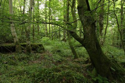
The Campbells have a nice forest out back.
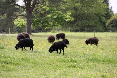
Every family has its black sheep.
Our digs are pretty nice here because we arrived in town on a busy weekend. We're in the honeymoon suite in a converted church overlooking Loch Fyne. Tomorrow night we'll be sleeping on boggy ground at 400 m wearing all our layers (after the mandatory tick check) and waiting for the chilly drizzle to begin. Both types of accommodation have their merits!

We went to register for LAMM and it gave me the usual butterflies. Here's how it works. We'll be handed a map as we walk to the starting line. It's huge - 66 cm X 77 cm - and laminated because we paid for that option. Otherwise, you'd need to get it into a map case.
All controls for all courses are marked on it with red circles (i.e. a master map) but there will be no indication of which controls belong to our course. As soon as the clock starts, we will be handed a control description sheet with the UTMs for our controls. We need to figure out which controls on the map belong to our course and which sequence to visit them in. I'm assuming that both days' courses will be on the map so it will be pretty busy. The map is posted on the race website now without any controls.
Pack weighs 8.6 kg, about 1.1 kg more than last year but I think I've got 1L more of H2O at this point. Should be interesting... report will come in a few days.
Thursday Jun 10, 2010 #
Note

We saw some very steep, rocky terrain along the road - probably only for the Elites and A course racers though! Wishful thinking.
Another good omen for the Tree Huggers (hopefully) is this feature on the estate where the race is being held.
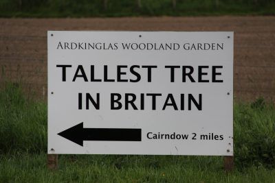
Here's Inveraray where it's great to be a Campbell - the opposite of the "No Campbells" sign in Glencoe. Barb Bryant will *really* be wishing she was here now. :-)
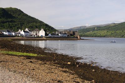
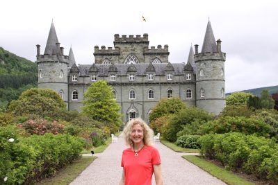
The only bad news about the race location was that it was *way* further west than the hints had indicated so we had a long drive across the country to get here. We're on the west coast directly west of Loch Lomond. However, as tourists, it wasn't exactly a hardship to drive a long way. And we visited Blair Castle enroute which was really nice. Tomorrow we'll visit Inveraray Castle to make sure my relatives are doing a good job taking care of the place. It's easy to taper around here. Much too easy!

Wednesday Jun 9, 2010 #
Note
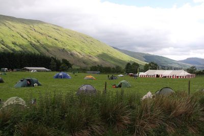
'Bent's knee continues to bug him - he's got an MRI right after we get home. We've dropped to the B course in hopes of not aggravating it too much. They offer Elite, A, B, C, D and Score-O courses. This year the B course covers about 48 km over mountainous terrain during the 2-day race, and all racers camp at a remote site on Sat. night. We carry lightweight camping gear and we don't learn the campsite location until we get our map on the way to the starting line in the morning. We're told that it's an "unusual" site this year - quite high, rugged and boggy.
Tuesday Jun 8, 2010 #
Mountain Biking (Trail) 3:30:00 [2] * 39.0 km (11.1 kph)
The forested areas reminded us of Canada.
We rode to a couple of very Canadian-looking lochs on well-maintained double track. About half our distance was on a rougher ATV-style trail with lots of puddles and a few stream crossings of different depths. It was awesome - like a really fun adventure race bike ride with lots of water and very little mud. That part of the ride took us above the treeline into sub-arctic vegetation as we headed up the long valley of Glen Eichan, which ends at beautiful Loch Eichan set in a crag surrounded by towering cliffs.
We're told that Scotland is the best country in the world for mountain biking - lots of trails and a culture that supports the sport better than many places. If you brought your own bike here, there would be lots of places to ride. Since we need to rent, it narrows down our choices, but Rothiemurchus was perfect for today's misty weather anyway.
I was reminded of how important clipless pedals are! And when my feet got bounced off the pedals occasionally, I missed my woman-specific gel bike seat. It's been awhile since I've ridden hardtail with front suspension and it took awhile to remember to stand up sometimes. The one thing I didn't mind was having only 8 gears in an internal hub (a lesser Rohloff-style). At least that didn't hurt - ow!!
Bothy Bikes was a very friendly bike shop by the trailhead; we chatted with staff for half an hour after our return. Did some shopping too - the range of Sealskinz products here is huge compared to back home.
No energy for whittling down the pics tonight, so here's a whole bunch. It looks weird to see 'Bent on a non-'Bent bike.


Monday Jun 7, 2010 #
Note
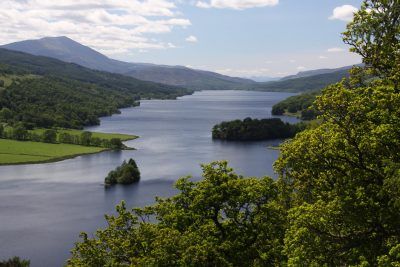
Drove along Loch Ness today. It's a beautiful lake but I'm not sure what all the fuss is about.

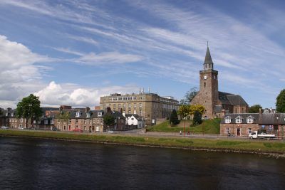
And then to Inverness. As Urthbuoy might say, I "pooches the nave" after dinner. Not that we went the wrong way but when I suggested the nice trail route along the River Ness and the Caledonian Canal, I failed to look at the scale of the town map. It was a lovely 6 km hike back to our B&B in increasingly dim light after taking only 10 minutes to get *to* the restaurant! Had banoffee pie for the first time.
Sunday Jun 6, 2010 #
Note
http://www.ar.attackpoint.org/viewlog.jsp/user_920...
Note
Trekking 1:45:00 [1] 7.0 km (15:00 / km)
shoes: Salomon XA Pros - Tomato
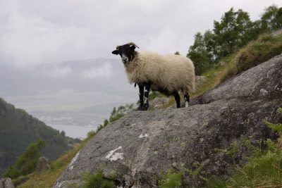
Things are greener up here with lots and lots of sheep. Lambs are everywhere and very cute!

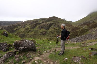
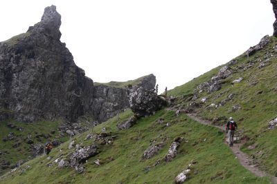
We hiked around the Quiraing, an area of weird rock formations and steep cliffs near the sea.
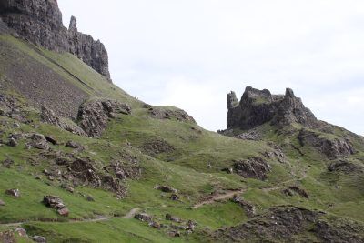
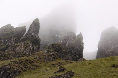
Because this was a shorter hike, I didn't take it as seriously as our mountain treks - and that's never a good idea. I didn't have my Garmin Forerunner or SPOT tracker; I didn't even have a map other than a cartoon drawing in the Lonely Planet guidebook. Most people stay low and just do an out-and-back to explore the rock formations but we'd been advised to climb up high and walk along the clifftops first, then descend and return along the tourist trail. The view was supposed to be spectacular - except that the fog started rolling in. Whenever we got to a place where there was supposed to be a wonderful view, we stopped and read the guidebook aloud so we would know what we were missing. "Fantastic view of the western isles!"

Eventually, it got difficult to see the edge of the cliff we were walking along. The trail became indistinct, confused with dozens of similar sheep trails. We found this cairn at the high point, as we were supposed to.

From there, we were supposed to hike a little while further to another cairn at a place where we could descend at a break in the cliffs. But we got pulled west on sheep trails in the fog and lost the edge of the cliff. At one point, I cheerfully announced that I'd spotted the cairn, "Strange - this one is made of white rock." As we approached, the "cairn" said "baa!", stood up and walked away. I'd been watching my compass in the absence of a map, plus I knew that the ocean and cliffs were to the east. So we headed due east in the fog and were lucky to hit our cairn exactly where the trail headed down below the cliffs. Yay, orienteering practice. (In case Mom is reading this, don't worry! It took about 5 minutes to get un-lost.)
As we descended, we got below the cloud and it started to burn off. Interesting area - very Lord of the Rings.
Off to see the Loch Ness monster tomorrow.
Saturday Jun 5, 2010 #
Trekking 4:06:44 [2] ** 13.86 km (17:48 / km)
shoes: Salomon XA Pros - Tomato
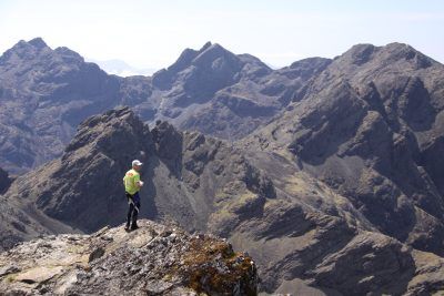
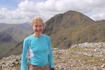
We've met so many friendly people in Scotland. Today we accidentally crashed a party on top of Bruath na Frithe but we were welcomed with open arms. A man named Jonah was climbing his final Munro (there are 283 peaks over 3,000' in the country!) About 25 of his friends and family hiked up to wait for him, then when he arrived at the summit, they cracked open champagne and Glenlivet to celebrate. Apparently, this is commonly done on a hiker's final Munro. He insisted on pouring champagne for us. Such an unexpected slice of life and so much fun!


Friday Jun 4, 2010 #
Note
The concession stands sold the usual food we see at sports events at home: porridge, haggis (regular and vegan) and risotto. !!!
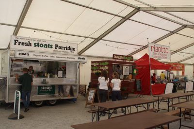
These were the only concession stands - no burgers, fries or sandwiches. We had a long chat with the young haggismobile owner, a retired MTB racer moving into ultrarunning. He says he's the only one around here who runs in Five Fingers and measures his running cadence, so he was interested to hear about Canadian trends.
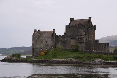
Passed Eilean Donan Castle...
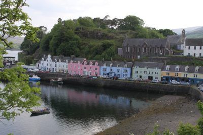
Then arrived on the lovely Isle of Skye. More hiking tomorrow! Sending good thoughts to all our friends at Wilderness Traverse this weekend - have fun and we'll be watching.

Thursday Jun 3, 2010 #
Trekking 4:34:22 ** 14.7 km (18:40 / km)
shoes: Salomon XA Pros - Tomato
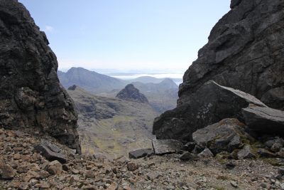
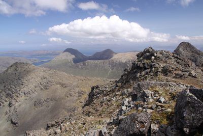
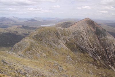
We took advantage of today's perfect weather forecast to plan a high ridge trek on Buachaille Etive Mor. This took us to the summits of a few more Munros (not that we're taking them too seriously!) in the big mountainous valley known as Glencoe, which is infamous as the place where the Campbells massacred the MacDonalds in 1692. (There were extenuating circumstances - honest!) The government ordered the Campbell regiment to do it because they had problems with highlanders who didn't support the King. Campbells have a bad name around here, so today I was Mrs. Ehrlich - which I never am! This "No Hawkers or Campbells" sign was in the lobby of the Clachaig Inn in Glencoe.

Yikes! Aside from that, it's a beautiful glen that has played a big part in Scottish mountaineering history.

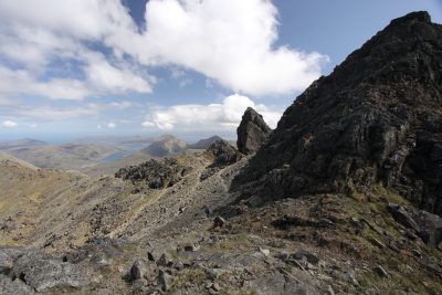
Here's the start of our hike - up the steep gully to the ridge, then to the summit on the left.

Here's what it looked like when we reached the ridge at the top of the gully. Our car is waaaaay down there!
If we'd climbed Ben Nevis today, we would have had great views - oh well, the stormy weather on the summit was an authentic Scottish experience.

Here's 'Bent on the summit of that first Munro we saw from the bottom.

From that summit, I took a photo of the Rannoch Moor for Hammer. This is a *very* important blanket bog.

Here's looking south toward another summit we climbed on the ridge.
Here's looking north after we'd hiked on the ridge for a couple of hours. The summit on the far right is the first summit we climbed - the one on the left in the photo from the bottom.
More boggy ground for Hammer. He would have loved this.

Today was more difficult than going up Ben Nevis because the trails were more rugged and steep. Sometimes it was just a rock scramble and there were lots of ups and downs.
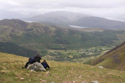
Lunch stop!
Wednesday Jun 2, 2010 #
Trekking 3:49:59 15.25 km (15:05 / km)
It was socked in at the top and turned quite nasty for about 15 minutes. In spite of all the warnings, I hadn't thought I would use my compass but I did take one bearing when the sideways rain was blowing hard and we couldn't see the next cairn 50 m away. (Didn't actually use it though.) Although lots of tourists do this hike, apparently it is possible to walk over the cornice, so they tell hikers the bearings and distances from the summit cairn to the trail. OK, Internet is disappearing - bye!


We passed about 200 people today but here's the one guy who passed us. He was wearing Salomon shorts so we didn't mind.


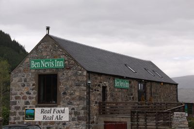
I had a wee glass of Ben Nevis Whiskey to celebrate.
Tuesday Jun 1, 2010 #
Note
