Discussion: map
in: Step Trek (Oct 7, 2017 - Pittsburgh, PA, US)
Oct 7, 2017 12:16 AM
#
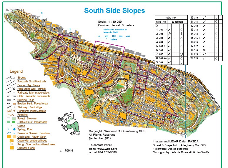
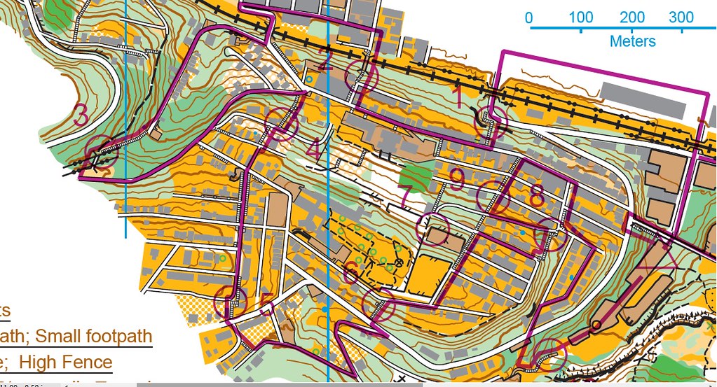
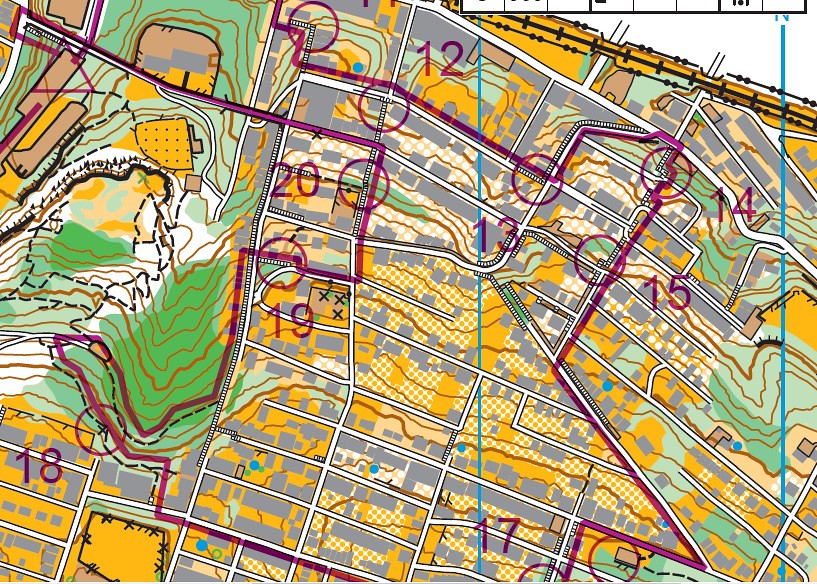
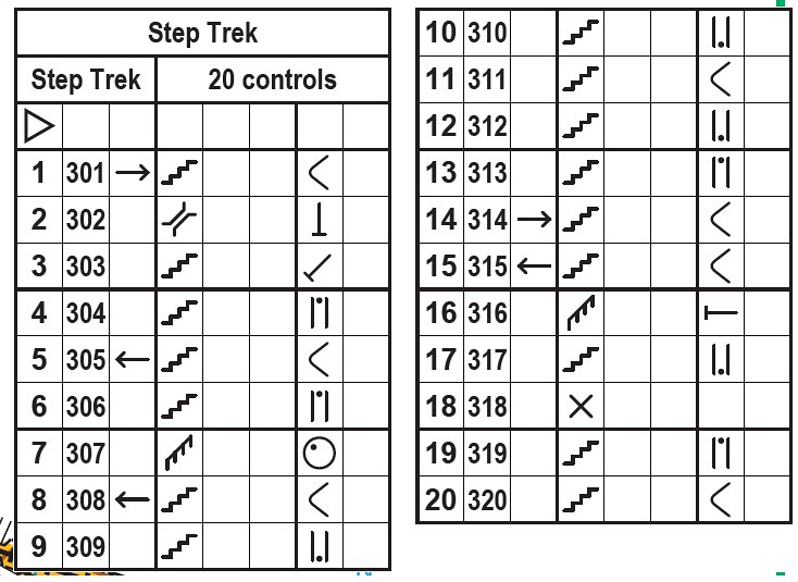
Map that will be handed out tomorrow to those that express interest. There will be an estimated 400+ people, but most likely only 10% of them will be interested in the "orienteering" concept.
Oct 7, 2017 11:21 PM
#
About 60 maps distributed with club brochure. Some folks loved, others didn't care. Some NEOOC folks came from Cleveland, and an experienced couple of recent transplants showed up as well.
photos
photos
Oct 8, 2017 4:09 AM
#
#StepTrek participants that used #topographic #orienteering map to find checkpoints on the route #SouthSideSlopes #Pittsburgh @brotheroneill pic.twitter.com/kRjrPU7lGT
— West PA Orienteering (@wpaorienteering) October 8, 2017
This discussion thread is closed.