Discussion: Billygoat 1979 Reenactment
in: Billygoat 1979 Reenactment (May 9–31, 2020 - Holyoke, MA, US)
May 6, 2020 1:38 AM
#
The first Billygoat Run was held at Mt. Tom in Holyoke MA on April 29, 1979, and it had the smallest number of finishers ever, just five (one of whom was well over four hours, but there was no time limit back then). Of course, there were only seven starters, which was also the smallest ever, but that means that a record 29% DNFed. More importantly, there are billions of people who did not get to experience this landmark course, probably including you. And here's your chance to experience it, 41 years later.
The course is 13.3 km, was set by Fred Pilon, vetted by Peter Gagarin, and now re-set by Phil Bricker. Since this year's Billygoat has been shifted to the fall, we're providing an opportunity for you to run this vintage course in the spring as a substitute. The 1979 event was an interval-start event, and due to this year's social-distancing policies, that's how you get to experience it as well. Note that the Billygoat tradition of skipping a control had not yet started in 1979. The course will be available from May 9 through at least the rest of the month.
Some things will be the same, or as close as we can make them, and some will be different. We're using the updated version of the map, to properly reflect the state of the terrain, but the course markings on the map are as close as possible to the way they were. One advantage that you will have is that you'll be printing the map at home and bringing it with you, so you could look over the course if you like, which is better than having to copy the course from a master map with the clock running as was the case back in the day. Rather than having to fumble with pin punches, you just have to get as close to the control as you feel like getting. The water stops will be historically accurate, which is to say nonexistent (if you want water, bring it). In some places, changes in the terrain, such as new trails, might make the routes a bit easier. In others, some route choices are no longer available (e.g. because there's now an off-limits quarry out there). And in the case of the last control... it used to be a knoll, but due to beaver activity, it's now an island. We tossed some logs and sticks in the swamp to make it easier to get there from the closest place on shore, but it's a longer way around than it used to be. Also note that that particular control flag there is so faded that you might think that it's been hanging out there since 1979. As for weather, we can't guarantee a match, it's up to you to pick a good day.
The original map scale was 1:15000, and if you want the full experience, you can have it. We're providing the map in a couple of different scales and formats, so depending on your preference and the capabilities of your printer, you can take your choice.
We'll put the course up on Attackpoint with the finish times of the original finishers so you can enter your splits and see how you compare. It's a physically and technically challenging course, but you have some advantages, so give it a shot. If you want to do just part of the course, or do it on two separate visits, that's fine, too.
A link to the map download, plus some additional course notes, will be posted in a couple of days. And I'll dig up some other historical tidbits as well.
May 6, 2020 2:23 AM
#
feet:
Might be tempting if I had 14 days to spare to self-quarantine on entering MA and another 14 days on returning to CT...
May 6, 2020 3:17 AM
#
Do you have to self-quarantine if you go there and back in the same day and don't encounter anyone?
May 6, 2020 5:22 AM
#
Governor Baker is asking those who enter the state to self-quarantine. As one site says: It''s a recommendation, not a requirement. But if you come to our state without wearing a seat belt, or holding a cell phone, you're in big trouble. That's the law.
May 6, 2020 5:42 AM
#
Billygoat 1979 Reenactment
Every participant grows long hair like a hippie, listens to rock-n-roll, and acts goofy like in 1970s
Every participant grows long hair like a hippie, listens to rock-n-roll, and acts goofy like in 1970s
May 6, 2020 8:21 AM
#
Sure, I'm doing that anyway.

(As Erma Bombeck once asked, do you need to wash a measuring cup with soap and water after using it to measure water?)
(As Erma Bombeck once asked, do you need to wash a measuring cup with soap and water after using it to measure water?)
May 6, 2020 3:07 PM
#
For historical accuracy I shall grow out my beard, wear bell bottom blue jeans and a white T shirt as I did on my 1st BG (not this one). No long hair in '79 though.
May 6, 2020 3:22 PM
#
I could dress like I did in 1979 but I I'd rather not run in a diaper and a onesie.
May 7, 2020 3:15 AM
#
From The NEOC Times, June/July 1979.
Sunday, April 22 1979: Mt. Tom Reservation, Mt. Holyoke, Mass Meet Director: Fred Pilon
The Mt. Tom meet proved to be a perfect training meet for those competing at West Point the following weekend. Most of the courses were set either long or difficult, and in some cases, both long and difficult. Most competitors alleged they were both. The Blue course, a/k/a The Billy Goat Run, had 600 meters of climb and 13.2 km of length. Top "goat" was Bob Lux, who ran an excellent course. Bob even beat Peter Gagarin's unofficial run of the course. - Fred Pilon -
(Peter's time seems to have been 133 minutes.)
Sunday, April 22 1979: Mt. Tom Reservation, Mt. Holyoke, Mass Meet Director: Fred Pilon
The Mt. Tom meet proved to be a perfect training meet for those competing at West Point the following weekend. Most of the courses were set either long or difficult, and in some cases, both long and difficult. Most competitors alleged they were both. The Blue course, a/k/a The Billy Goat Run, had 600 meters of climb and 13.2 km of length. Top "goat" was Bob Lux, who ran an excellent course. Bob even beat Peter Gagarin's unofficial run of the course. - Fred Pilon -
Blue course - 13.2 km., 18 controls
 1 Bob Lux                  131.13
 2 Dave Southworth          155.48
 3 Steve Tarry              156.46
 4 Roland Cormier           168.34
 5 Dave Bailey              263.57
                   2 DNF
(Peter's time seems to have been 133 minutes.)
May 7, 2020 3:21 AM
#
600 meters of climb
Ha! Maybe Mt Tom has been growing over the last 41 years. I did a quick calculation and got 750 meters.
Ha! Maybe Mt Tom has been growing over the last 41 years. I did a quick calculation and got 750 meters.
May 7, 2020 3:22 AM
#
Ages at the time:
Bob: 33
Dave S: ~25?
Steve: 29
Roland: 39?
Dave B: 35
Fred: 33
Peter: 35
Bob: 33
Dave S: ~25?
Steve: 29
Roland: 39?
Dave B: 35
Fred: 33
Peter: 35
May 7, 2020 9:22 AM
#
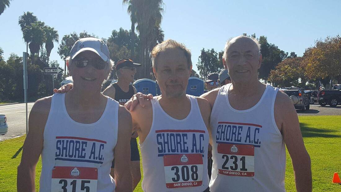
Now THAT's the JJ I remember!
Great idea to re-run that classic course.
I'll be waiting to hear how these kids of today do.
Great idea to re-run that classic course.
I'll be waiting to hear how these kids of today do.
May 7, 2020 12:24 PM
#
In 1991 there was a re-enactment of the 1976 Australian Championships at Belanglo State Forest (later to become (in)famous for reasons other than orienteering). You could run either your current class or your 1976 class; a few of us with early 1970s birthdates were a bit disappointed that there was no string course. The 1991 M21 winning time was 3-4 minutes faster than the 1976 one, not a huge difference.
May 7, 2020 1:07 PM
#
May 7, 2020 1:55 PM
#
I pretty fit guy, and interesting he lives in NJ, wonder if he considers doing O? 48 minutes for 8Km.,,...
May 7, 2020 7:20 PM
#
Those old-timers should be greeted at start with
I Can Feel It Something In The Air Tonight...
I Can Feel It Something In The Air Tonight...

May 8, 2020 9:20 PM
#
Map will be posted sometime this evening, I'm making some final adjustments.
May 9, 2020 12:43 AM
#
The map files and course notes are here. And here is J-J's description of the many map files:
A Billygoat is a long course, and you can't expect a long course to fit onto a letter-sized sheet of paper at 1:10000. Of course, the 1979 Billygoat didn't use 1:10000 maps, it was back in the day when 1:15000 was the standard. But we've provided a number of accommodations, depending of what scale you want and what size printer you have
BG79 w course 15000 rot -- This is the whole map, at 1:15000, on a letter-size page. But it's rotated to fit. Everything is aligned to magnetic north except the edges of the paper.
BG79 w course 10000 rot tabloid -- Same as the above, but it's 1:10000, and you need an 11x17 printer.
BG79 w course 10000 rot N and BG79 w course 10000 rot S -- The rotated 1:10000 version, but split onto two pages, which you can tape together or carry back to back as you see fit.
BG79 w course 15000 norot tabloid -- If you've got an 11x17 printer, you can have the whole map on one sheet, not rotated.
BG79 w course 15000 norot N and BG79 w course 15000 norot S -- For those who want the non-rotated version at 1:15000, but who have only a letter-size printer.
BG79 w course 10000 norot N tabloid and BG79 w course 10000 norot S tabloid -- Like the above, non-rotated 1:10000 that fits onto two pages.
And finally, BG79 w course 10000 norot NE and BG79 w course 10000 norot SW -- The 1:10000 version non-rotated version split onto two pages that overlap diagonally.
Control descriptions are in English only, because that's how it was back in 1979!
May 10, 2020 10:01 PM
#
The park is now open until 6:00, at which time they lock the gate. If there is any chance you will not be done in time, you should park outside the gate and walk in.
May 11, 2020 12:39 AM
#
Control #11 is missing the tag with the historical code. The regular code on it I think is 330, but it's the only control in that area, so whatever.
May 13, 2020 1:11 AM
#
Back in 1979, the organizers prepared a course profile showing where the climb was. Fortunately, this historic relic has been preserved for posterity.

May 13, 2020 11:44 AM
#
I took the same route that you did, more or less, out to the right and down where there was a bit of a reentrant. But I have a copy of a map where PG drew his route. Back then, the quarry was a clearing and wasn't out of bounds. He went pretty much straight! Yikes!
May 13, 2020 11:56 AM
#
PG:
Back then, when men were men? :-)
I think I drew up the profile after I had run the course (but before the event), hence the parachute on the drop after 8 and then the long up to 9-10-11. My only real contribution to the event was the name. Fred wanted to put on a long hard course and he did all the work.
I think I drew up the profile after I had run the course (but before the event), hence the parachute on the drop after 8 and then the long up to 9-10-11. My only real contribution to the event was the name. Fred wanted to put on a long hard course and he did all the work.
May 20, 2020 1:11 AM
#
More people have now done the course this year than did it back in 1979.
May 25, 2020 3:59 AM
#
Twice as many people ran the course *today* as did in 1979. Though I'm not sure if there were as many finishers as back then
May 25, 2020 9:14 PM
#
RouteGadget is now available (thank you, vmeyer!). Because there's no epunching and the map is not georferenced, there's a little extra work on your part to get your route lined up. In case you haven't done this before, here are the steps:
1) Download your route as a gpx file (as usual)
2) Go to the link above, and click GPS upload in the upper right (as usual)
3) Choose the Blue course, and browse to your gpx file (as usual). Click OK.
4) When the course appears on the map, enter your name in the box in the upper right part of the map. (If you forget to do this, your track will appear anonymously.)
5) The red track will have three blue squares on it, one for the start, one for the finish, and one in the middle. Drag the start and finish squares to the start and finish of the course, then drag the third square to some appropriate place so that the track hits as many of the controls as possible.
6) If that looks good enough, click Save. But it likely won't. In that case, you can right-click on places on the track to add more blue squares that you can drag to where they belong (the sharp corner at a control is a good spot to do this). When you have it lined up to your satisfaction, click Save.
If you screw things up somehow, drop me an email and I'll try to explain better (or I can delete your track so you can start over).
May 26, 2020 9:52 PM
#
Or you JJ can make the map look as if it is geo-referenced.
I used this on Saturday with a 1970 Ottawa OC map and course.
1) Open OCAD 2019 and use New Map Wizard to import a map of the same area from Open Street Map.
2) Bring the competition map with the course into background, lining it up with some common registry points.
3) Delete or hide all the detail from the Open Street Map import and you are left with the old map geo-referenced.
But if you have to e-mail it anywhere remember the map in background will have to be e-mailed as well. So keep those registry points handy.
May 27, 2020 1:09 AM
#
But if there was a pseudo-georeferenced version of the map, pseudo-epunching could happen with UsynligO or O-range.
I'd been considering asking about this anyway since it looks like some of the people interested in trying the course (self included) aren't going to make it before the end of the month. This would allow the controls to be brought in and still allow people to get there "eventually". But don't sweat it if that's unrealistic.
I'd been considering asking about this anyway since it looks like some of the people interested in trying the course (self included) aren't going to make it before the end of the month. This would allow the controls to be brought in and still allow people to get there "eventually". But don't sweat it if that's unrealistic.
May 27, 2020 1:40 AM
#
Or you could load it into Livelox, which has an easy georeferencing step, and then people can load the course in the UsynligO app.
May 27, 2020 1:50 AM
#
My impression is that Livelox would require using NEOC's installation of it, and NEOC decided they don't want anything to do with this event (because we didn't get permission from the park).
My tentative plan is to get some permanent markers to put out there when we pull in the standard controls, in order to give people more time.
If somebody wants to set up some other route tracking thing or whatever, have at it. Contact me if there are materials you need (like the map file).
My tentative plan is to get some permanent markers to put out there when we pull in the standard controls, in order to give people more time.
If somebody wants to set up some other route tracking thing or whatever, have at it. Contact me if there are materials you need (like the map file).
May 27, 2020 1:27 PM
#
The permanent markers seem like the way to go. Thanks.
UsynligO used enough battery on my 1:40 excursion yesterday that I don't think it would last for the time I'd take for this event (if I ever do it).
UsynligO used enough battery on my 1:40 excursion yesterday that I don't think it would last for the time I'd take for this event (if I ever do it).
May 31, 2020 12:56 AM
#
The flags will stay out on the course at least through next weekend. The gate at the entrance to the park is now locked at 8:00 PM.
Jun 3, 2020 10:48 PM
#
Hoping to get there the 9th or 10th, weather permitting, hopefully the flags are still out!
Jun 9, 2020 4:05 AM
#
Latest word is that Phil thinks they'll probably be there all summer, though nobody is checking to make sure thay haven't fallen down. We'll post a note here before removing them, but there are negotiations afoot that could result in permanent markers.
Jun 14, 2020 3:08 PM
#
Update 6/13: Went slow, got lost, fun course. All flags still in place. Woods quite dry and quite clear, most watercourse are empty. 60s, breezy and basically no bugs!
Sep 8, 2020 2:44 PM
#
Is there still a chance to run this? If there are flags out, that would be wonderful.
Sep 8, 2020 3:48 PM
#
The flags are still out, but I'd expect by now one or two could be missing or on the ground. Have fun!
This discussion thread is closed.