Discussion: How would you map/overprint a parked train?
in: Orienteering; General
Aug 29, 2010 5:57 AM
#
Here is a situation I have not encountered before.
We have a map with a narrow gauge railway running through it. Although this is the main line, it is not in use anymore (tourist trains go from Skagway to Carcross; this is on the other side of Carcross). But there is a 450 metre long section of rail cars parked on it (for storage I guess, but it doesn't look as if they are going anywhere soon).
Photo is available here - scroll down to "COC Long Distance - carcross desert"
http://www.yukonorienteering.ca/coc2011/terrain.ht...
It is crossable 'physically' by ducking down/crawling under. But we are wondering about the wisdom of that - for liability reasons and safety (what if someone hits their head or cuts themselves badly against metal?). Plus the railway company may be against it.
I am considering a 3-prong approach - avoid it in terms of course setting; advise people about it in the meet info; overprint it as out of bounds (i.e. purple #709). But this still leaves an 'enforcement issue', because as I said, it is generally physically crossable.
Any thoughts of how you as a runner might expect this to be shown on your map?
Aug 29, 2010 7:17 AM
#
Its sad that you have to worry about someone getting upset because they cut themselves - its orienteering, its an adventure sport
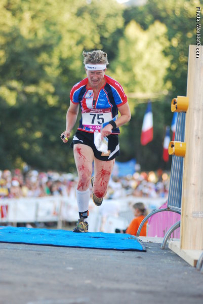
WOC Final? Did she get upset because she cut herself....
http://runners.worldofo.com/bilder/large/sarahroll...
From a runners point of view, its either crossable or its not. You could also use the forbidden route symbol of purple X's if you plan to block it off.
WOC Final? Did she get upset because she cut herself....
http://runners.worldofo.com/bilder/large/sarahroll...
From a runners point of view, its either crossable or its not. You could also use the forbidden route symbol of purple X's if you plan to block it off.
Aug 29, 2010 10:45 AM
#
Overprinting it as out of bounds seems good to me, as well as just avoiding it in the course setting. Maybe you can even map it as an uncrossable pipeline (just an idea cause it's far from ideal I realise).
All in all I think there isn't just one best solution, as long as the situation is clear to the runners.
All in all I think there isn't just one best solution, as long as the situation is clear to the runners.
Aug 29, 2010 1:34 PM
#
Interesting problem.
I would be tempted to map the individual cars as buildings (black rectangle) and then add the out-of-bounds symbol or forbidden route symbols.
What is a rail car but a small building on wheels?
I would be tempted to map the individual cars as buildings (black rectangle) and then add the out-of-bounds symbol or forbidden route symbols.
What is a rail car but a small building on wheels?
Aug 29, 2010 2:31 PM
#
AZ:
Wouldn't you use 707 - uncrossable boundary? (rather than 709 which is an "area" symbol)
Aug 30, 2010 6:51 AM
#
depends on how many cans of spray paint you've got & what your tagging style's like ( or you could paint the carriages purple all over to match the map)
Aug 30, 2010 10:27 AM
#
I reacall seeing a long line of similar rail cars the last time I was in the Yukon and helping to pick up controls after a meet in the Carcross area. Notwithstanding the town name I preferred to go betwen the cars where the line was broken for roads rather than crossing the cars. However in a pinch they would have been of little more difficulty to cross than a couple of barbed wire fences using the drop and roll technique.

Aug 31, 2010 2:30 AM
#
Well, that's silly. Those don't provide much of an obstacle (you can run underneath most of them) so they are buildings with canopies.
Aug 31, 2010 3:11 AM
#
I'm curious to know how one would go about getting permission to run an orienteering meet through an airfield - military or otherwise.
Aug 31, 2010 4:23 AM
#
This has been a favorite control location over the years. It's mapped a a building.
I also mapped these as buildings once.
I also mapped these as buildings once.
Aug 31, 2010 4:27 AM
#
permission to run an orienteering meet through an airfield
It's not an airfield, it's a mothball yard. That stuff is all dead-parked, pretty much like the locomotive.
It's not an airfield, it's a mothball yard. That stuff is all dead-parked, pretty much like the locomotive.
Aug 31, 2010 4:40 AM
#
mothball yard
Hey now, there's 'regeneration' going on at the boneyard...
Hey now, there's 'regeneration' going on at the boneyard...
Aug 31, 2010 4:42 AM
#
I suspect it would still be a difficult process no?
In this particular case it would probably be impossible.
Don't know why you'd want to run through an airfield, military or otherwise... it's just miles of pavement.
In this particular case it would probably be impossible.
Don't know why you'd want to run through an airfield, military or otherwise... it's just miles of pavement.
Aug 31, 2010 11:53 AM
#
... it's just miles of pavement.
... covered with really cool airplanes! :)
... covered with really cool airplanes! :)
Aug 31, 2010 1:18 PM
#
And that would be more fun than running through a WalMart parking lot, how?
Aug 31, 2010 1:34 PM
#
While in Heathrow, getting the bus between terminals, it was commented how class a sprint map it would be!! Using all the baggage and services areas and all that jazz - it would rock!
Aug 31, 2010 2:59 PM
#
@Cristina: because there are no really cool airplanes in a WalMart parking lot? I suppose I've got a little fetish ...
Aug 31, 2010 3:23 PM
#
I guess you've lost me on the "really cool" part. An airplane is about as interesting as a car to me, which is about as interesting as a concrete block. Let's run through forests!
Aug 31, 2010 3:39 PM
#
Yeah, I can appreciate airplanes as works of art/objects of technical marvel, so it would be fun for me. Not that I don't appreciate a quality forest. :)
Aug 31, 2010 9:13 PM
#
Old logging trucks make good control points in a forest that is just a bunch of trees with no real mappable features. They are black X's on GAOC maps. The old rusty hulk blends in with the tree bark, and you really have to navigate to find it.
Sep 1, 2010 12:05 PM
#
I'm sure it's still there, but it's barely recognizable, and only if you know what it is in advance (or want to stop and examine it very carefully). It looks like just a small pile of miscellaneous junk. There is (or was) also a crashed helicopter on another West Point map, which I think would occasionally get trucked to different spots as needed for training exercises.
Sep 2, 2010 5:23 AM
#
I had a control on one of those at West Point only a few years ago (pretty sure it must have been the plane, not the helicopter, as there wasn't a whole lot left of it) and it was mapped as a black X. There's also a wrecked plane on QOC's Patuxent map and I've had a control there as well.
Been on many, many maps with old rusted cars in the woods, those were always black X as well.
Been on many, many maps with old rusted cars in the woods, those were always black X as well.
Sep 2, 2010 7:36 AM
#
I think my Dad wanted to do the "broken down car sprint" in one of the St. Louis parks. It has tons of sinkholes, and many of them are the final resting ground of old cars and refrigerators.... enough for a sprint course.
Sep 2, 2010 5:34 PM
#
GuyO:
So, one would have to climb in and out of these sinkholes to get to the old cars / controls? Which of the StL parks is a former junk yard?
Sep 2, 2010 8:48 PM
#
At the Peter Palmer junior relay a few years ago I spotted the cabin and wings of a commercial jet being moved through the army training area where it had been used the night before. Seeing the huge bulk of metal moving through the area just after dawn was a bit strange and it proceeded to go past assembly when most people were waiting around for the prizegiving.
At the JK a few years ago too I remember crossing a disused railway line near the start of my relay leg, the area was being used as an army training area, evidently in urban combat, it had a series of carriages parked along the track, these were not marked at all and most people either ducked under them or went around, nobody at all reported any injuries from the trains, although a few did trip on the tracks without carriages on them.
At the JK a few years ago too I remember crossing a disused railway line near the start of my relay leg, the area was being used as an army training area, evidently in urban combat, it had a series of carriages parked along the track, these were not marked at all and most people either ducked under them or went around, nobody at all reported any injuries from the trains, although a few did trip on the tracks without carriages on them.
This discussion thread is closed.