Training Log Archive: BruceIn the 7 days ending Jul 23, 2016:
| ||||||||||||||||||||||||||||||||||||||||||||||||||||||||||||||||||
| « | » |
| » now | |||||||||||||
| Su | Mo | Tu | We | Th | Fr | Sa | ||||||||||
Saturday Jul 23, 2016 #
Rogaining race 23:45:07 [2] *** 85.0 km (16:46 / km) +5000m 12:57 / km
spiked:40/41c slept:0.0
Ross River, NT
Team 145 with Craig Feuerherdt
Score 3210 points
13th overall of 304 teams
5th Men's Veteran of 176 teams
10th Men's Open
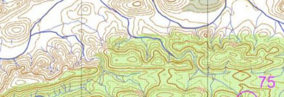
Map & Route
Photos
Results
Craig and I arrived on Friday afternoon in warm temperatures. The high twenties was a welcome relief from the Melbourne winter, but probably too hot for rogaining. Luckily the forecast for Saturday and Sunday was just perfect. Maximum of 21 with an overnight minimum of 8 or 9. The campground was packed with competitors, but we had the relative luxury of the bunkhouse for Friday and Sunday nights. A soft mattress would be very welcome with no sleep planned for Saturday night. The only downside was it was close to the effluent treatment site for the toilet block. About 700 campers was too much for it to cope with, which made for a rather unpleasant odour.
The bunkhouse was also quite useful for planning. Although the rogaine was a 24hr event, you actually had to concentrate for almost 27 continuous hours. The action began at 9am when the maps were handed out. The first thing noticed was the huge map size; a waterproof A1 size map. This required a lot of folding. Your hands actually got tired of holding the springy, folded map for long periods. The next thing to notice was that there was no easy terrain on the map. It was almost entirely either spikey spinifex or steep hillsides. There was not going to be much running. You had to factor in shorter routes than normal, but no one really knew how fast you could travel.
In our planning, we tried to link together series of high point scoring checkpoints. There was a high points scoring grouping in the southern hills, but it was also quite steep. We also identified some high scores in the northern spinifex, and these offered a few more options to return to the Hash House in the final hours, depending on how much time is left. The other large consideration was the lack of water points on the course. Most of the refilling points were quite close to the Hash House, and not where the higher scoring points were. We ended up planning our course anti-clockwise, aiming to reach the All Night Cafe between 10pm and 2am, depending on our speed. This meant that we would fill up our water at about 1pm, but then have to make our 3L of water last until the All Night Cafe. We would then re-evaluate depending on our progress at that stage.
I was a little unsure how many layers to pack. If we kept moving we would not get too cold, but if something happened at night and we had to stop, we would get very cold very quickly. I started with a short sleeve, and took a long thermal and another lightweight thermal jacket, in addition to the mandatory space blanket.
Bike pants eliminated any risk of chafing and kept me cool in warm afternoon. Then the essential gaiters and heavy duty Salomon trail shoes kept most of the spinifex prickles out.
Nutrition included 8x gels, muesli bars, muffin bars and a couple of bananas. I had eaten and drunk a lot on Friday night and Saturday morning. My fluids included 2L in my camel back, 500ml of strong lemon cordial and 500ml of coke zero as a treat.
At midday, we set off with 304 teams. A number of them raced off in our direction, much faster than we wanted to go. Many of them charged through the creek only 400m after the start. I didn't want wet feet for 24 hours, so we took the slightly longer route to the crossing point. This was the only water that we saw on the entire course. Within minutes we were already passing those silly enough to get their feet wet. The first hour was lovely. A nice passage along creeks and open grasses mixed with some open forest. #52 was my favourite checkpoint of the event. If only there was more like this. Alas, this was not the case.
Approaching #90 we hit the first major spinifex patch. Our gaiters were doing the job, but it was slow going. Running was out of the question, and you couldn't really walk in a straight line. The occasional spike seemed to pierce my shoes. It seemed to help if you could keep your toes pointing forwards and not expose the top of your shoe.
It was a relief to exit the dense spinifex after #111 and take on the big hills. As we climbed to #92 we realised that we would need to do some rock climbing. To avoid risk on the rocky slopes we took some wider routes, and
tried to climb the cliffs where it was more passable. Progress was good but was mostly too steep for running. The green forest areas on the map were also significantly slower, with low branches making going tough. Our aim was to push as hard as we can in the late afternoon to make use of the daylight hours. We didn't really want to be descending the broad spurs on this range in the dark, as navigating the right branches would be very difficult. The last we saw of the sun was at #93. This gave us plenty of twilight to get down the steepest part of the mountain down a rocky creek full of dry waterfalls. This would have been extremely tricky to negotiate at night. Craig was asking to refill his front bottles with his spare reservoir in his pack, but I wanted to get as far as possible before dark. We ended up stopping just before the climb up to #104 and turned on our headlamps at 1830.
My first sign of discomfort was descending from #104. The small rocks were sliding out from underneath me, and I was gripping with my heels to avoid slipping down the hillside. I could feel some hot spots developing on my right heel.
The tricky night navigation then started. I soon adjusted to the map skills required with frequent checks of my compass, and scanning my headtorch to spot the bigger contours around me.
There was a huge climb to the saddle south east of #94. The moon hadn't risen, but with our torches off, we could make out the shape of the big mountains on either side. My feet were not improving, so before we descended another rocky slope, I stopped, took my shoes off, and retaped my feet with Fixomul tape. I did have some on my heel already, but it had slipped off with all of the steep slopes.
This then led to an easier section approaching the All Night Cafe. We arrived here right on 2200 - right at the faster end of our estimate. We were looking forward to some refreshing drinks and some tasty fuel, and a sit down for a while. I was actually disappointed with the quality on offer. The cordial had run out, there was no fruit, the burger rolls were floury and dehydrating and there were no spare chairs. We should have taken this as a sign to fill our water and move on quickly. Instead, we hung around for the chairs to become vacant. We cooled down and had to put jackets and gloves on. I wanted to re-fuel so drank 3 cups of milo. Evenutally I sat down with Craig and replanned our next phase of the course. We looked to avoid the worst of the northern spinifex and take in more of the white forest to the north east. Neither Craig or I made the move to leave, waiting for the other to get going. Meanwhile, Robbie and Kathryn Preston had arrived, left to collect 76 and returned again. We also had a quick chat to Geoff Lawford to gather intelligence on the terrain that they had been through in the north.
Eventually we got going again at 2300.
With thermal jacket, gloves and buff on, we took off down the road. It took me 30 minutes to warm up. But then I started sweating profusely, but still felt cold. It seemed that the milo I drank was not agreeing with my body getting back into motion. Near #116 I had to take my jacket off. But I was falling far behind Craig up the rocky creek and I was very gassy. My temperature regulation was still not right,and I was becoming a little concerned that I could be ill. The one comfort was that for the next hour I would still be within 5kms of an aid station if things got worse. Back in the main creek I pulled out my first aid kit and took a panadol. Within 15 mins things improved. I no longer felt hot and cold and I stopped burping so much. The only side effect was my gasses progressing further through my digestive system. This was ok as long as Craig stayed in front of me :-)
I then had a good section through to #87. Then, right on 0200, my headlamp battery started to flash. I had expected (and tested it) it to last longer than this. However, the Reactive lighting system self adjusts to the amount of ambient light. With the moon not rising until 2130 it must have been working harder than normal. I still had about an hour of low power mode, plus about 2hrs of AAA spare batteries, but I probably needed 4.5hrs of light. I decided to turn it off and follow in Craig's footsteps on the track and creek bed to #118 and #89.
I needed my lights for #117 and low power mode was good enough. I tried this again for #48, but it was too flat and with only being able to see the tree in front of me and no wider shapes I found the earlier creek to the east. With my weaker light I had trouble reading the detail on the map and I failed to see the extra creek under the purple circle of #48. This was very frustrating as the creek was extremely thick, and it was time consuming searching for a flag in the wrong spot. We decided that it would be better to move on to #108 rather than waste more time on a 40 pointer. Craig seemed to work it out with his brighter light, but was not confident enough to call me over. He was probably within 50m of it, but we never really looked hard enough for it and missed out on 40 points.
From here I pulled out my spare batteries as I didn't want to repeat this with a 100 pointer, and I thought that I could make it through the 2 hours until dawn with my spares. We got a bit frustrated with the forest near #108 and #97. We were expecting open white forest, but we used the creeks to navigate and they were actually quite thick. It was hard work and slow going, but we found the tricky controls cleanly in the dark and scored 190 points in the next hour. The birds were chirping at us, but the sun was nowhere to be seen. It seemed to take forever for dawn to arrive.
The sun finally made an impression near #33 at 0630. On the way to #101 I had a good look at the remaining point scoring options to make the most of the morning daylight hours. I figured that we would have 4 hours from #72. We weren't running, but Craig was still walking fast and we had agreed to try to keep scoring points through to the end and not take any short cuts back to the hash house.
We took on another large spinifex section to #91 and #102, but it was more bearable in the daylight. Finally we reached W5 just before 1000, almost 11 hours after our last water point. A quick refill, and a short chat to the volunteers (co-incidentally my Aunty's parents) had us ready to take on the last 2 hours.
This section was quite scenic and fast. We had one last big climb at #62. This was another one of those with some steep scree slopes and we were happy to make it out safely without falling over. Our feet had almost had enough, but there was still one checkpoint to collect #81. We had 42 minutes to cover the 3km back to the hash house. This was enough time to walk comfortably, but not long enough to run to any additional checkpoints.
We finished with 15 minutes to spare and very satisfied with our score of 3210. Given it was our first 24hr event together we were very pleased to have made it without any major mishaps. It was my first 24hr since 1992, so I was quite unsure how I would last the distance. Perhaps we could have run a little more at times, but we didn't want to be too aggressive given our lack of 24 hr experience.
In the end we finished 5th in Men's Veterans, still 140 points behind a medal and 360 points from the win. No minor changes to our strategy would have made up this gap. The only way would have been to have run an extra 10 -15 kms (approx 15-20%), but that is much easier said than done. We would have had to have covered more of the white areas in daylight to be able to run more, and perhaps take on a few more risks by pushing our bodies further in the morning.
Our route choice was probably almost optimal. We scored 48.8 pts/km, the 3rd best of all 304 teams, marginally behind the Cranes with 49.1 pts/km. So our planning and navigation was excellent. We just needed to go a little faster for longer and not stop for so long at the All Night Cafe.
The main disappointment was that large sections of the terrain were unpleasant. There was some spectacular scenery, but not all of it was enjoyable. Not even the local wildlife enjoy being there. In the whole 24 hours I only saw 3 birds, 1 grasshopper and 75 spiders!
However, the map was excellent and overall the event was great fun and a challenge worthy of a World Championship. The organisation was excellent and we thank all of the volunteers. We will go away with some great memories.
I ended up with a few blisters on my heels from the stoney slopes, but otherwise just general tiredness. Walking around on Monday was hard work, but I started to improve by Tuesday.
I'm in no hurry to do another Rogaine in spinifex terrain, but after some time I could possibly be convinced to do another one in a more pleasant area.
Thursday Jul 21, 2016 #
Cycling 33:21 [2] 9.72 km (17.5 kph) +30m
Running 49:13 [2] 7.74 km (6:22 / km) +32m 6:14 / km
Cycling 36:11 [2] 9.64 km (16.0 kph) +64m
Wednesday Jul 20, 2016 #
Cycling 32:58 [2] 9.57 km (17.4 kph) +18m
Running 57:19 [2] 9.89 km (5:48 / km) +3m 5:47 / km
Cycling 29:46 [2] 8.4 km (16.9 kph) +45m
Tuesday Jul 19, 2016 #
Cycling 27:33 [2] 9.18 km (20.0 kph) +20m
Running intervals 1:10:46 [4] 13.14 km (5:23 / km) +4m 5:23 / km
Cycling 32:31 [2] 9.55 km (17.6 kph) +67m
Monday Jul 18, 2016 #
Cycling 26:39 [2] 9.69 km (21.8 kph) +18m
Running 29:08 [2] 4.82 km (6:03 / km) +4m 6:01 / km
Cycling 29:16 [2] 9.51 km (19.5 kph) +64m
Sunday Jul 17, 2016 #
Running 16:12 [1] 0.76 km (21:17 / km)
Running 24:03 [1] 1.5 km (16:00 / km) +2m 15:54 / km
Running 21:43 [1] 0.91 km (23:57 / km)
Running 24:24 [1] 1.31 km (18:36 / km) +2m 18:27 / km
Running 41:37 [2] 5.25 km (7:56 / km) +152m 6:56 / km