Register | Login
Attackpoint - performance and training tools for orienteering athletes

Training Log Archive: Nadim

In the 30 days ending Jun 30, 2019:

activity # timemileskm+m
  Bicycling27 15:21:19 250.14(3:41) 402.56(2:17) 1518
  Running16 10:38:03 63.54(10:03) 102.26(6:14) 900
  Orienteering4 6:03:58 16.13(22:34) 25.95(14:01) 822
  Hiking1 2:21:34 4.48(31:36) 7.21(19:38) 336
  Other1 45:00
  Total45 35:09:54 334.28 537.98 3576
  [1-5]45 35:03:03
averages - sleep:6.2 weight:196.2lbs

«»
2:57
0:00
» now
SaSuMoTuWeThFrSaSuMoTuWeThFrSaSuMoTuWeThFrSaSuMoTuWeThFrSaSu

Sunday Jun 30, 2019 #

9 AM

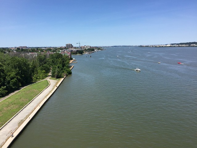
Running (Trail) 40:06 [3] 3.19 mi (12:34 / mi) +106m 11:24 / mi
weight:195.5lbs

Great Falls Park, MD. Starting from the Falls Rd. and MacArthur Blvd. intersection, Peggy led me on a hilly figure 8 loop through the park. I ran a bit easier than she did but it was hot and hilly enough for me to feel I was getting a workout. Every now and then, Peggy would pickup the pace on flat or downhill stretches. We walked some of the steeper hills.

I'd planned to do a bicycle ride after visiting my mother and sister, but there wasn't time for that. I probably needed the rest anyway.

Saturday Jun 29, 2019 #

4 PM

Running warm up/down (Street & Trail) 2:24 [2] 0.26 mi (9:14 / mi)
slept:8.25 weight:196lbs

Fountainhead Regional Park, VA. I warmed-up with a short jog to the restroom, and then back. In many ways, I was already warm--thunderstorms had been raking the area and cooling things off. When Peggy, Max, and I arrived, the parking lot was steaming and quickly drying off. It had been in the low 90s F but it had dropped down to the upper 80s F.

Running (Trail) 6:53 [3] 0.57 mi (12:05 / mi)

Fountainhead Regional Park, VA. From the main parking lot, I ran the Bull Run Trail to the double-bridge where the start for the SSS was. The trail had been re-routed to swing left, then right. As a result, it was longer and a little hillier.

Orienteering (Foot) 56:54 [3] 3.07 mi (18:32 / mi) +212m 15:16 / mi

Fountainhead Regional Park, VA. Gavin Weise setup a nice short course. People could choose to go with or without trails on the map. I chose a map without trails. I rusty starting out. The woods were very open though there was some deadfall occasionally. I ran in shorts and gaiters and barely got a single scratch. Initially the controls were rather steep but further into the course it got easier. Gavin's loop went counter-clockwise, then crossed on the way back for a figure eight. I missed on the 2nd control, going up the wrong reentrant. The controls were hard to see--2-3 small construction white flags. Sometimes the flags would be oriented on edge from the direction I was coming from and would be invisible. I was standing basically on top of some without seeing them, like when I stopped and Keg Good caught-up running right up to it. A few control features seemed mapped incorrectly--boulders that were hardly there and Gavin chose a spot or 2 that wasn't really a feature, but it was done pretty well overall. Afterward, a lot of us had dinner together at Oh George near the George Mason campus.

Running warm up/down (Street & Trail) 2:44 [2] 0.26 mi (10:31 / mi) +40m 7:09 / mi

Fountainhead Regional Park, VA. I warmed-down with a short jog to the restroom, and then back. This actually helped me feel cooler as the air dried my sweat.

Friday Jun 28, 2019 #

11 AM

Running (Trail) 1:00:29 [3] 5.95 mi (10:10 / mi) +20m 10:04 / mi
slept:7.0 weight:195lbs

Glen Echo, MD. From the Lock 7 parking lot, to the C&O Canal Towpath, then south to the Chain Bridge, back along the towpath, then side trails along the river back to the towpath above Lock 5, then back to the Lock 7 parking lot; finally once around the lot. It was about 87 F starting out. I didn't feel so hot initially but it did take a toll on me. I probably would have been slow either way since my quads were hurting in the first mile. I thought I would loosen up and it'd be better but after the second mile I slowed down. The towpath had a fair amount of shade but there were sunny stretches too. There were several groups of cyclists. One even looked like they had been camping. I was glad to have water waiting in the car when I got done.

Thursday Jun 27, 2019 #

7 AM

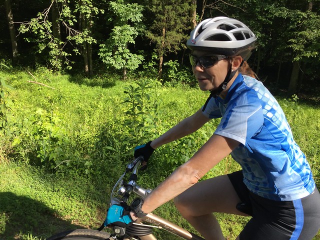
Bicycling (Commute) 39:43 [3] 12.2 mi (3:15 / mi) +19m 3:14 / mi
slept:4.75 weight:195lbs

From Northfield Rd., Bethesda, MD. to 13th & C St. SW, Washington, D.C. I rode steadily and may even have been slow starting out. It was warm out. I apparently had a little tailwind but could only feel it after Georgetown. Closings have begun in West Potomac Park for the upcoming fireworks on July 4th.
7 PM

Bicycling (Commute) 45:37 [3] 12.0 mi (3:48 / mi) +114m 3:42 / mi

From 13th & C St. SW, Washington, D.C. to Northfield Rd., Bethesda, MD. Leaving late, it was raining lightly from the edge of yet another thunderstorm that I was lucky to miss. I got through Georgetown in pretty good time. I got passed on the flats and picked-up the pace, but I dropped off the other rider well before Fletcher's Boathouse. I guess I was spinning pretty well going up the hill. I only got passed by a fast moving electric bicycle and thought I was doing well, but at Bradley Blvd., I was surprised to find myself a bit behind. I was able to make up time when I got home.

Wednesday Jun 26, 2019 #

7 AM

Bicycling (Commute) 5:56 [3] 1.41 mi (4:13 / mi) +9m 4:07 / mi
slept:5.5 weight:194lbs

From Northfield Rd., to the Bethesda Metro Station.
7 PM

Running (Commute) 53:03 [3] 5.41 mi (9:48 / mi) +90m 9:19 / mi

From Takoma Park Metro Station, Carol St., to 4th St. to Aspen St. NW. to Sherill Dr. to Beach Dr. to the Pinehurst Trail, to Western Ave. to Cummings La. to Turner La. to Brookeville Rd. to Taylor St. to Connecticutt Ave. to Thornapple St. to Leeland St. to Woodmont Ave. to the Bethesda Metro Station. It was in the 80s F and sunny today--somewhat more difficult than the very similar run I did last week in light rain. I finished at the station but ran about the same distance. It was only a 6 second difference (slower) but I'll call it a slight improvement.

Bicycling (Commute) 6:13 [3] 1.41 mi (4:25 / mi) +20m 4:13 / mi

From the Bethesda Metro Station to Northfield Rd. I was tired and slow starting out but I picked-up the pace.

Tuesday Jun 25, 2019 #

8 AM

Bicycling (Commute) 5:50 [3] 1.41 mi (4:08 / mi) +10m 4:03 / mi
slept:5.5 weight:194.5lbs

From Northfield Rd., to the Bethesda Metro Station.
6 PM

Bicycling (Commute) 6:01 [3] 1.41 mi (4:16 / mi) +14m 4:08 / mi

From the Bethesda Metro Station to Northfield Rd. I was carrying 2 backpacks with my work clothes from Monday and Tuesday. Though it wasn't very hot, I decided to run in the evening when it would be cooler. I was tired.
10 PM

Running (Street & Trail) 36:19 intensity: (35:49 @3) + (30 @5) 4.05 mi (8:58 / mi) +30m 8:46 / mi

Bethesda, MD. From Northfield Rd., Greenwich Park, to Old Georgetown Rd. to Beech Dr. to Singleton Dr. to Bulls Run Pkwy., to the trail along the middle school to Bradmore Dr. to Folkstone Rd. to Hartsdale Ave. to Heampstead Ave. to McKinley St. to Garfield St., to Roosevelt St., to the trail at Jefferson St. to Northfield Rd. It did turn out to be a much nicer evening by the time I go out to run--low to mid 70s F with low humidity. Starting out I was slow from having dinner still in my stomach. The lightning bugs distracted me in Greenwich Park. With it rather dark in there tonight, it was much like Christmas lights. I gradually picked-up the pace on Old Georgetown Rd. The second and third miles are more downhill so worked on running form. I'm getting strong enough again to hold a better form but it still took an effort. When I cut through the middle school there was another impressive display of lightning bugs. I though I might slow a lot more than I did as I headed uphill. I wonder if it's because I ate more

Monday Jun 24, 2019 #

7 AM

Bicycling (Commute) 6:05 [3] 1.41 mi (4:19 / mi) +11m 4:13 / mi
slept:6.25 weight:195lbs

From Northfield Rd., to the Bethesda Metro Station.
6 PM

Running (Street & Trail) 15:48 [3] 1.75 mi (9:02 / mi) +12m 8:51 / mi

From the Tenleytown Metro Station, to River Rd., to the Capital Crescent Trail (CCT). My legs were feeling pretty dead. The first mile of this was almost all downhill and even then, I wasn't that fast. It was humid out but a little cooler (~83 F) than it had been earlier in the daytime. The ground was still wet from the edge of another thunderstorm.

Running (Trail) 12:12 intensity: (6:06 @2) + (6:06 @5) 1.19 mi (10:15 / mi) +26m 9:36 / mi

From the CCT at the Landy Ln. access point (near River Rd.) to Woodmont Ave. doing fartlek. I did 11 fast segments of about 30 seconds each, with about an equal jog in-between. With as slow as I was feeling warming-up, this went okay. I suppose it was because I was using different muscles than when I run slowly. The damp trail was a bit slippery. I was thoroughly soaked from sweat afterward and I walked around to cool off.

Running warm up/down (Street & Trail) 13:16 [2] 1.36 mi (9:45 / mi) +15m 9:26 / mi

From Wisconsin Ave. and Woodmont Ave., to Strathmore St. to Wellington Dr. to Bradley Blvd. to Arlington Ave. to Old Georgetown Rd., to Edgemore Ln. to the Bethesda Metro Station. I jogged about to warm down and to get in sufficient miles. Besides being hot and sweaty, I was feeling hungry and somewhat weak.

Bicycling (Commute) 6:40 [2] 1.41 mi (4:44 / mi) +30m 4:26 / mi

From the Bethesda Metro Station to Northfield Rd. I was pretty tired so I took it easy. I weighted out at 193.

Sunday Jun 23, 2019 #

12 PM

Bicycling (Street & Trail) 1:20:40 [3] 22.5 mi (3:35 / mi) +118m 3:32 / mi
slept:8.5 weight:195.5lbs

From Northfield Rd., Bethesda, MD, to the Jefferson Memorial, Washington, D.C., across the 14th St. Bridge to the Mt. Vernon Trail, taking the river route to the Wilson Bridge, to the MGM Casino, to the intersection of American Way and Fleet St. Peggy and Samantha met me there so that we could go on to drop off Samantha to her away camp. On my ride, the Capital Crescent Trail was busier than on my usual morning commutes. Not only were more people out enjoying the perfect weather, but there was a different mix of people--more kids, strollers, and recreational riders. It made for some potentially dangerous situations with people passing in both directions. I slowed some for it. The Mt. Vernon Trail wasn't as busy where I rode it, except for at Gravelly Point where lots of people were watching the airplanes land and takeoff. I got through the busy streets of Alexandria pretty well. I didn't stop to take pictures but the area under the Woodrow Wilson Bridge had been improved with pavement and restroom facilities. It's interesting in its own right with V-shaped columns going lengthwise. I had light headwinds most of the trip.


4 PM

Bicycling (Trail) 1:17:57 [2] 14.56 mi (5:21 / mi) +38m 5:19 / mi

Near Indianhead, Charles County, MD. From the trail parking off of Livingston Rd., Peggy and I took the Indianhead Railroad Trail to Indianhead, did a small loop through a city park, got back on the trail, rode to Pomfret Rd., then rode back to the parking lott off of Livingston Rd. The trail was pretty nice! As railroad trails go, it was pretty flat and that was good since this ride kind of served as a cool down for me. I enjoyed the suddenly open views of marshes feeding into Mattawoman Creek. There were various fisherpeople on boats and along the shores. The area we were in is somewhat isolated with the Potomac River blocking through-traffic from far away. It was exceedingly quiet for being near Washington, D.C. There were hardly any airplanes to be heard though a single engine prop plan flew overhead--it was probably from a nearby dirt runway airport where they advertise flight instruction but the planes visible from the road had been losing their paint. There was a slight breeze and late into the ride we got more shade.

Indianhead Railroad Trail, MD

Indianhead Railroad Trail, MD

Indianhead Railroad Trail, MD

Indianhead Railroad Trail, MD

Saturday Jun 22, 2019 #

3 PM

Running (Trail) 49:09 [3] 4.5 mi (10:55 / mi) +71m 10:25 / mi
slept:7.25 weight:195.5lbs

From Watkins Mill Rd. to Huntmaster Rd. and back on the Greenway Trail. Peggy and I started out together. It was about 79 F and not humid, but the sun was strong. Neither of us felt energetic. My memory of the big ridge we crossed was that the woods were more open than they appeared today. I was thinking of having a Summer Short Series event here but now I'm not sure. I'd have to explore the side trails again. Other parts of the Greenway Trail had been shifted to keep it off the wetter areas. I felt sore in my quadriceps.

Friday Jun 21, 2019 #

8 AM

Bicycling (Commute) 37:46 intensity: (20:00 @3) + (17:46 @4) 12.2 mi (3:06 / mi) +31m 3:04 / mi
slept:4.25 weight:195lbs

From Northfield Rd., Bethesda, MD. to 13th & C St. SW, Washington, D.C. The threat of rain stopped so I finally rode today. I had a kicker of a tailwind almost all the way to work. I zipped around like I used to. At Bradley Blvd., a younger guy took off. I eventually caught him and passed him. I did get caught myself at around the trestle bridge by a guy who'd been passing me on other commutes earlier in the year. Though I didn't give chase, this time, he stayed in sight a long while. I did have a slowdown going up 15th St., SW when going into the wind. I'd pushed to make the light and then almost stopped when I thought I should wait. I had time so I tried to get going again and was tired.
6 PM

Bicycling (Commute) 45:08 intensity: (20:08 @3) + (25:00 @4) 12.0 mi (3:46 / mi) +129m 3:38 / mi

From 13th & C St. SW, Washington, D.C. to Northfield Rd., Bethesda, MD. I had headwinds getting to Georgetown and a little traffic. I took that part easy and was over a minute slow getting out of Georgetown. Trees protected the trail pretty well for a while and the curve in the Capital Crescent Trail eventually led to what seemed like tailwinds. I never got passed but one guy whom I'd caught up to at the Palisades, accelerated and I couldn't keep up. he eventually slowed and I caught him at the Bradley Rd. traffic light. I got the faster start there and he drafted me up to Wilson Ln. where we split. Overall, I felt stronger and made up time from my slow start.

Thursday Jun 20, 2019 #

6 PM

Running (Street & Trail Commute) 35:46 intensity: (23:46 @3) + (12:00 @4) 3.96 mi (9:02 / mi) +48m 8:42 / mi
slept:5.75 weight:193lbs

From the Bethesda Metro Station, Wisconsin Ave/Rockville Pike to W. Cedar Lane, to Old Georgetown Rd. to Edgemoor Ln, to the Bethesda Metro Station. It felt hotter than the day before. I started with a small rain shower; the edge of another thunderstorm that went south. Once I got moving, I felt better than I thought I would. Maybe it was being lighter or my training finally starting to kick-in. I wasn't moving that fast but it was encouraging. In Bethesda, the excavation of the new Marriott Headquarters was in full view--the vast pit took out almost all the buildings and parking lots for a block behind the old Bethesda Diner--interesting that the diner survived. Another block further north that had gotten taken out was further along with a tower frame and concrete flooring all visible. As I got to leaving downtown Bethesda, I saw a very nice double rainbow. I ran along a ways until I could line it up with the Bethesda Naval Medical tower and fortunately, it lasted. Though I slowed, going up the hill on W. Cedar wasn't so bad--that was encouraging too. I tried to run with better form on the stretch back, and was glad about it being gently downhill.
Summer Shower Over Bethesda Naval Medical Center

Wednesday Jun 19, 2019 #

6 PM

Running (Street & Trail Commute) 33:35 intensity: (28:00 @3) + (5:35 @4) 3.7 mi (9:05 / mi) +45m 8:45 / mi
slept:4.5 weight:194lbs

From the Bethesda Metro Station, Woodmont Ave. to Wisconsin Ave., to Norwood Park, to the Little Falls Trail, to Dorset Rd., to Falls Rd., to Glenbrook Rd., to Edgemoor Ln. and into to the Bethesda Metro Station. It was 85 F and humid. There were supposed to be thunderstorms and that's why I didn't bicycle to work. I moved okay and was a little sore. I did push in the last kilometer. I weight-out at 193.5 lbs.

Tuesday Jun 18, 2019 #

6 PM

Running 52:57 [3] 5.42 mi (9:46 / mi) +112m 9:11 / mi
slept:6.25 weight:196lbs

From Takoma Park Metro Station, Carol St., to 4th St. to Aspen St. NW. to Sherill Dr. to Beach Dr. to the Pinehurst Trail, to Western Ave. to Cummings La. to Turner La. to Brookeville Rd. to Taylor St. to Connecticutt Ave. to Thornapple St. to Leeland St. to Woodmont Ave. to Edgemoor Ln. It had been years since I'd run from Takoma Park to Bethesda. Most of the year I leave work too late and it gets too dark to cross Rock Creek Park without lighting. I've had other similar options too such as from Silver Spring to Bethesda, until the Purple Line construction took away the Georgetown Branch Trail. Another prevalent reason was that I hadn't been all that ready to run this distance across the hills. Leaving Takoma Park, the route was hillier than I remembered it, getting to the park. The old Walter Reed complex had been partly replaced by condo construction (in the $400K range). Other parts of it looked like it'd have made a great o-sprint campus. What I recall earlier running past there in years past was a delusional vet who was probably getting treatment, yelling at me as I ran past. Today it was raining lightly--just the edge of a thunderstorm. It still got me wet. The dirt trails in the park had some slippery parts. The narrow west end thread of the Pinehurst Trail would sometime disappear, and I'd have to cross the creek to find it again. The climb up through Chevy Chase wasn't so hard and that was good. It gave me confidence to run harder finishing up. Altogether it was an enjoyable run.

Monday Jun 17, 2019 #

8 AM

Bicycling (Commute) 6:02 [3] 1.41 mi (4:17 / mi) +10m 4:11 / mi
slept:6.5 weight:196lbs

From Northfield Rd., to the Bethesda Metro Station.
6 PM

Bicycling (Commute) 6:06 [3] 1.41 mi (4:20 / mi) +17m 4:10 / mi

From the Bethesda Metro Station to Northfield Rd. I got home before the rains started again. I decided to take it easy and get some stuff done inside.

Sunday Jun 16, 2019 #

10 AM

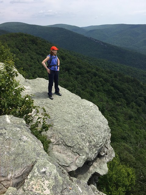
Hiking (Trail) 2:21:34 [3] 4.48 mi (31:36 / mi) +336m 25:38 / mi
weight:196.5lbs

Wolf Gap on the Virginia and West Virginia border (west of Woodstock, VA), For our anniversary, Peggy and I hiked from the gap to Big Schloss and back. I probably hadn't been there is +20 years. The first part of the trail is about a steep 600ft. climb in half a mile. My memory of it was that it was easier. After that it was a rocky trail on a narrow ridge for a while. We were lucky to have escaped rain which had come through before we parked and made the rocky trail a little slippery. I was glad to see that the area was not overly crowded. Several groups of campers had been hiking back on the trail as we headed out. The ridge widened out before getting to Big Schloss (German for castle). The old bridge (think Monty Python, Bridge of Death) that gets one onto the rocky knob, used to be made from natural logs--it had been replaced by thick lumber with concrete footings. It was hard to get a 360 degree view from the top like before. The Schloss rocks were much more tree covered than they used to be but there were still great views and it was still fun. Seeing the deathly steepness on all sides had me thinking about the risks I took when younger.

Big Schloss

Big Schloss

Big Schloss

Big Schloss
9 PM

Running (Street & Trail) 36:17 [3] 3.86 mi (9:24 / mi) +45m 9:04 / mi

From Northfield Rd., Custer Rd. to Wilson Ln. to Glenbrook Rd., to the Capital Crescent Trail, to Bethesda Ave. at Woodmont Ave., to Old Georgetown Rd. to Wilson Ln. to Battery Ln. to Park St. to Custer Rd., to Northfield Rd. After a nice day of hiking, celebrating our wedding anniversary, and celebrating Father's Day, Max and I needed to run. It was a good Father's Day activity and a nearly full moon was out. I was worried that I'd be too slow for Max. It was a couple of hours after dinner but I was still feeling undigested. It was also much more humid than it had been earlier in the day. We started out pretty slowly but picked-up the pace a little. I think Max was worn out too. He'd often run a little behind me. Mostly, I think he's not as used to running without stopping more frequently. We stopped for a drink on the CCT. After getting home we found that it was 78 F and we were a sweaty mess. After cooling down, both of us got to bed relatively quickly.

Saturday Jun 15, 2019 #

8 AM

Bicycling (Street & Trail) 1:53:32 [3] 29.76 mi (3:49 / mi) +322m 3:41 / mi
slept:6.5 weight:197lbs

From Northfield Rd., to the Capital Crescent Trail (CCT), to Fletcher's Boathouse, the C&O Towpath to Chain Bridge, into Virginia, up North Glebe Rd. to Williamsburg Rd., to Meridian St., to Locust St., to Great Falls St., to the W&OD Trail, to W. Church Rd., in Sterling, VA, to Sterling Cemetery. Peggy went out to run a race this morning and since we were going to drop off our daughter Samantha with my mom anyway, I bicylced over to our family cemetery, where we remembered my father (Father's Day is tomorrow), and my sister. Winds were from the south and not so bad on the CCT. I got behind a pretty good group of runners on the C&O towpath but snaked my way through them and other oncoming runners. The climb up into Arlington was hard but didn't wipe me out. A passing pickup truck gave me wide berth on the blind curve that has a cliff on the right. As an oncoming car hit the curve it had to move further right on the already narrow road, and then turn sharply left--I heard squealing tires behind me, but no crash. Crossing the ridges of Arlington County on Williamsburg Rd., I saw a large cycling group spread out in subgroups going the other way. When I crossed under I-66 and still didn't see the W&OD, I didn't realize that the trail was still ahead. I had a small detour figuring that out. On the W&OD Trail, my pace picked-up. There were some parts with headwinds and others where the trail climbed slowly or steeply still, so I felt I didn't get going good until after cross the Capital Beltway (I-495). I got stopped at a few traffic lights and was in Vienna in a little over an hour. The uninterrupted stretch from Vienna to Reston was fast but just before the downgrade ended, I got passed--the guy had drafted me for a little while first. I got moving again pretty well after leaving the Reston Town Center area. After the stop at the cemetery, Peggy, Samantha, my sister Rubina, and my mom ate lunch.
4 PM

Running warm up/down (Terrain) 9:34 [2] 0.97 mi (9:52 / mi) +15m 9:25 / mi

Summer Short Series (SSS) at Norwood Park in Bethesda, MD, I warmed-up running around the edge of the park 1 1/2 times. It was nice to run in a group like that again--it was like my old cross country days. I chatted with several people including: Ted Good, Joe Barrett, Will Hubsch, Elaina Bretton, Kathleen Lennon and my son Max Ahmed. I was glad that my legs weren't sore yet from riding this morning.

Running (Terrain) 16:51 intensity: (6:51 @0) + (5:00 @4) + (5:00 @5) 0.86 mi (19:36 / mi) +57m 16:15 / mi

Norwood Park - Peggy setup a training exercise in which we would run up a short hill, read a control on a map to memorize it, then run back and mark it on our own map. The run up the hill was less than 30 seconds. Sometimes I'd read the control quickly and be running again in 10 more seconds. Other times I'd take 30 seconds to make sure I was memorizing the control correctly. The run back, though downhill, was similarly 20-30 seconds. For the Advanced runners, there were 14 controls on the map, and they we in places more difficult to memorize than the other 2 levels. At each stop, I'd get down on the ground to get to the map and either read it or mark it up. I finished toward the end of the other runners, but I got all but 1 control correct. The one that I'd missed was only off a little bit.

Running 5:52 [3] 0.56 mi (10:29 / mi) +10m 9:57 / mi

I warmed-down with a half loop of Norwood Park.

Friday Jun 14, 2019 #

7 AM

Bicycling (Commute) 39:12 [3] 12.2 mi (3:13 / mi) +33m 3:11 / mi
weight:196.5lbs

From Northfield Rd., Bethesda, MD. to 13th & C St. SW, Washington, D.C. I got moving okay and there was a good tailwind. It was still cool and maybe in the upper 50s F. I did hit areas where the wind was swirling and I slowed riding into it. I passed a lot of riders and thought I'd be faster overall. My back was okay and I felt it less afterward.
5 PM

Bicycling (Commute) 46:49 [3] 12.0 mi (3:54 / mi) +131m 3:46 / mi

From 13th & C St. SW, Washington, D.C. to Northfield Rd., Bethesda, MD. It was windy (headwinds) and there was traffic leaving work. The amount I was slow getting out of Georgetown was about how much I was slow overall. The woods around the Capital Crescent Trail gave me some shelter and there were areas finishing up that I had tailwinds. On the way up the trail, I saw David Onkst running toward DC.

Thursday Jun 13, 2019 #

11 PM

Running (Street & Trail) 34:47 [3] 3.77 mi (9:14 / mi) +44m 8:54 / mi
slept:5.25 weight:198lbs

From Northfield Rd., Custer Rd. to Wilson Ln. to Glenbrook Rd., to the Capital Crescent Trail, to Bethesda Ave. at Woodmont Ave., to Old Georgetown Rd. to the Huntington Pkwy., to Custer Rd., to Northfield Rd., I put off running after work since I'd left late, came home and ate dinner. My back had been sore on the lower right side too. Continuing to procrastinate (and do some work), I didn't get out until 11pm. I was surprised how nice it was out. In the upper 50s F I think, there was a bright moon out and patchy clouds. It was more like an October night than a night in June. I was going to only go out for 2 miles since it was late but the weather and a downhill stretch made be add on. I was rather slow starting out but feeling better when I turned off. On the very gradual climb back, my quads were feeling worn out. I'm pretty sure I slowed more.

I followed-up by matching-up some better contours to the Bolger Center map--the new LiDAR pinpoints the single trees in the open area that were hard to match-up earlier--it turned out that the trees were pretty well mapped, except where they bunched. The intermediate vegetation background file that OCAD produced showed where the trees should be represented as open forest instead of individual or semi-open ground. The LiDAR also identified other ditches and spurs really well. I'll work on the file some more when I get a chance and hope to have a Summer Short Series event there. It might have to be a morning event.

Wednesday Jun 12, 2019 #

Note
slept:5.0 weight:196lbs

I'd worked at home this day so that Peggy and I could see Samantha's 5th grade graduation. While most graduations are not so interesting and tend to be long, the special needs kids at her school were very heartwarming. So many had enough trouble just going up to get their diploma. Many did their own thing and everyone was fine with that. The school had decorated quite well and had pictures of each of the graduating kids put on frames that the teachers could all write something to remember them by. They had a nice lunch afterwards. They split and go many directions next.

We went out to dinner in the evening and it was raining later. I needed to run but didn't . I used the time working on a form to get Samantha in her next school.

Tuesday Jun 11, 2019 #

8 AM

Bicycling (Commute) 38:53 [3] 12.2 mi (3:11 / mi) +30m 3:10 / mi
slept:5.0 weight:195.5lbs

From Northfield Rd., Bethesda, MD. to 13th & C St. SW, Washington, D.C. Overnight rains cleared enough by the time I'd gotten home from taking Samantha to school, so I changed my clothing and rode. There was a strong tailwind most of the way. I was tired and not seemingly able to capitalize on it much. Two separate riders went by pretty easily before teaming up just ahead of me. I didn't feel awful but with the tailwind I had, I was expecting to be faster than when I rode in without it the previous week.
6 PM

Bicycling (Commute) 46:00 [3] 12.0 mi (3:50 / mi)

From 13th & C St. SW, Washington, D.C. to Northfield Rd., Bethesda, MD. There was a lot of auto and pedestrian traffic. There were winds too but sometimes they seemed to help--overall I was riding into it but it didn't seem so bad. I was carrying a heavier load with 2 sets of clothing and my work laptop. I kept a steady pace after getting through Georgetown and surprisingly, no one passed me. My time is estimated since I apparently stopped my watch on Water St. in Georgetown, while waiting to get through and intersection.

Monday Jun 10, 2019 #

5 PM

Running (Street & Trail Commute) 43:08 [3] 4.56 mi (9:28 / mi) +79m 8:59 / mi
slept:7.0 weight:197lbs

Washington, D.C. From 12th & Independence Ave., SW, down The Mall along Independence Ave. and the Reflecting Pool to the Lincoln Memorial, to Ohio Dr. to the Rock Creek Trail, to Calvert St., to the Woodley Park/Zoo Metro Station. My quads were sore and I was slow much of this run. It was a nice day, but rather humid. By the time I got to Woodley Park Station, I was pretty soaked. I walked around outside the station a while trying to cool off but I didn't stop sweating much--people were staring at me. I got onto a train and though my sweating had slowed, I was dripping--an embarrassing puddle formed under me. After getting home I weighted-out at 193.5 lbs.

Sunday Jun 9, 2019 #

9 AM

Running (Trail) 58:58 intensity: (28:58 @2) + (30:00 @3) 5.9 mi (10:00 / mi) +38m 9:48 / mi
slept:6.8 weight:197lbs

Great Falls Park, MD. Starting from the restroom at the Old Angler's Inn parking lot, I ran with Peggy up the Berma Rd. to the towpath, to the River Trail, back to the towpath at the north end of the River Trail, down the towpath to the Berma Rd., and to the restroom where we'd started. I hadn't run in a while, so this was what I needed. I'd been feeling worn out yesterday and earlier in the week--the flatter ground and the easier pace was good. The pace didn't all feel easy. At times my lazy bones needed to put some effort to keep Peggy's pace, which changed with the terrain. After finishing I was walking up a small grade to the upper parking lot and the left side of my hip was hurting a good deal. It went away on the flat ground of the parking lot. It was nice getting out early enough to use the day. Peggy and I had breakfast in Cabin John outside. I'd not started my watch correctly so my GPS track starts just past the first mile.

Saturday Jun 8, 2019 #

4 PM

Orienteering (Foot) 1:21:42 intensity: (1:00:00 @2) + (21:42 @3) 2.72 mi (30:02 / mi) +221m 23:59 / mi

Summer Short Series (SSS) - Starting on the River Rd., near the Grist Mill Bridge, SE of Ellicott City, I walked and jogged Ted Good's line-o course. It was billed at 4K, 200m. The day was pretty good for this time of the year--in the 80s F, and partly cloudy. Though several of us had walked to the start together, I took off right away. Max followed me out and soon we fell into step. I'd memorized the first part of the course but I was still matching-up features and contours. The first control was easy--Joe Barrett had apparently started just a little before I had and was visible at the control near a stream. Max actually spotted the second control on a boulder to our left as we rounded a bend. The first climb out from the stream was really steep. I stayed on line but had trouble matching-up the summer growth at the top, with the vegetation on the map showing an open clearing. Max corrected us for that, spotting the control before I did. I got the next 2 pretty easily though I didn't recall (when I skimmed the notes) that some features had been removed from the map. I was curious why I was seeing both big boulders and various vegetation items missing. I hit the cairn control but seeing another nearby on the map had me unsure if I'd done something wrong or if Ted just mapped it a bit off. We descended along a stream, getting through a lot of thick vegetation by being in a rocky stream course. It seemed like we had to descend further than the line showed, just to get past it. When the line turned and we came out, I found a rock cliff I was looking for but climbing up to another clearing I came up a little short. Max saw it and got us there. The hills were wearing on me. The biking the last 2 days and cummulative training hours had my legs sore. I came. Max and I hit every control on the line up to the road. We drank water and proceeded by checking off features as we ran, but somehow we missed an easy one along the road--I was probably looking left for features when it was on the right. We did leave the road in the correct place and climbed past the two depressions. Eventually working our way up to open rides, I think we hit every control that was set. As the course looped back down the steep hill, we decided to cut it shorter and go upward across the power lines. We picked-up the course from there, and stuck with the line pretty well, even where it got thick and thorny with Cotoneaster bush (Max had gaiters but no o-pants). We saw Francis Hogel coming toward us, perhaps shortening his loop. We also ran into Greg Lennon who thoght we might have been making an error, but he'd actually gotton onto the wrong line where they crossed. Kathleen Lennong was not far away after we left Greg. There was a small trail much of the way back and that was the best terrain of the course. It went across a steep hillside. Max and I walked when the route was off the trail but jogged again. Soon we saw Michael Dickey catching up so we jogged more. Peggy was not far behind him and passed us as we looked at some rocks a bit early. Michael made a mistake where the route left the small trail, but Peggy didn't. We finished-up walking and jogging down another steep hillside to the stream near where we'd started from. Max and I finished right behind Peggy.

Ted brought cold water for everyone to have after the traiing. After cooling down and getting to our car, we found that we got a $35 parking ticket. We never saw the sign. There was a gravel area where signs were posted and no one was parking, but we were away from that. A whole row of cars were lined-up along the road where we were when we'd gotten there--all of them except for Marcus who also did the training, were gone when we returned.

Friday Jun 7, 2019 #

7 AM

Bicycling (Commute) 39:03 intensity: (20:00 @3) + (19:03 @4) 12.2 mi (3:12 / mi) +19m 3:11 / mi
slept:5.5 weight:196.5lbs

From Northfield Rd., Bethesda, MD. to 13th & C St. SW, Washington, D.C. I decided to ride in again since I need to be home early enough to make dinner. Running after work doesn't allow for that. The rain held off but there were significant headwinds at times. The trees on the trail gave shelter. I got past a lot of walkers and other cyclist with pretty good time. I even passed 2 electric bikes. However I was redlining and slowing a lot in the stronger headwinds on Ohio Dr.
5 PM

Bicycling (Commute) 43:18 [3] 12.0 mi (3:37 / mi) +113m 3:30 / mi

From 13th & C St. SW, Washington, D.C. to Northfield Rd., Bethesda, MD. I got through the auto traffic pretty well but had some headwinds getting to the Lincoln Memorial. I passed another electric biker along the way. I actually got through Georgetown in a little over 13 minute--fastest in a long time. Hitting the Capital Crescent Trail I kept to my pace and rode alone. The rest was pretty steady too, but sometimes I'd feel strain in me left side of my hip.

Thursday Jun 6, 2019 #

7 AM

Bicycling (Commute) 38:25 [3] 12.02 mi (3:12 / mi) +20m 3:11 / mi
slept:6.5 weight:198.5lbs

From Northfield Rd., Bethesda, MD. to 13th & C St. SW, Washington, D.C. There were a lot of other cyclists riding today. I rode my pace. I think only the electric bike guy went past me, though one guy I'd passed earlier came up and led me across the flats to Georgetown. He stopped there.
6 PM

Bicycling 45:16 [3] 12.0 mi (3:46 / mi) +119m 3:40 / mi

From 13th & C St. SW, Washington, D.C. to Northfield Rd., Bethesda, MD. There was a lot of car traffic initially, and headwinds getting to Georgetown. I moved better after that except when I stood up on pedals to accelerate or climb. Something is slipping badly and it makes me lose momentum. I'd hoped I'd seen the end of that for a while with the shop work (replacing the chain, cassette, and front chain rings) done several weeks back but it's happening frequently now. One guy went past me and I didn't try to keep up. The electric bike guy passed me right near home. I weighed out at 196.5 lbs. With the traffic and wind and being tired, I thought I'd be slower. I guess I'm getting a little more fit and losing weight, even a little bit, is helping.

Wednesday Jun 5, 2019 #

8 AM

Bicycling (Commute) 6:16 [3] 1.41 mi (4:27 / mi) +10m 4:21 / mi
weight:198lbs

From Northfield Rd. to Bethesda Metro Station.
6 PM

Bicycling (Commute) 5:59 [3] 1.41 mi (4:15 / mi) +19m 4:05 / mi

From the Bethesda Metro Station to Northfield Rd. I was feeling worn out and thought I was going slower. I'd planned to go run this day but being late and needing to fix dinner for the kids this week, I forewent that. I should have cycled all the way to work.

Tuesday Jun 4, 2019 #

7 AM

Bicycling (Commute) 38:09 intensity: (30:00 @3) + (8:09 @4) 12.2 mi (3:08 / mi) +20m 3:07 / mi
weight:198lbs

From Northfield Rd., Bethesda, MD. to 13th & C St. SW, Washington, D.C. I had a tailwind and it was around 56 F starting out. When I got onto the Capital Crescent Trail at Falls Rd., another rider was 30-40m ahead of me. We weaved through other riders, runners, walkers and I finally caught him at the water treatment plant. I sat in his draft all the way to Georgetown, though I had to do various accelerations where we got separated waiting to pass others. Unlike other mornings, we passed a guy on his electric bike. In Georgetown, I passed him and cruised through the streets, trails, and construction detours, to work.
5 PM

Bicycling (Commute) 44:43 [3] 12.0 mi (3:44 / mi) +113m 3:37 / mi

From 13th & C St. SW, Washington, D.C. to Northfield Rd., Bethesda, MD. After fighting the wind and a little traffic getting to the Lincoln Memorial, I found that I had a tailwind just about all the way going home.

Monday Jun 3, 2019 #

5 PM

Other (Gardening) 45:00 [1]
slept:5.5 weight:197.5lbs (rest day)

I'd worked from home after Peggy and I had a school meeting for Samantha. I would have biked-in to work otherwise. After working, I finally got around to taking the mulch from the oak tree that I had felled. I put it onto the garden that I created over the Memorial Day weekend. This involved shoveling mulch into large buckets, carrying it across the yard, and spreading it. Afterward, my back was a little sore but overall this was less work than I had done making the garden. I also got to transplant a few things that were in or under the mulch pile.

Sunday Jun 2, 2019 #

Event: QOC Jug Bay
 
11 AM

Orienteering race (Foot) 1:51:20 [4] 10.6 km (10:30 / km) +306m 9:11 / km
slept:7.0 weight:198.5lbs

QOC: The (Beer) Chase at Jug Bay Park. The season finale was as fun as ever. Craig Shelden set courses that were slightly longer than usual. He got us into a little bit of new terrain and updated the map along with David Linthicum. Though several club members weren't able to make it, many did. Lots people have been standing up to take over roles that many have been doing for a long time.

The Mass start was for multiple courses. In the first loop for each course, there was some crossing of legs that kept people on their toes. I ran the Long Advanced course. It was billed at 185m climb, but my GPS track came in with 306m of climb. I realized as I closed in on the first control (Loop A, but a White course level one) that I'd left my eye glasses at the start. I was able to read things okay for a while and I used my memory of the park to fill-in. I was falling off the pace but I hit 1, 2, and 3 pretty well. I hit #4 okay but adjusted near the end to do so. I couldn't read the detail in the circle for #5 very well but I could read the bigger things on that leg. I had a feeling I was about on track. I passed the control a bit but came back where others were and found it. A similar thing happened to me on #6. I was pulled left as I got distracted by another orienteer on #7, but I realized about where I was from the contours and corrected quickly. On the leg to #7, I realized that my legs felt wobbly already and knew it'd be a long day. I was on target pretty much, going straight to #8. I heard Max say hello as he was coming up behind me to that control--Max ran the Middle Advanced course. Not having my eye glasses helped me miss on #9. I was thinking the control was in the reentrant and on the same side that I was approaching from. I got past the control and came back to see Peggy and Howie punching. I chased both and closed-in. I punched #10 just behind Peggy and got ahead of Howie. I punched #11 right behind Peggy. I thought I'd get ahead of her there but I crossed the reentrant earlier than she did, thus finding myself right behind her as we went around a corn field. Leaving he corn field, on trails, I finally got ahead of Peggy, only to make a mistake as I often do--I missed a trail intersection. I realized I was getting too far east and I saw others on a different course coming across my path. I corrected and got to #12 behind Jan Merka. I took the low route to #13, and got ahead of Jan. I went around the reentrants by going north leaving #13. I successfully cut across to the farm/garden fields and control #14. When I punched #15, I drank my second beer and went for my eyeglasses. After punching out, I saw Peggy coming in behind me and I was confused. I thought she was still ahead of me. Peggy did tell me not to punch the finish control, after the drink exchange.

Going out on Loop D, I could see people far ahead. I thought I might have been seeing Tom Nolan for a little while, but I'm not sure. I did catch-up to Eugene Tcipnjatov and fell-in step behind Vido Aleksiev. Things were better in the woods going to control 2 on Loop D--we'd passed the same way in Loop A but I was more confident. I couldn't quite get past Vido we started to leave Eugene behind to the left, and followed the edge of the green into the control. Initially, on the long leg to #3, I was behind Vido, but we diverged. I went more left and did so again at the road to get around the green. The way was fast though I still didn't have much speed. As we got nearer Pindell Branch, it got greener. I hit a earth wall, showing me a bit left of the leg line. That helped me correct and perfectly hit the Farm Connector Trail going down to cross Pindell Branch. After walking up the hill and hearing rustling of leaves to my right, I saw Vido, just ahead of me again. I almost caught him at control #3. We crossed the stream over to the farm fields and I led us going straight in to #4. I got there just ahead of Vido as he paused further up the reentrant. I led Vido for a while and across the Pindell Branch again. As we hit the stream for #5, I thought to go around the green on the right and I hesitated. Vido got ahead and went left-a safer but slower route through the green. We crossed a side ditch that turned out to be unmapped, then went on to find it. I got ahead of Vido again driving toward #6--it was like two turtles racing, but fun. I made it into the drink exchange and downed another beer.

I couldn't find the maps to start the last loop. A few seconds later Craig gave me one (he'd been distracted talking to others). Vido got his just behind me. I went up toward the house and hit the road. I got to #1 just fine and decided along the way to be safe going to #2. I'd set a similar leg once when I was course setter here, so I had a memory of what I'd see ahead. I ran up the road and passed the Farm Trail head on my left. I went a bit further past the green and cut in with out seeing the mapped distinct tree. I did a good job keeping my bearing straight (according to my GPS track) but I was off to the left. I was seeing a ditch and a small earth wall that led me to think I was in the right area, but it looked much different from how I remembered it all. It was drier and less discernible. I stopped and looked back, seeing that Vido was nowhere to be seen (he later said that I was about 20m off to the left). I cut northwest and could see the earthwall I'd passed twice on the first 2 loops--too far north. I looped back south but I was hesitant and slow. I cut back to the east and this time I found it. I suppose I lost a few minutes. I had a glimpse of Eugene ahead but lost sight of him as I ran toward #3. Running at this point was like just throwing my feet forward over and over. I went around the green by going east on the road, then I curved my way right to the control--happily. I'd seen Eugene before I got there as he was heading off to #4. I chased and since Eugene was walking, I caught him. I had to adjust a bit to the right at the end. Eugene said something about the heat wearing him down. I was tired but okay. I went around on the left side of the green getting to #5. I hit it perfectly. Going to #6 I ran straight. I should have used the road to go west because I ended up having to walk through the only wet marsh on the course (for me). I hit #6 fine. Finishing up, I ran straight and hit the field in a good place to get #7. I gave it a little push at the end, passing 82 year old Sid Sachs. One of the others I saw already finshed and cooled off was Tom Nolan. I downed my 4th beer for the day and was finally done.

I sat down for a while after downloading. I felt pretty awful, more so after stopping than when I was still finishing. My arms were dead. I didn't eat for a while, and then I wasn't hungry enough to eat much. I drank a few times but even after a few hours I didn't need to pee. I look forward to getting in better shape with continued training, but I have a long way to go. I'm feeling like I'm over-trained right now, despite not really having done a lot--I'm just not recovering quickly enough. Maybe when I get more used to the heat I'll be better.

Saturday Jun 1, 2019 #

4 PM

Running (Trail) 17:55 [2] 1.49 mi (12:01 / mi)
slept:8.0 weight:199.5lbs

Germantown Soccerplex, MD. From the parking lot between fields 15 and 16, Peggy and I went exploring Hoyles Miill Conservation Park. I'd been eyeing this park for a long while for mapping. This was the first time I got off-trail to do that. Peggy and I started on the Hoyles Mill Trail but we quickly found a somewhat new trail, the Diabase Trail. That got us off my planned loop of running a mile or so, and then walking off-trail northwest of the soccerplex. The trail got us to the south side of the power lines and to Schaeffer Rd. Near the power lines, the forest was thicker. There were boulders on the north side but not as many on the south side. However the woods did open up a bit west of the power lines and south of the creek. They just weren't so nice that we'd feel impelled to use them in the summer. We stopped running when we got to Schaeffer Rd.

Orienteering (Field Checking) 1:54:02 [1] 3.75 mi (30:25 / mi) +83m 28:27 / mi

Starting from Hoyles Mill Creek at the Schaeffer Rd. bridge, Peggy and I continued our exploration of Hoyles Miill Conservation Park. I'd created a base map for doing this. There were problems with the way OCAD converted the contours from the available Montgomery County LiDAR; the datum was off or something, and the DEM was off scale by the ratio of a foot to a meter. I corrected for these things in OCAD, but I wasn't sure what the contour interval really turned out to be. They turned out to be 1m, as planned, but for a long time, I wasn't sure. Using the 1m contours, with an index contour at 5m was awkward too; the reality was so much flatter than the map seemed to indicate. It was pretty hard to tell where we were most of the time.

There was some semi nice stuff early, after leaving the road. The woods were open enough to see far. A long stone wall was off to our left all the way to the power lines and there were some boulders too. At the power lines, things greened-up. We relied on deer trails to get through. Being on a flood plain for a while, we moved closer to the creek. Things were medium green mostly but there was a lot of rock. We eventually got to the old road that is now the Hoyles Mill Trail. We used the pedestrian/cycling bridge to get back across the creek. I convinced Peggy to get back off trail. We tried following a spur; it was pretty hard to recognize with the 1m contours but we did. We were able to successfully navigate to a series of small knoll too--in the wintertime this area would mostly be white forest, but in the summer, there was enough growing low that it would keep one's pace down. The area at times seemed flatter than QOC's Mason Neck map. In the knoll area, we found a lot of nicely scattered rock. It went on for quite a while. With it being away from streams, and in a flatish area, is highly unusual for near Washington. I'd like to get back here when the leaves come off to do some serious mapping.

I have mixed feeling about doing the mapping--I like creating new places for the club and the creative process in general. However creating maps has come at the expense of me doing training. It didn't matter so much last year when I was injured, but I have enjoyed doing more running than mapping this year.
8 PM

Note

Post-dated entry 3/6/2022:

It turned out that the contour interval of the base map I'd created was 1 ft., not 1m. No wonder it was hard to use and match with what we were seeing. As I got ito mapping this area in 2020, the 1ft contours really turned out to be beneficial, since many areas were really flat. I was able to get a single image of file as a background map, and this had vegetation and buildings on it too. The image was large enough that when I matched it up to the contours obtained via LiDAR, there was a very close match.

« Earlier | Later »