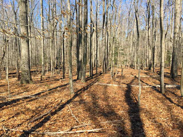
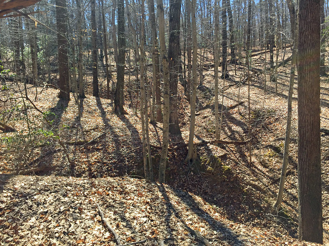
Training Log Archive: NadimIn the 31 days ending Mar 31, 2019:
| ||||||||||||||||||||||||||||||||||||||||||||||||||||||||||||||||||||||||||||||||||||||||||||
| « | » |
| » now | ||||||||||||||||||||||||||||||||||||||||||||||||||||||
| Fr | Sa | Su | Mo | Tu | We | Th | Fr | Sa | Su | Mo | Tu | We | Th | Fr | Sa | Su | Mo | Tu | We | Th | Fr | Sa | Su | Mo | Tu | We | Th | Fr | Sa | Su | |||||||||||||||||||||||||||
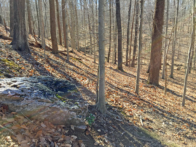
Sunday Mar 31, 2019 #
Orienteering 1:57:33 [3] 5.41 mi (21:44 / mi) +218m 19:18 / mi
(injured)
Before I got started, I dropped off Peggy at Cabin Camp 1, further SW down Rte. 243. She ran back while scouting new terrain to meet me at Warm Springs Rd.
Peggy and I had a similar experience getting started. Our base map didn't show exactly where we were starting from so we eventually had to locate ourselves on the map with primarily only contours. Given that there were lots of parallel contours, it took us each a long time to be sure of where we were--about 30 minutes for Peggy, and about 38 minutes for me.
Both of us found various things and most of it was nice. Where there was green terrain, it wasn't so awful to not want to get near it. I often found distinct edges to dense vegetation or deadfall. If mapped well, one could see the ways through most of it. The areas I got into were flatter than what we often are racing through. That made it extra hard to stay on track. I thought I'd hit a stream confluence just perfectly once, when I later found that I wasn't where I thought I'd been--I found myself going downhill when I should be going up. However, streams did help me to relocate pretty well. I think this terrain would be a great addition to what we've already got in PWF. Some might consider the lack of contours and not so many point features close together to be bland, but I think it reflects a legitimate challenge in navigating. The later half of my run was through a lot of very fast open terrain where it's tempting to overrun one's navigation ability. I messed-up even though I was going slowly, but I was glad to be out and moving again. My right calf did get a little sore again during the run but it held up. I just slowed down and walked more when I felt it.
Saturday Mar 30, 2019 #
Bicycling (Trail) 1:08:42 [1] 6.45 mi (10:39 / mi) +44m 10:26 / mi
slept:8.5 weight:201.5lbs (injured)

Friday Mar 29, 2019 #
Bicycling (Commute) 41:13 [3] 12.2 mi (3:23 / mi) +24m 3:21 / mi
weight:201.5lbs (injured)
Bicycling (Commute) 43:40 [3] 12.0 mi (3:38 / mi) +115m 3:32 / mi
(injured)
Thursday Mar 28, 2019 #
Bicycling (Commute) 5:59 [3] 1.41 mi (4:15 / mi) +18m 4:05 / mi
(injured)
Bicycling (Commute) 5:26 [3] 1.41 mi (3:51 / mi) +15m 3:44 / mi
(injured)
Wednesday Mar 27, 2019 #
Bicycling (Commute) 5:46 [3] 1.41 mi (4:05 / mi) +14m 3:58 / mi
slept:5.5 weight:202lbs (injured)
Bicycling (Commute) 5:38 [3] 1.41 mi (4:00 / mi) +19m 3:50 / mi
(injured)
Tuesday Mar 26, 2019 #
Bicycling (Commute) 5:40 [3] 1.41 mi (4:01 / mi) +18m 3:52 / mi
slept:5.5 weight:202lbs (injured)
Bicycling (Commute) 6:04 [3] 1.41 mi (4:18 / mi) +16m 4:09 / mi
(injured)
Sunday Mar 24, 2019 #
Note
slept:7.0 weight:202lbs (injured)
Saturday Mar 23, 2019 #
Bicycling (Trail) 46:00 [3] 4.52 mi (10:11 / mi) +17m 10:04 / mi
(injured)
Friday Mar 22, 2019 #
Running (Street & Trail) 19:20 [3] 1.95 mi (9:55 / mi) +33m 9:26 / mi
(injured)
Wednesday Mar 20, 2019 #
Bicycling (Commute) 5:31 [3] 1.41 mi (3:55 / mi) +19m 3:45 / mi
weight:200lbs (injured)
Bicycling (Commute) 5:45 [3] 1.41 mi (4:05 / mi) +13m 3:58 / mi
(injured)
Tuesday Mar 19, 2019 #
Bicycling (Commute) 5:45 [3] 1.41 mi (4:05 / mi) +18m 3:55 / mi
weight:202lbs (injured)
Running 17:56 [3] 2.02 mi (8:53 / mi) +6m 8:48 / mi
(injured)
Bicycling (Commute) 6:20 [3] 1.41 mi (4:30 / mi) +16m 4:21 / mi
(injured)
Monday Mar 18, 2019 #
Bicycling (Commute) 6:28 [3] 1.41 mi (4:35 / mi) +18m 4:25 / mi
weight:203lbs (injured) (rest day)
Bicycling (Commute) 6:03 [3] 1.41 mi (4:17 / mi) +13m 4:11 / mi
(injured)
Sunday Mar 17, 2019 #
Orienteering 36:40 1.63 mi (22:30 / mi) +82m 19:27 / mi
(injured)
Orienteering 22:45 [2] 1.09 mi (20:52 / mi) +61m 17:47 / mi
(injured)
Orienteering (Foot) 43:48 [3] 2.92 mi (15:00 / mi) +134m 13:08 / mi
(injured)
On the second loop, I repeated a leg from the night-O where I'd gone to the wrong control--this time it was the right one. Max was ahead of me initially, but staying to the right where the running was better, I passed him. I thought he might catch me as I left #2 and ran to a road. Max stopped at the road while I turned left to get to a junction that was just out of sight. I hit the next control well and saw Max with Wyatt Riley as I was already heading off to #3. I was again feeling good about places where I was able to be pretty efficient without using a compass. I finished the loop with Max somewhere behind me.
Going out on my third loop, someone told me that Peggy was a minute ahead of me. Some loops were shorter than others so it didn't worry me and though I was moving better, I still wasn't moving that well. I did a short loop, and realized that the mapping was not so perfect on one gully that I attacked from a distinct location up high above.
On my last loop, I moved well until control 3 or 4. I was following a stream and stopped early at a stream ditch junction. It was a bit green in this area. Going on, I saw Rick Oliver coming in more directly--a benefit of having a compass. I saw the control first but Rick was closer and punched it first. I took similar routes for the next 2 controls and punched our Go control just behind Rick. There was an obvious route choice to dog-leg on the trail we'd come down, or to go straight. Rick suggested we go different ways and I chose going straight. After cutting through a short bit of forest, I adjusted my route to use a second trail or ride and got ahead of Rick. I then saw Peggy converging but just ahead of me. Family pride was on the line and others were shouting. I picked up the pace. Peggy did too, and warned me not to injure myself running too hard. I was happy to match pace and finish together. It was again a nice exercise and it turned out to be pretty good weather to run in too.
Saturday Mar 16, 2019 #
Orienteering (Foot) 1:04:10 1.9 mi (33:46 / mi) +87m 29:33 / mi
(injured)
Orienteering (Foot) 1:04:00 [2] 1.61 mi (39:45 / mi) +88m 33:58 / mi
(injured)
Orienteering (Foot) 1:17:46 [3] *** 3.51 mi (22:09 / mi) +144m 19:39 / mi
spiked:7/11c (injured)
S-1 - I headed straight to the control but pulled away just short of it when I saw a reflector to my left. The reflector was from a control set for Sunday training exercises. After checking the other control, I turned back and hit the control I needed, well.
1-2 - Since experiencing the thickness of the forest, I went out to the road on the shortest route. I turned left and ran through the junction. I was slow. Leaving from before a road bend, I found a patch of white forest to get into the nicer terrain and spiked it.
2-3 - I ran back out to the road (It would have been nicer to have another control in this part of the forest like the long advanced course did but Gary said he wanted to shorten the Short Advanced course. As it was, the control for the Advanced Course had gotten set on the wrong marsh) and turned left. I took the left fork which had a shorter route but a longer distance through forest at the end. In retrospect the longer route out of the forest was faster. Though I didn't make any mistakes following a stream from a powerline ride, deadfall slowed me again.
3-4 - I left #3 going to the cabin roads. Turning left, I thought to cut some distance on a short stretch across the forest. I really didn't know what I'd really done until looking at my GPS track. I made a complete counter-clockwise 360 as I tried to make my way around deadfall. I came out close to where I'd started at #3, and then took a while with a incorrect explorations to figure out where I was. Best that I can guess, I had at some point held the map at 180 degrees which is something the beginners that I was coaching to day were worried about doing. Finally I relocted myself on a road bend and proceeded straight to the control on bearing from far away. I had a little help at the end when I'd seen some headlamps across the road where I was heading--they were from Matyas and his father--I'd been coaching Mayas earlier in the day so it was good he didn't see me making my horrible 6-7 minute mistake.
4-5 - I went off straight but drifted left in some deadfall. The vegetation here wasn't as bad and I was being more careful than my last leg. When I hit a stream ditch, I realized it wasn't the stream closer to the control that I was aiming for. I had been aiming off a bit and I followed the stream to a junction and until I was in sight of the control. Someone was closing in on me
5-6 - Initially I headed off straight. I realized after going that I would have to cross the stream so I cut left more to get across and not have to climb. I was going to come down the stream on the other side of the ridge but I kept getting pushed back by deadfall at the top. I ended up following the ridge until it ended, then following an intermittant trail along the creek to the next stream junction, and to the control.
6-7- I thought the intermittent trail going along the creek was okay so I dog-legged back the way I'd come. This also seemed better than crossing the creek twice--I thought it looked deep. The vegetation started getting rougher and once around the creek bend. The trail completely disappeared where there were big trees that'd fallen amidst mountain laurel and thorns. I picked my way through climbing and descending a few times. The area mapped open with a trail on one side was completely green too--saplings had grown-up in it. Only after hitting the flat ground did it open up. I ran past two people who recognized me but whom I couldn't verify. I spiked the control but this felt very slow. I heard from some who had crossed the creek who did better and some who also found thick vegetation.
7-8 - Instead of following the creek a ways, I took a bearing straight and ran it to where I started climbing. I come see a slope to my left and thought it was the reentrant. I didn't descend into it so I wasn't sure if it was the one I needed or a wider one along the main creek. I climbed higher to see if I was going to get to the ridge top. Using my bright light for the first time, I could see a mess of vegetation that was still climbing, so I dropped back down into the correct reentrant. It still seemed a long way to get to the control but I stuck with the reentrant until finding it.
8-9 - I headed out straight across instead of angling toward the road. I crossed the stream and hit the road soon after. Jody was running along the road so after a slight bobble, I eventually passed him getting into the field. I didn't feel the need to go to the corner of the field so I went straight in. I misread the control being lower than it was--the circle coverd-up a contour but I probably should have known better. After getting too low, I climbed up to the control.
9-10 - I angled back to the field and past the backstop onto the roads. I read everything well on the roads and trails I used getting to a cabin above the control.
10-11 - I went straight, eschewing the longer trail route to the right. Initially this was okay. I got to a road at a powerline junction right where I wanted to be, without much trouble or really bad vegetation. However, going across the next reentrant was different. I hit big tree fall and drifted right. I came out into the field without hitting the trail I'd intended to, which would have gone to the control. I ran around the cabins until I got there.
11-F - I was not far behind someone who'd come up the trail. I tried to catch him but only closed the gap.
It was fun to do night-o again but this wasn't so great a place to do it any more. I was happy that all the climbing over deadfall seemed to loosen what'd been bothering my calf to an extent. I finished running better than I had earlier in the day. After the run, my stomach didn't feel right and I'd passed some blood again.
Friday Mar 15, 2019 #
Bicycling (Commute) 5:47 [3] 1.41 mi (4:06 / mi) +21m 3:55 / mi
slept:5.0 weight:203lbs (injured)
Running (Street & Trail) 21:28 [2] 2.0 mi (10:44 / mi) +8m 10:36 / mi
(injured)
Bicycling (Commute) 5:44 [3] 1.41 mi (4:04 / mi) +14m 3:57 / mi
(injured)
Bicycling (Commute) 12:10 [3] 1.5 mi (8:07 / mi) +92m 6:49 / mi
Thursday Mar 14, 2019 #
Bicycling (Commute) 5:56 [3] 1.41 mi (4:13 / mi) +18m 4:03 / mi
weight:202lbs (injured)
Bicycling (Commute) 5:36 [3] 1.41 mi (3:58 / mi) +18m 3:49 / mi
(injured)
Bicycling (Commute) 6:49 [1] 1.3 mi (5:15 / mi) +10m 5:07 / mi
(injured)
Bicycling (Commute) 13:27 [1] 1.3 mi (10:21 / mi) +14m 10:01 / mi
(injured)
Tuesday Mar 12, 2019 #
Hiking (Street & Trail) 25:00 [1] 1.1 mi (22:44 / mi)
(injured)
Sunday Mar 10, 2019 #
Orienteering (Foot) 1:03:26 6.5 km (9:46 / km) +6m 9:43 / km
slept:6.25 weight:200lbs (injured)
S-1 - I dutifully started a brisk walk and it felt pretty slow. I planned to go as straight as possible to save time. I entered the woods just past the house and got a little hung up at the first ditch--it was filled with a lot of water. I backed-up to go around it. I did go straight from there to the trail, hitting the intersections, and proceeding on the trail to cross the stream. I left from a reentrant with a control in it and went straight to the marsh.
1-2 - I went straight out, crossing the road to the trail. I felt like I'd pulled to the right. It seemed harder to keep a bearing walking at my slower pace. I ran the trail a little to the big bend. I walked straight toward the control and saw the green on my left. I also spotted the new trail which was also on the map. I decided it safest to use the trail and attacked successfully from the bend; it'd nearly been visible from the trail.
2-3 - I went straight, still walking. I'd site a bearing to a tree and go to the tree sometimes. That let me go around deadfall or thicker areas at my walking speed. I did start warming up so I snuck in a jog for a few steps sometimes. I was a little surprised at the amount of water when crossing the second reentrant. I sighted side reentrants and figured I was on target--I was, and I spiked it.
3-4 - I went straightish, moving around some green at times, and looking for the reentrant.
4-5 - Leaving #4, I was well on target. I paused at the reentrant (+30 seconds), descending into the flat area. When I got to the other side, I found my bearing climbing the spur hill, instead of being on the right side of it. Dropping, I was okay crossing the next reentrant. I ran up a spur, then on the side of it. Before I got to the control, Florence and another guy were crossing my path leaving it.
5-6 - I could see control #6 from #5. I ran straight across the big puddle of a marsh. My feet didn't sink much into mud.
6-7 - I thought about staying in the long curving reentrant the whole way but still felt I was moving too slowly for that. I felt skilled enough to go straight. I was okay initially. I read the green on my right and edged around it. At the first side reentrant crossing, I still felt good, but perhaps I stopped reading my bearing. I climbed out and found things looking too flat ahead. I decided to cut left. I could see what I thought was the reentrant ahead. Getting closer, I figured I'd see the control in it, but I didn't. I next overcompensated and cut left more, perhaps even backward a little, to check the next reentrant to the west. When I figured that reentrant wasn't it, I doubled back to the other reentrant that I'd seen, and this time I could see the control. I probably lost close to 2 minutes.
7-8 - I ran straight across the big reentrant and up a spur to a knoll. I kept going straight (checking side reentrant to be sure where I was) and gained on Florence and the other guy I'd seen at #5. I passed the other guy but didn't quite catch Florence.
8-9 - I ran straight, checking off a side reentrant as I climbed out of the big initial one. I kept straight, to the next reentrant system, then went around the fingers, to the control.
9-10 - I ran straight checking off reentrants along the way. At one point, I felt like I was losing count. Fortunately I hit the ditches SE of the control. I made a slight correction there, to spike it.
10-11 - Going straight, I saw the wooden foot bridge crossing the marsh so I cut left a little to use it. Trails took me to the road from there. I pretty much kept my bearing, but was a little to the right when I saw it. A tree had hid it in the direction I was coming from.
11-12 - I ran straight and ended up hitting the trail near the bridge over the stream that I'd used on the way to #1. I used the trail a little but cut more left up a reentrant as a troop of scouts were filling the trail. That got me to the parking lot. I stayed on the paved trail until crossing the first reentrant. From there I cut left, crossed the next reentrant and found the control. I was a bit hesitant at the end, as to whether the control should be nearer the tip of the reentrant or not.
12-F - Going straight, I hit the green just before the circle. I got hung up in the thorns a little. A straight route might suggest hitting the trail so either I executed it poorly, or #12 had been deeper down the reentrant that mapped.
I felt happy about the run despite the problem at #7. The happiness was largely from being able to run instead of walking the whole way. The warm-up walking, and the soft and flat ground probably helped.
There was only one couple needing beginner instruction on my shift. Jim Chapman told me that his scout numbers were down but that he'd been seeing growth in Islamic Boy Scouts, from other regions. He sent a group of them to me for course review that would help them earn a merit badge. They were a great bunch of kids. Half of them had gone out before, but it was the first time for the rest of the group I talked with. They surprised me by completing the Brown course! Plenty of long-time orienteers have a lot of trouble on advanced controls in this park and these newbies did it smiling at the end! I was heartened to see new people with similar backgrounds as my own, having fun with, and being interested in the sport. Knowing the challenges of growing up in their parent's culture and living in this country, it made me happy to see them having fun.
Saturday Mar 9, 2019 #
Running (Trail) 1:45 [3] 0.17 mi (10:17 / mi)
(injured)
Hiking (Trail) 3:04 [3] 0.19 mi (16:08 / mi)
slept:9.0 weight:200lbs (injured)
Thursday Mar 7, 2019 #
Bicycling (Commute) 6:14 [3] 1.41 mi (4:25 / mi) +18m 4:15 / mi
weight:200lbs (injured)
Bicycling (Commute) 6:10 [3] 1.41 mi (4:22 / mi) +12m 4:16 / mi
(injured)
Wednesday Mar 6, 2019 #
Bicycling (Commute) 6:13 [3] 1.41 mi (4:25 / mi) +21m 4:13 / mi
weight:199.5lbs (injured)
Bicycling (Commute) 6:20 [4] 1.41 mi (4:30 / mi) +20m 4:18 / mi
(injured)
Tuesday Mar 5, 2019 #
Bicycling (Commute) 5:57 [3] 1.41 mi (4:13 / mi) +19m 4:03 / mi
weight:199.5lbs (injured)
Bicycling (Commute) 7:14 [3] 1.41 mi (5:08 / mi) +20m 4:55 / mi
(injured)
Monday Mar 4, 2019 #
Bicycling (Commute) 5:38 [3] 1.41 mi (4:00 / mi) +19m 3:50 / mi
slept:6.25 weight:199lbs
Running 21:02 [3] 2.12 mi (9:55 / mi) +8m 9:48 / mi
(injured)
I'd had this kind of calf problem, mostly on my right calf, in the past. As all things seem connected, it's been a precursor to back troubles. After similar trouble in 2018, but months later, I had my second back surgery.
Bicycling (Commute) 6:37 [3] 1.41 mi (4:42 / mi) +19m 4:31 / mi
(injured)
Sunday Mar 3, 2019 #
Orienteering (Foot) 1:21:59 [3] 5.64 mi (14:32 / mi) +239m 12:51 / mi
S-1 - I just didn't orient the map correctly starting out. Starting off in the wrong direction, it seemed like 10-15 seconds went by. After than I went past the amphitheater and administrative building right to it.
1-2 Down the tracks and off from a bend in the tracks when I could see the reentrant ahead. I already wasn't feeling that strong.
2-3 - I messed this up going straight initially, but dropping low enough that it seemed I should just drop further to the trail. Coming up, it seemed like the control wasn't on the right set of boulders, but I wasn't sure. AP says I lost 1:15 minutes.
3-4 - Down the trail to the road crossing - I moved carefully so as not to trip on the roots. I think the rain had started by this point.
4-5 - Road crossing, with the time supposed to have been removed - I waited for cars and took my time walking.
5-6 - I ran this mostly on memory. Had I read it better, I would have gone to the right set of rocks. The area was green and sloping so I didn't do much reading. I was just poking around high, when it was low. I probably lost 25 seconds though AP doesn't show any of it.
6-7 - I extricated myself from the green going backwards a bit. At this point, I was still avoiding the big puddles.
7-8 - Just up the hill and across the reentrant going straight. I could see it a long way off, but I wasn't strong enough to run the whole way through the low vegetation that's grown-up.
8-9 - I ran off to the right to avoid green and use the trails. I'm not sure if my route was efficient.
9-10 - I backtracked the trails to the pavilion, planning to use the road afterward. Partway down the road, I decided to save distance and climb by cutting across the low vegetation where it looked better. I still got slowed and never got as far as the trail along the highway. A young guy wearing something like a US Team o-top came up from the trail to the left and punched before me.
10-11 - I went straight initially. I could see the young guy who was at #10, off to my right, and pausing on the trail. I dropped toward the rock but the kid got there ahead of me.
11-12 - I dropped to the trail immediately while the kid had gone high. I stumbed on something at one point and had a slight right ankle twist. I was feeling this in my right calf, a little bit throughout the rest of the course. Later I could see him dropping to the trail too, but I was just ahead of him when he hit it. I figured he'd pass me and I offered to let him but we just kept running. I got there seconds ahead of him.
12-13 - The kid popped ahead of me on trail as we doubled-back. I ended up leaving the trail where he did, but I stayed more to the right where the vegetation looked better. It was better but took me across a marshy spot and it was farther than the kid ahead of me had gone. I ran along the creek a way where it was good running on the sands, then splashed across. The kid got there first of coarse, and was just getting back to the trail when I was leaving it to punch.
13-14 - Up the trail until I could see the control.
14-15 - I angled for the trail and could see the kid to my left below, pausing to figure out a way across a gully. I crossed small stream on the bridge and got ahead. Running up the reentrant, I was a bit off the the right and I moved slowly. The kid saw it before my and got there ahead of me.
15-16 - The kid started off going what seemed a little left. Then he cut right. I kept straight but soon realized we were off to the right. We corrected and the kid got there first.
16-17 - The kid took the trail around the first reentrant so I gained time by cutting across. I was going to drop earlier but the trail seduced me to stick it out. We both left the trail to get to the control at the bridge, with the kid still clearly ahead.
17-18 - This was the road crossing. A little tired, I walked it all and figured I wouldn't see the kid any more.
18-19 - I just stayed high going past the large rock cluster near the houses. Getting into the field was pretty easy today--not too many thorns. I crossed the hilltop in the power line ride and found a way in west of the large pylon.
19-20 - Up and over, I spiked it, skirting around the thicker stuff.
20-21 - I was tempted to cross the creek but at this point I was still avoiding puddles. That way also would have required getting through the unmapped green terrain that had grown-up over where the woods were mapped white. I cut right of straight until crossing the creek. I got on an animal trail that climbed diagonally. When descending the spur, I could see both the kid who'd passed me, and Dasa Merkova, ahead. After that, I stayed low like they had. The control seemed higher than I was expecting it, but placed correctly.
21-22 - I stayed low, taking the remnant of an old trail. This used to be better but had gotten overgrown near #21. Further ahead, water had filled it. It was too green to run along it so I decided to splash through most of it. I seemed to be losing time. I climbed across the big spur east of the control, then contoured across. I could see the control from far off, and then see Dasa descending to it. It was too green for me to run well. I had to actually drop lower than the control and climb back a little.
22-23 - I followed Dasa's basic route across the creek and gained ground. She kept straight at the field opening. I cut left going past the amphitheater. I kept running right up to the control as I could see Dasa coming over from my right.
23-24 - I stayed high, going to the top of the knoll before descending. It was actually a boulder, not a dot knoll as noted in the control description.
24-25 - Down to the trail and bridge, I went left around the hill. I kept on the trail, not sure which side of the reentrant it'd be - I was having trouble reading it but knew I had to go high enough to line up with the apartment building bend southward. Of course, the control was on the other side of the gully but it wasn't hard to cross just past the control.
25-26 - Straight over the saddle, but around on the left side of some unmapped deadfall.
26-27 - Down to the trail and bridge, past a happy mud splashing young orienteer and his mom. I think it'd started to sleet by this point. I stayed on the trail until I could see the control.
27-28 - Looking as the leg, I was thinking this would be the toughest leg. I should have doubled back to the trail since I knew it'd go close, but I ran up to the ballfield edge before getting back in the woods. Getting back to the trail from there was slow, but I did. I was somewhat surprised to see how close to the trail that the control was.
28-F - I stayed on the trail until a little before the cair, then dropped through lighter woods to the power line. The grasses had grown up on the far and low side to what looked like a very messy to impassable barrier. I kept on the trail to get around what had been mapped as the green edge of the barrier, then cut left. I crossed high and above the gully. It was surprisingly easy. I climbed up across the train tracks to the administrative parking lot near #1. From there, I reversed my route to the start/finish. The snow had let up but it was still raining.
I felt okay with slightly numb feet. My right calf didn't seem too hurt. I ran okay considering the weather and not having run the whole week before. According to my van, it was 34 F. after finishing My knees both felt okay.
Orienteering (Control Pickup) 1:04:09 [2] 2.0 mi (32:04 / mi) +57m 29:28 / mi
I felt okay enough to do some drywall sanding after the event. That involved sanding on the ceiling. After that, my arm was tired and my back felt like it had achy tendon for a while. Standing up after watching a movie, I was surprised how much my right calf was hurting.