Training Log Archive: NadimIn the 7 days ending Aug 10, 2013:
| |||||||||||||||||||||||||||||||||||||||||||||||||||||||||||||||||||||||||||||||
| « | » |
| » now | ||||||||||
| Su | Mo | Tu | We | Th | Fr | Sa | |||||||
Saturday Aug 10, 2013 #
Note
slept:7.0 weight:175.5lbs
I felt like I'd been eating a lot the last few days so I was surprised to find out that my weight had dropped overall.
Friday Aug 9, 2013 #
4 AM
Running (Street & Trail) 25:02 [3] 3.05 mi (8:12 / mi) +9m 8:08 / mi
slept:7.0
Reykjavik, Iceland. From our hotel on Hagatorg Circle, Neshagi to a foot trail at Hoffsvalagata to AEgisida to Tjamarstigur to Tjarnabol, to Tjamarstigur to Lambastadab to Skerjabraut, to SAEBraut, then basically back the same way. It felt good to run again but I needed a toilet on the return run.
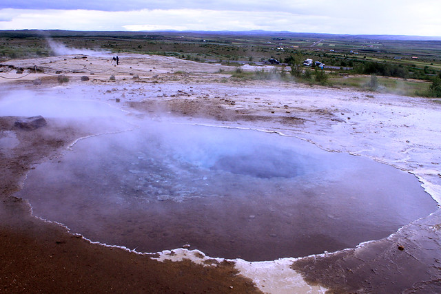
To finish our trip to Iceland (and stay out of the rain), we toured a geothermal energy plant after my run. The exhibition plant sits near a volcano and an old scout camp. They explained how +90% of Iceland's heating, hot water, and electricity come from renewable energies such as the plant we saw.
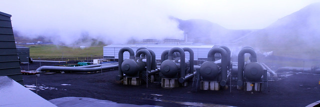
To finish our trip to Iceland (and stay out of the rain), we toured a geothermal energy plant after my run. The exhibition plant sits near a volcano and an old scout camp. They explained how +90% of Iceland's heating, hot water, and electricity come from renewable energies such as the plant we saw.
Wednesday Aug 7, 2013 #
11 AM
Hiking (Trail) 20:30 [0] 1.3 mi (15:46 / mi) +27m 14:49 / mi
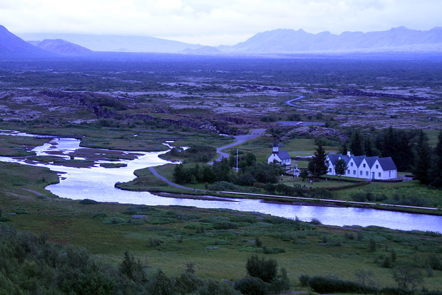
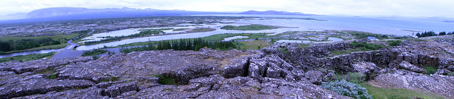
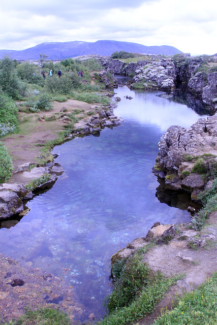
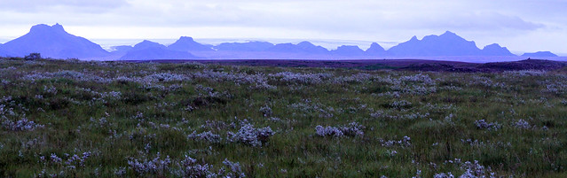
We continued our vacation in Iceland with a drive east from Keflavik and Reykjavik. On the way we stopped at Thingvellir (Pingvellir?) National Park. We were short on time since we'd scheduled a guided hike for later and further east. The hike was partly to get better directions to Gullfoss. Though we had rented an auto GPS and set it to English, it wouldn't locate some places unless we listed things alphabetically in the native Icelandic language, and selected them--the English spellings could not be found. On the hike in Pingvellir, we walked into a crevassed fault line (the one that represents where the Atlantic is spreading both east and west), past the site of the old legislature of which virtually nothing remains, and past some pretty stream valley that empties into the largest lake in the country.
2 PM
Hiking (Glacier) 1:00:00 [1] 1.1 mi (54:33 / mi) +60m 46:39 / mi
After a quick bite to eat, Peggy, Max, and I joined a tour for a glacier hike on Langjokull Glacier in Iceland. Max was upset about not getting to see the end of a movie he had been watching on my iPad. At age 8, he can only absorb just so much from site seeing and without a booster seat, looking out the window or over luggage was hard. He didn't seem to want to get ready to go and this soured a part of the trip that I had been looking forward to.
Before we could hike, we had to go northeastward by bus on dirt roads for almost an hour, then take a boat Across Hvitarvatn Lake. The boat ride was 35-40 minutes. It ended with a close in view of a glacial tongue that we would later climb over. One chunk of ice hung looking ready to calve. Our a Captain jokingly blew a horn at it to try to get it to go. We landed and got off our life jackets. When we had gotten our crampons and ice axes, Max lit-up with a mischievous smile. Moments later there was yelling. The chunk of ice we'd seen had started dropping. I couldn't get my lens cap off quickly enough to catch the start but I did snap a few shots of the small house or shed sized piece fall into the lake. It sent a wave that washed up onto the shore not far from where we were standing. We were really lucky to have seen it. In 3 years, our guide hadn't once seen it happen. The Captain said that at this time of year the glacier begins retreating so it'd probably be the last of the season. Max was even more interested after that.
The actual hike was fun and easy. We learned a bit of technique in holding the axe and how to bite into the ice with the crampons. It felt very natural and I didn't slip at all. We heard a submerged river, saw some crevasses, and saw some surface streams disappear into holes. It was fun.
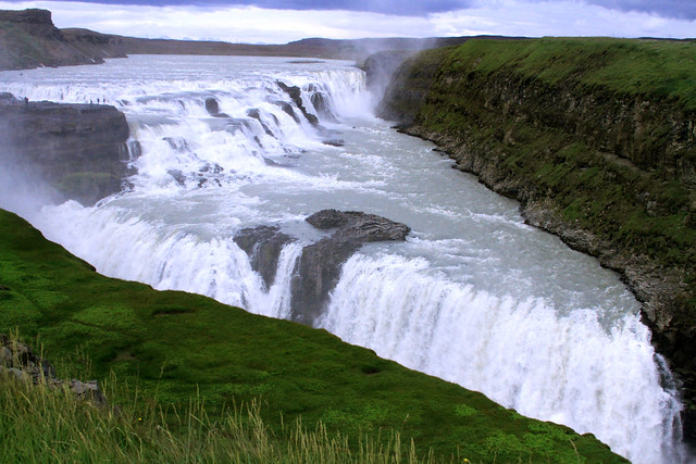
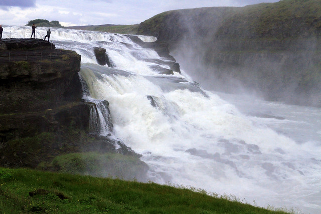
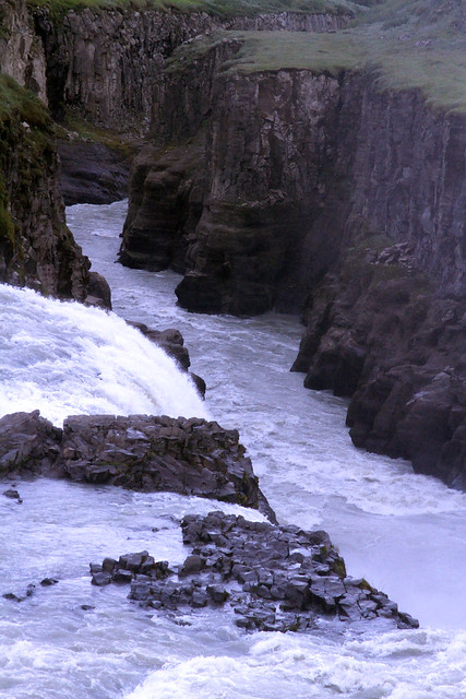
The trip back across the lake was colder. A storm had been moving in with a lot of wind and lower temperatures. Water splashing against the boat in waves got us a little wet. Peggy and Max had rain pants and coats. I only had my raincoat due to packing too quickly so my legs got wet. It was an invigorating ride and the Captain's daughters sold us some candy when we returned. They were young and very cute kids who seemed happy in the otherwise isolated A-frame hut they were living in with their parents for the summer. On the drive back to Gullfoss I was amazed at how green things had become. It was monochromatic on the way out. Our guide explained how the rain let things turn green--it had only been a few hours. At Gullfoss, we walked the trails along the falls. They were impressive, falling along two angled fault lines and carving a canyon in the fault at the bottom.


Before we could hike, we had to go northeastward by bus on dirt roads for almost an hour, then take a boat Across Hvitarvatn Lake. The boat ride was 35-40 minutes. It ended with a close in view of a glacial tongue that we would later climb over. One chunk of ice hung looking ready to calve. Our a Captain jokingly blew a horn at it to try to get it to go. We landed and got off our life jackets. When we had gotten our crampons and ice axes, Max lit-up with a mischievous smile. Moments later there was yelling. The chunk of ice we'd seen had started dropping. I couldn't get my lens cap off quickly enough to catch the start but I did snap a few shots of the small house or shed sized piece fall into the lake. It sent a wave that washed up onto the shore not far from where we were standing. We were really lucky to have seen it. In 3 years, our guide hadn't once seen it happen. The Captain said that at this time of year the glacier begins retreating so it'd probably be the last of the season. Max was even more interested after that.
The actual hike was fun and easy. We learned a bit of technique in holding the axe and how to bite into the ice with the crampons. It felt very natural and I didn't slip at all. We heard a submerged river, saw some crevasses, and saw some surface streams disappear into holes. It was fun.
The trip back across the lake was colder. A storm had been moving in with a lot of wind and lower temperatures. Water splashing against the boat in waves got us a little wet. Peggy and Max had rain pants and coats. I only had my raincoat due to packing too quickly so my legs got wet. It was an invigorating ride and the Captain's daughters sold us some candy when we returned. They were young and very cute kids who seemed happy in the otherwise isolated A-frame hut they were living in with their parents for the summer. On the drive back to Gullfoss I was amazed at how green things had become. It was monochromatic on the way out. Our guide explained how the rain let things turn green--it had only been a few hours. At Gullfoss, we walked the trails along the falls. They were impressive, falling along two angled fault lines and carving a canyon in the fault at the bottom.
Hiking (Trail) 30:00 [1] 0.5 mi (59:59 / mi)
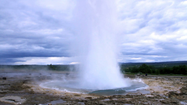
Geysir, Iceland. To finish-up our day, Peggy, Max and I walked around the Geysir area. It reminded me of the Yellowstone geyser valley though it was smaller. There were bubbling holes and small pools with the telltale colorings of thermophiles. The original Geysir for which other geysers were named no longer spouted but Strokkur put on a frequent and good show averaging 8 minutes apart. Both Max and I caught it on video. It was more memorable fun for our family. We got out before it rained again. Eventually we got to Reykjavik to a very comfortable hotel.
A storm is blowing outside now and the realities of going home soon are ahead.
A storm is blowing outside now and the realities of going home soon are ahead.
Tuesday Aug 6, 2013 #
Note
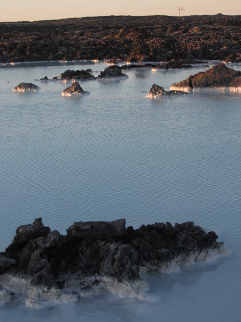
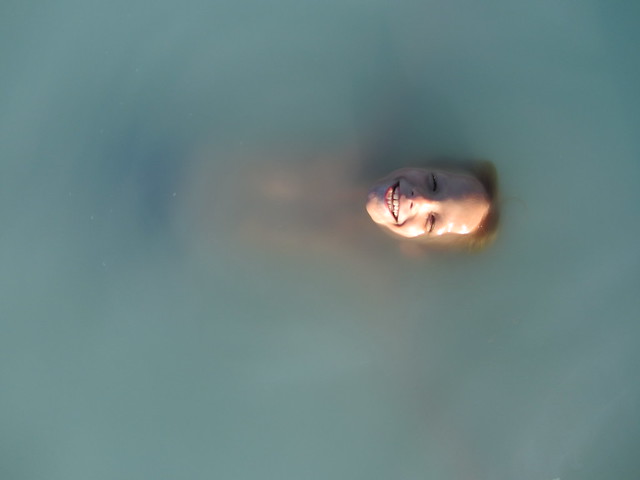
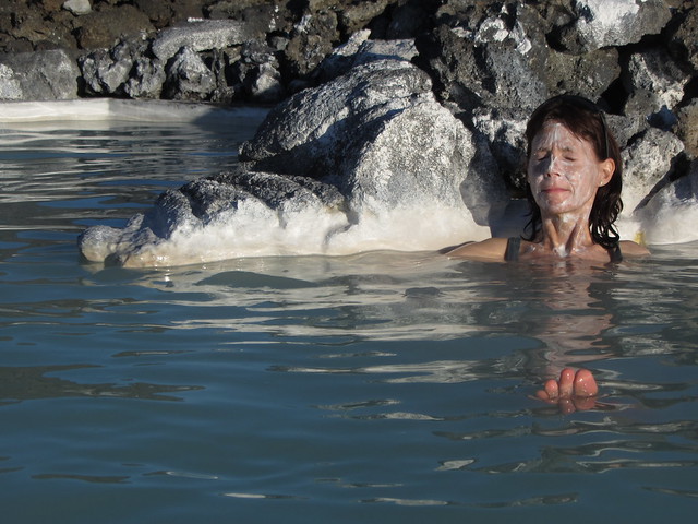
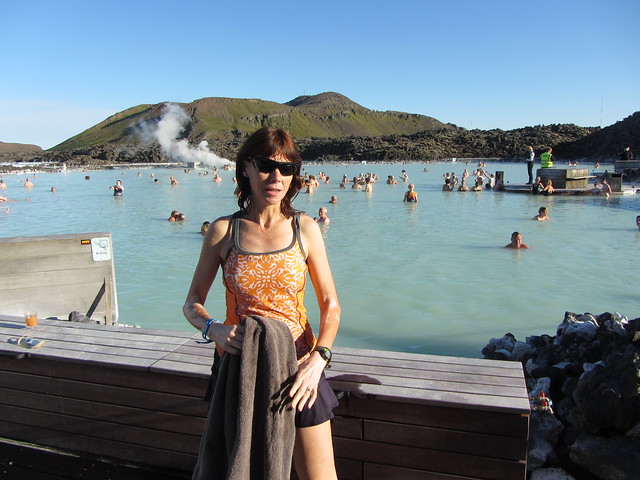
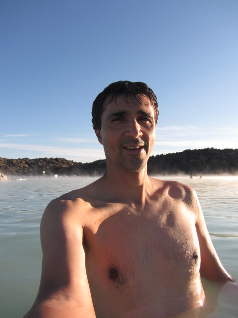
Peggy, Max, and I arrived in Iceland. We rented a relatively inexpensive cabin with all the basic amenities, near the airport. I played a bit of soccer with Max using a ball he'd found but it was nothing worth logging for training. I would have liked to have gone for a short run but our time was such after the soccer playing to go to the Blue Lagoon. This hot spring is in open air and in a somewhat naturalistic setting (next to a sizeable greeting/changing building) It was clear that they cleared the water area to make it more accommodating and they were pumping water in some places. The ground was mostly sandy though with a milky whiteness, I couldn't see through it. I did manage to find and step on some rocks in an unpleasant way but most of it was just fine. The tendency for minerals to precipitate out seemed to coat the floor and sides. Other parts were less natural such as the bar and some side pools for massage. The water was good enough for us. The temperatures varied as we moved a round. We did partake in the use of the white silca "mud" as did others--a supposed healthy salve that is supposed to be worn for 10 minutes. It at least gives couples an excuse to spread it on each other and otherwise makes people laugh at each other.
Sunday Aug 4, 2013 #
10 AM
Hiking (General) 1:00:00 [1] 0.5 mi (1:59:57 / mi)
slept:6.75
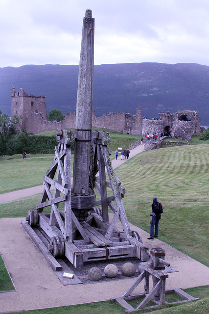
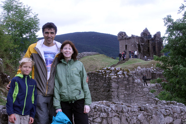
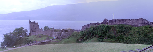
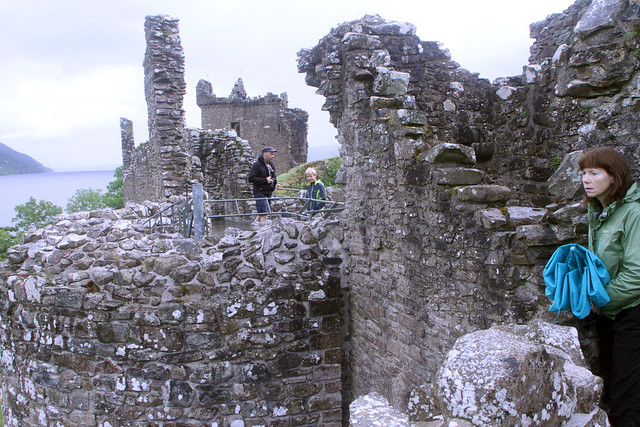
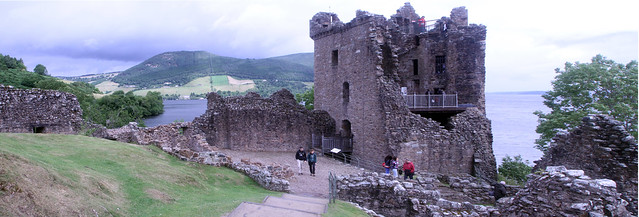
Near Drumnadrichit and Loch Ness, Scotland: Peggy, Max, and I toured Urquart Castle today. This was a ruin on a site that once was a strategic crossroad. We paid to get in. I wasn't disappointed.
4 PM
Hiking (General) 2:42:04 4.73 mi (34:17 / mi) +436m 26:39 / mi
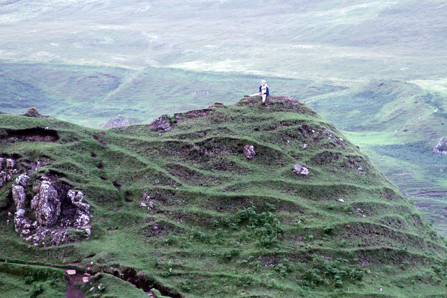
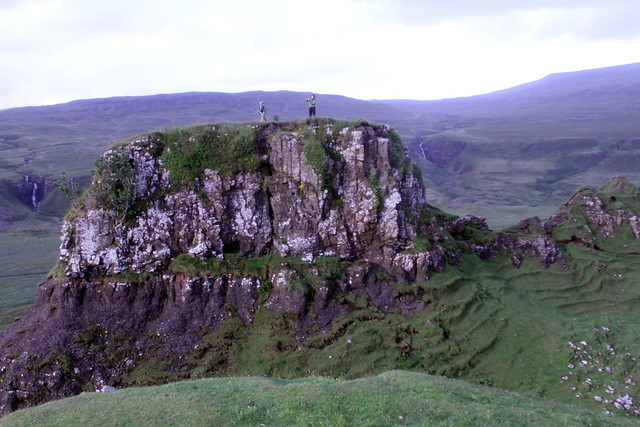
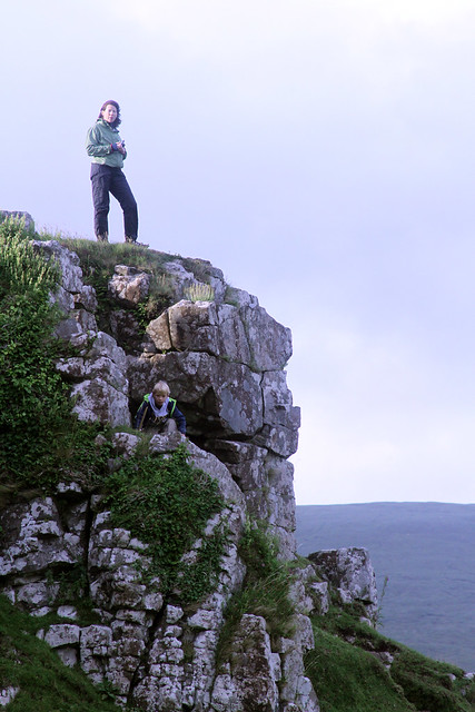
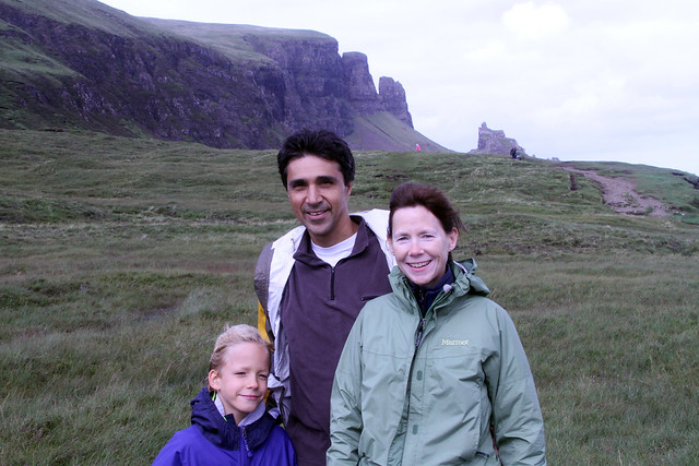
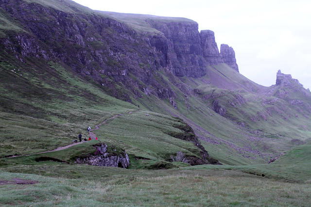
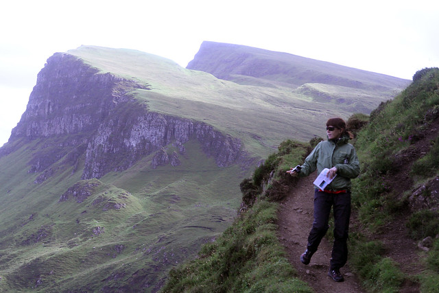
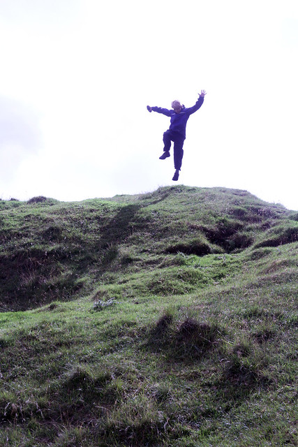
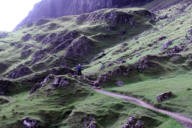
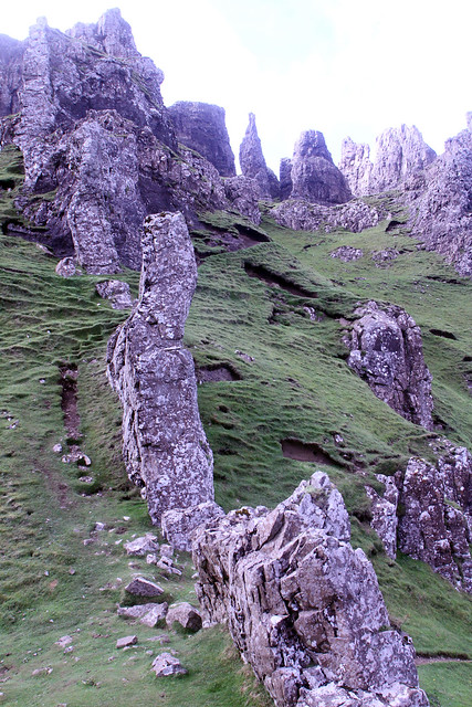
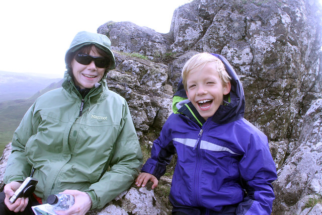
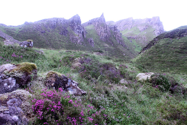
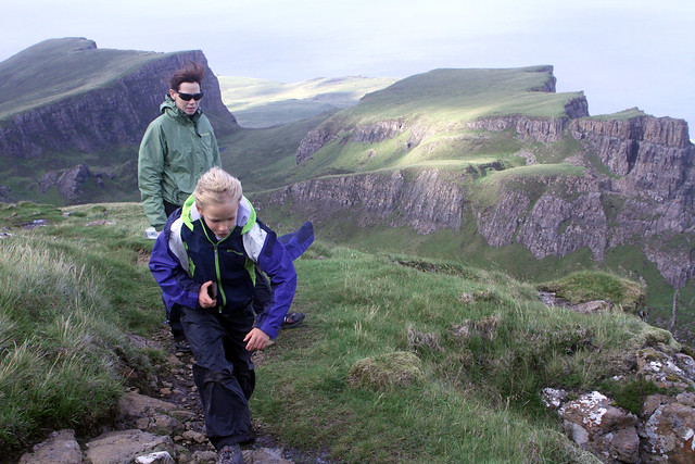
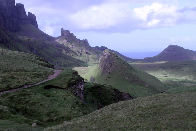
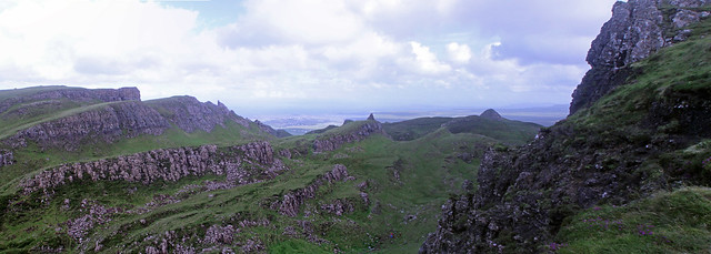
Near Uig, Isle of Skye, Scotland: Peggy, Max, and I hiked today. I think that this was one of the most scenic hikes that I'd ever done. We hiked The Quiraing, a popular trek near the northernmost end of the isle. The views started before we even got started hiking, during the treeless drive up to a saddle. The saddle was about 800 feet up but it seemed higher. For the first mile we didn't climb much. The trail weaved amongst rocky outcrops covered in lichens. We stopped a lot snapping pictures everywhere we looked. Max was amongst the worst of us for doing this (with his iTouch). I counted seven colors repeated over and over in the landscape. Green grasses appeared dominant until one gazed further. White lichens and waterfalls covered the grey and black rocks as the grey clouds covered the blue sky. A few purple heathers and yellow flowers would spice things up. It was windy but either at our backs going out or on the leeward side. The rocks were whimsical; often large spires or flakes that didn't look like they could have weathered that way naturally. Like the orienteering terrain we'd been running this week, shapes of ridges and depressions were repeated on a larger scale. Our return trip was shorter but took us quickly higher over the upper ends of the ridge (close to 2,000 feet in elevation). We eventually left the cliffs altogether walking on grass where the trail was flatter. The views were farther seeing but not as grabbing as the hike up was. I postulated that we just can't take in much more beyond a 2-3,000 foot elevation difference.
7 PM
Hiking (General) 50:27 1.3 mi (38:49 / mi) +49m 34:45 / mi
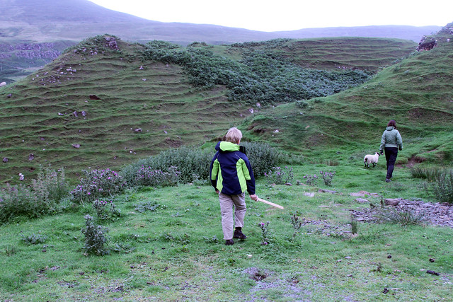
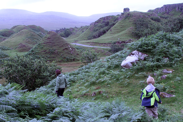
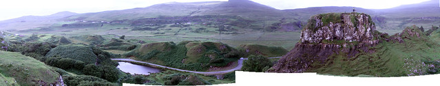
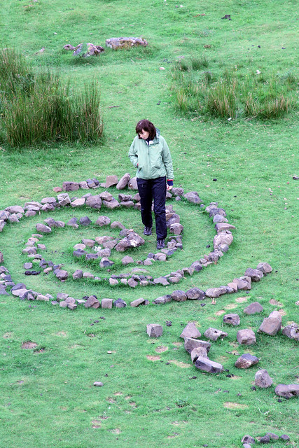
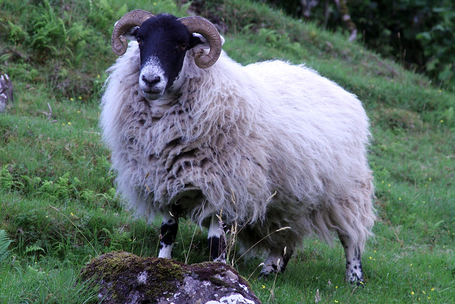
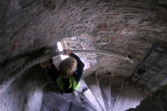
Near Uig, Isle of Skye, Scotland: For an encore, Peggy, Max, and I squeezed in another hike. This one was not far from the last but it was much lower. We wandered through Fairy Glen. There lots of unusual rock formations abound. There were a lot of strange conical stone and grass covered hills amongst other ridges streams with waterfalls, and a pond. Max charged up most of the hills while carrying his new wooden sword (from Urquart Castle). There were sheep and strange black slugs. On the ground people used rocks to form shapes or spell words. It was fun. Afterward, we had a nice dinner in Portree (3 kinds of smoked fish and a sweet potato soup for me). The drive across Skye both coming and going was really picturesque.