Training Log Archive: PGIn the 7 days ending Dec 19, 2010:
| ||||||||||||||||||||||||||||||||||||||||||||||||||||||||||||||||||
| « | » |
| » now | ||||||||||
| Mo | Tu | We | Th | Fr | Sa | Su | |||||||
Sunday Dec 19, 2010 #
Note
trail running 1:12:58 6.04 mi (12:05 / mi) +876ft 10:37 / mi
ahr:144 max:160 rhr:50 weight:141.5lbs shoes: saloman
The elevation gain listed continues to only have a modest connection with reality. Counted the lines on the O' map and got about 450 meters climb.
Oh, and for Phil, nice job mapping the bike trails in the maze just east of the power line and south of the South Side trail. With my glasses on, I can't read the map that well on the run, so can't vouch for every detail, but the mapping sure felt right on.
Saturday Dec 18, 2010 #
trail running 1 [0] +3855ft
ahr:144 max:164 rhr:51 weight:141lbs shoes: saloman
Ran all the hills, slowly and just barely. But I think that is a little progress.
It seems the chunky contingent may pursue my "lose 10 kilos" challenge (alternatively lose 5 kilos). Ten would be a bit much for me, by 5 would be excellent, though the starting point is the 144/2.2 = 65.4. Got down there once about 4 years ago, felt great, but not sure if I have the discipline again.
By the way, I figured the climb on today's run was about 250 meters. AP calculates it as 1,175. Huh?
trail running 45:15 3.62 mi (12:30 / mi) +958ft 10:00 / mi
ahr:144 max:164
Friday Dec 17, 2010 #
trail running 48:44 4.32 mi (11:17 / mi) +630ft 9:55 / mi
ahr:137 max:159 rhr:50 weight:141.5lbs shoes: saloman
Thursday Dec 16, 2010 #

QR.jpg)
Note
Though I could see why it was leaving town, only about 5 others in the theater.
Note
trail running 44:15 4.02 mi (11:00 / mi) +702ft 9:26 / mi
ahr:141 max:160 rhr:50 weight:141lbs shoes: saloman
And the legs are slowly getting used to running again.
Wednesday Dec 15, 2010 #
trail running 38:54 3.63 mi (10:43 / mi) +472ft 9:32 / mi
ahr:139 max:158 rhr:53 shoes: saloman
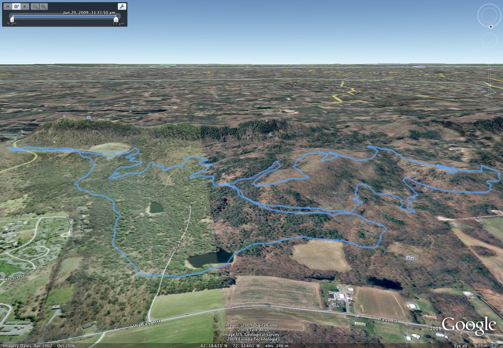
These runs on the bike trails build up more anticipation than ever before as to what the 305 will show as my route. On an O' map I usually know where I am, and on trail runs on USGS maps I have a pretty good idea, but the combination of long undulating slopes without many obvious features and the bike trails continually turning makes it anywhere from hard to nearly impossible to keep track of where I am as I go along. Did pretty well today, but still surprised a couple of times.
Question -- anyone know a nice way to display the tracks from several runs on the same map (preferably USGS)?
Tuesday Dec 14, 2010 #
trail running 53:49 4.65 mi (11:34 / mi) +663ft 10:12 / mi
ahr:142 max:162 rhr:53 weight:142lbs shoes: saloman
Did a different loop, trying to figure out more connections. Towards the end we could have saved a bunch of distance by bushwhacking, but the point was to explore the trails. A really nice outing, good run and good company, and certainly what qualifies as an over-distance effort these days.
And then, prodded by Jeff and Judy about my lack of reading in recent months, stop at B&N and bought three books. Will be fun to get back into the habit.
Monday Dec 13, 2010 #
Note
QR.jpg)
Got caught in a jungle leaving 3, two extra side excursions on the way to 5, and didn't realize there was a #16 until most of the way to the finish. But could have been worse!
trail running 36:30 2.87 mi (12:42 / mi) +574ft 10:41 / mi
ahr:138 max:163 weight:142.5lbs shoes: saloman
Also carried the bike map of the trails. As you could say about some of my professional work at times, the map was a mixture of fact and fiction. I wasn't expecting much in the way of accuracy and I got even less. On the other hand, that made it more interesting, since you really never knew where a mapped trail was going to go.
A couple of deer, one biker, no hunters.
Oh, and where I parked this time there is a sign from the town police saying no trespassing (and also a sign saying no motorized vehicles, which makes you think that if you're on foot maybe trespassing is OK. But I wasn't sure I wanted to park there. Saw a neighbor out doing chores, asked him what the story was, he said not to worry, nice place to walk and the police don't care. Good to know.
Will try to check out the area some more while the conditions are still OK. It's just a lot of fun going someplace new.